Lower Matecumbe Key Topo Map Florida
To zoom in, hover over the map of Lower Matecumbe Key
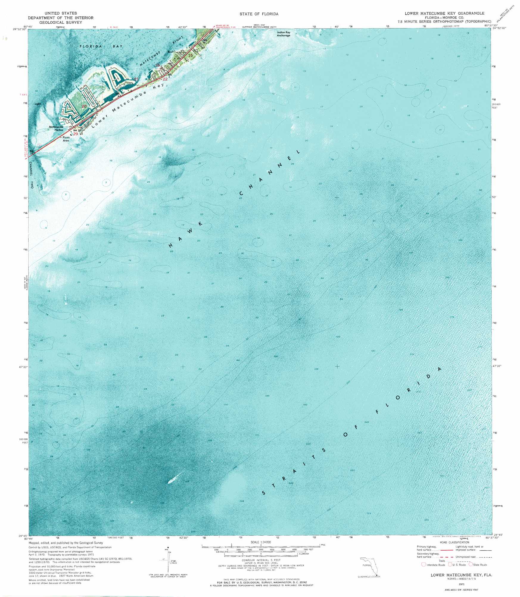
USGS Topo Quad 24080g6 - 1:24,000 scale
| Topo Map Name: | Lower Matecumbe Key |
| USGS Topo Quad ID: | 24080g6 |
| Print Size: | ca. 21 1/4" wide x 27" high |
| Southeast Coordinates: | 24.75° N latitude / 80.625° W longitude |
| Map Center Coordinates: | 24.8125° N latitude / 80.6875° W longitude |
| U.S. State: | FL |
| Filename: | P24080G6.jpg |
| Download Map JPG Image: | Lower Matecumbe Key topo map 1:24,000 scale |
| Map Type: | Orthophoto |
| Topo Series: | 7.5´ |
| Map Scale: | 1:24,000 |
| Source of Map Images: | United States Geological Survey (USGS) |
| Alternate Map Versions: |
Lower Matecumbe Key FL 1971, updated 1973 Download PDF Buy paper map Lower Matecumbe Key FL 2012 Download PDF Buy paper map Lower Matecumbe Key FL 2015 Download PDF Buy paper map |
1:24,000 Topo Quads surrounding Lower Matecumbe Key
Clive Key |
Pelican Keys |
Calusa Keys |
Tavernier |
Rock Harbor |
Schooner Bank |
Buchanan Keys |
Upper Matecumbe Key |
Plantation Key |
|
Grassy Key |
Long Key |
Lower Matecumbe Key |
||
Crawl Key |
||||
> Back to 24080e1 at 1:100,000 scale
> Back to 24080a1 at 1:250,000 scale
> Back to U.S. Topo Maps home
Lower Matecumbe Key topo map: Gazetteer
Lower Matecumbe Key: Bars
South Islamorada Underwater Coral Gardens elevation 0m 0′Lower Matecumbe Key: Bays
Matecumbe Bight elevation 0m 0′Matecumbe Harbor elevation 0m 0′
Lower Matecumbe Key: Harbors
Indian Key Anchorage elevation 0m 0′Lower Matecumbe Key: Islands
Lower Matecumbe Key elevation 0m 0′Matecumbe Keys elevation 0m 0′
Veterans Key elevation 7m 22′
Lower Matecumbe Key: Parks
San Pedro State Underwater Archaelogical Preserve State Park elevation 0m 0′Lower Matecumbe Key: Populated Places
Lower Matecumbe Beach elevation 0m 0′Lower Matecumbe Key digital topo map on disk
Buy this Lower Matecumbe Key topo map showing relief, roads, GPS coordinates and other geographical features, as a high-resolution digital map file on DVD: