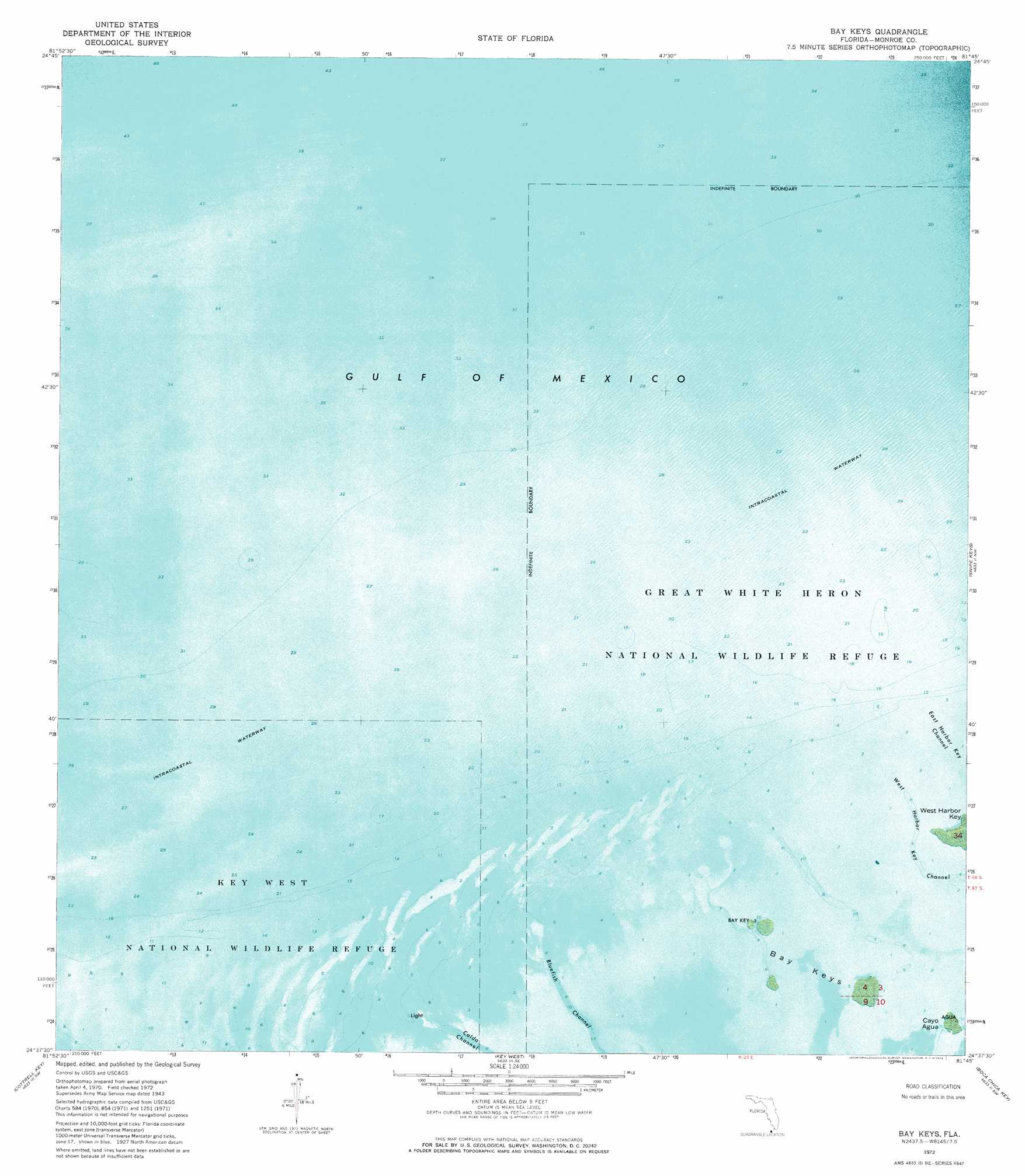
Bay Keys Topo Map Florida
To zoom in, hover over the map of Bay Keys
USGS Topo Quad 24081f7 - 1:24,000 scale
| Topo Map Name: | Bay Keys |
| USGS Topo Quad ID: | 24081f7 |
| Print Size: | ca. 21 1/4" wide x 27" high |
| Southeast Coordinates: | 24.625° N latitude / 81.75° W longitude |
| Map Center Coordinates: | 24.6875° N latitude / 81.8125° W longitude |
| U.S. State: | FL |
| Filename: | P24081F7.jpg |
| Download Map JPG Image: | Bay Keys topo map 1:24,000 scale |
| Map Type: | Orthophoto |
| Topo Series: | 7.5´ |
| Map Scale: | 1:24,000 |
| Source of Map Images: | United States Geological Survey (USGS) |
| Alternate Map Versions: |
Bay Keys FL 1943 Download PDF Buy paper map Bay Keys FL 1972, updated 1973 Download PDF Buy paper map Bay Keys FL 2012 Download PDF Buy paper map Bay Keys FL 2015 Download PDF Buy paper map |
1:24,000 Topo Quads surrounding Bay Keys
Sawyer Key |
||||
Bay Keys |
Snipe Keys |
Sugarloaf Key |
||
Marquesas Keys East |
Cottrell Key |
Key West |
Boca Chica Key |
Saddlebunch Keys |
> Back to 24081e1 at 1:100,000 scale
> Back to 24080a1 at 1:250,000 scale
> Back to U.S. Topo Maps home
Bay Keys digital topo map on disk
Buy this Bay Keys topo map showing relief, roads, GPS coordinates and other geographical features, as a high-resolution digital map file on DVD: