Madeira Bay Topo Map Florida
To zoom in, hover over the map of Madeira Bay
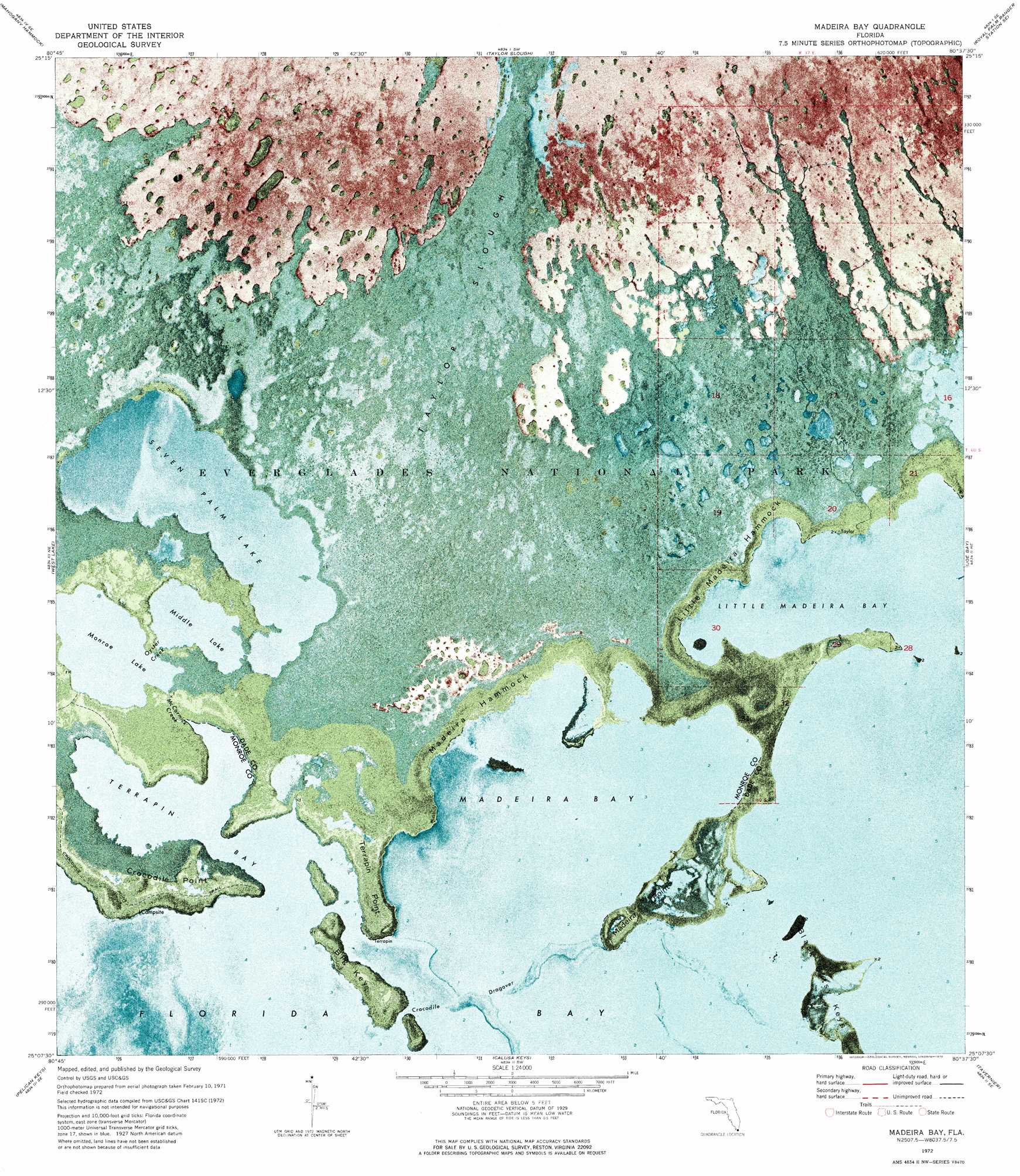
USGS Topo Quad 25080b6 - 1:24,000 scale
| Topo Map Name: | Madeira Bay |
| USGS Topo Quad ID: | 25080b6 |
| Print Size: | ca. 21 1/4" wide x 27" high |
| Southeast Coordinates: | 25.125° N latitude / 80.625° W longitude |
| Map Center Coordinates: | 25.1875° N latitude / 80.6875° W longitude |
| U.S. State: | FL |
| Filename: | P25080B6.jpg |
| Download Map JPG Image: | Madeira Bay topo map 1:24,000 scale |
| Map Type: | Orthophoto |
| Topo Series: | 7.5´ |
| Map Scale: | 1:24,000 |
| Source of Map Images: | United States Geological Survey (USGS) |
| Alternate Map Versions: |
Madeira Bay FL 1972, updated 1976 Download PDF Buy paper map Madeira Bay FL 2012 Download PDF Buy paper map Madeira Bay FL 2015 Download PDF Buy paper map |
1:24,000 Topo Quads surrounding Madeira Bay
Tarpon Bay |
Pa-Hay-Okee Lookout Tower |
Long Pine Key |
Royal Palm Ranger Station |
Homestead |
Whitewater Bay East |
Mahogany Hammock |
Taylor Slough |
Royal Palm Ranger Station Se |
Glades |
Flamingo |
West Lake |
Madeira Bay |
Joe Bay |
Blackwater Sound |
Clive Key |
Pelican Keys |
Calusa Keys |
Tavernier |
Rock Harbor |
Schooner Bank |
Buchanan Keys |
Upper Matecumbe Key |
Plantation Key |
> Back to 25080a1 at 1:100,000 scale
> Back to 25080a1 at 1:250,000 scale
> Back to U.S. Topo Maps home
Madeira Bay topo map: Gazetteer
Madeira Bay: Bars
Crocodile Dragover elevation 0m 0′Madeira Bay: Bays
Little Madeira Bay elevation 0m 0′Madeira Bay elevation 0m 0′
Terrapin Bay elevation -1m -4′
Madeira Bay: Capes
Crocodile Point elevation 0m 0′Maderia Point elevation 0m 0′
Terrapin Point elevation 0m 0′
Madeira Bay: Guts
McCormick Creek elevation 0m 0′Oyster Creek elevation 0m 0′
Madeira Bay: Islands
Big Key elevation 0m 0′Black Betsy Keys elevation 0m 0′
Little Madeira Hammock elevation 0m 0′
Maderia Hammock elevation 0m 0′
Madeira Bay: Lakes
Middle Lake elevation 0m 0′Monroe Lake elevation 0m 0′
Seven Palm Lake elevation 0m 0′
Madeira Bay: Streams
Taylor River elevation 0m 0′Madeira Bay digital topo map on disk
Buy this Madeira Bay topo map showing relief, roads, GPS coordinates and other geographical features, as a high-resolution digital map file on DVD: