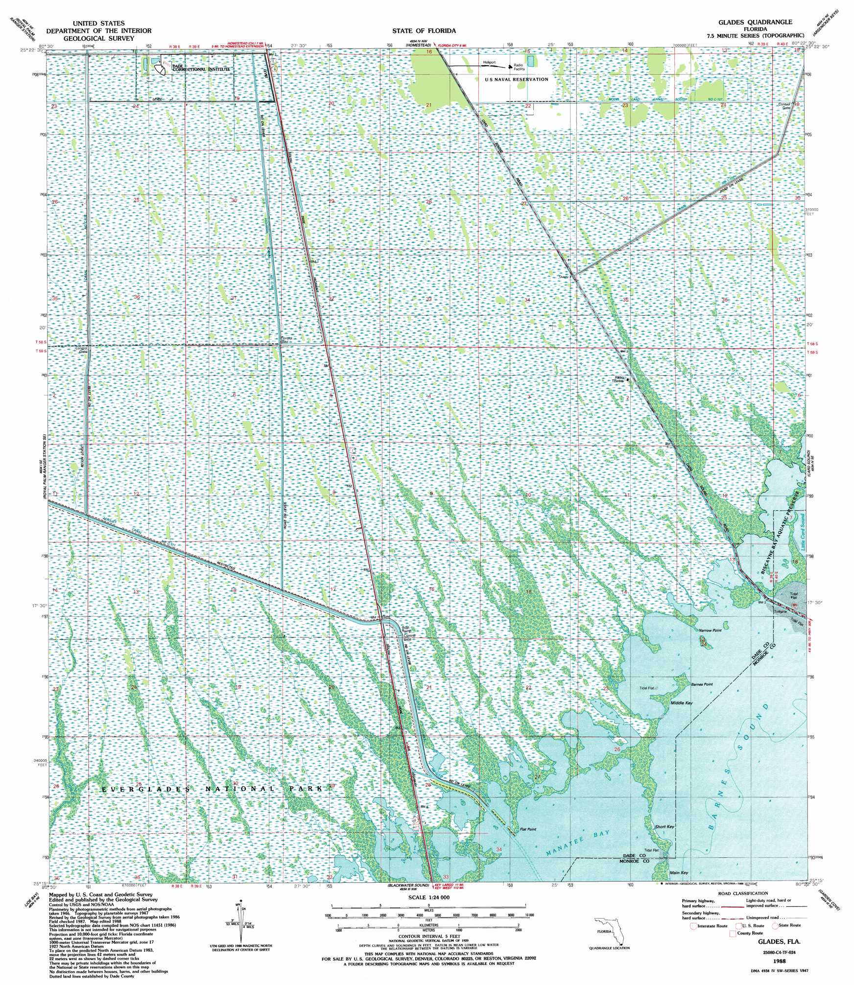
Glades Topo Map Florida
To zoom in, hover over the map of Glades
USGS Topo Quad 25080c4 - 1:24,000 scale
| Topo Map Name: | Glades |
| USGS Topo Quad ID: | 25080c4 |
| Print Size: | ca. 21 1/4" wide x 27" high |
| Southeast Coordinates: | 25.25° N latitude / 80.375° W longitude |
| Map Center Coordinates: | 25.3125° N latitude / 80.4375° W longitude |
| U.S. State: | FL |
| Filename: | O25080C4.jpg |
| Download Map JPG Image: | Glades topo map 1:24,000 scale |
| Map Type: | Topographic |
| Topo Series: | 7.5´ |
| Map Scale: | 1:24,000 |
| Source of Map Images: | United States Geological Survey (USGS) |
| Alternate Map Versions: |
Glades FL 1950 Download PDF Buy paper map Glades FL 1956, updated 1957 Download PDF Buy paper map Glades FL 1956, updated 1968 Download PDF Buy paper map Glades FL 1956, updated 1970 Download PDF Buy paper map Glades FL 1956, updated 1974 Download PDF Buy paper map Glades FL 1988, updated 1988 Download PDF Buy paper map Glades FL 1988, updated 1988 Download PDF Buy paper map Glades FL 1994, updated 1999 Download PDF Buy paper map Glades FL 2012 Download PDF Buy paper map Glades FL 2015 Download PDF Buy paper map |
1:24,000 Topo Quads surrounding Glades
Black Hammock |
Grossman Hammock |
Goulds |
Perrine |
Soldier Key |
Long Pine Key |
Royal Palm Ranger Station |
Homestead |
Arsenicker Keys |
Elliott Key |
Taylor Slough |
Royal Palm Ranger Station Se |
Glades |
Card Sound |
Pacific Reef |
Madeira Bay |
Joe Bay |
Blackwater Sound |
Garden Cove |
|
Calusa Keys |
Tavernier |
Rock Harbor |
> Back to 25080a1 at 1:100,000 scale
> Back to 25080a1 at 1:250,000 scale
> Back to U.S. Topo Maps home
Glades topo map: Gazetteer
Glades: Bays
Manatee Bay elevation 0m 0′Glades: Canals
Aerojet Canal Number C-111 elevation 1m 3′Canal Number C-110 elevation 1m 3′
Glades Canal elevation 0m 0′
United States Highway Canal Number C-109 elevation 1m 3′
Glades: Capes
Barnes Point elevation 0m 0′Flat Point elevation 0m 0′
Narrow Point elevation 0m 0′
Glades: Islands
Middle Key elevation 0m 0′Short Key elevation 0m 0′
Glades digital topo map on disk
Buy this Glades topo map showing relief, roads, GPS coordinates and other geographical features, as a high-resolution digital map file on DVD: