South Of Coopertown Topo Map Florida
To zoom in, hover over the map of South Of Coopertown
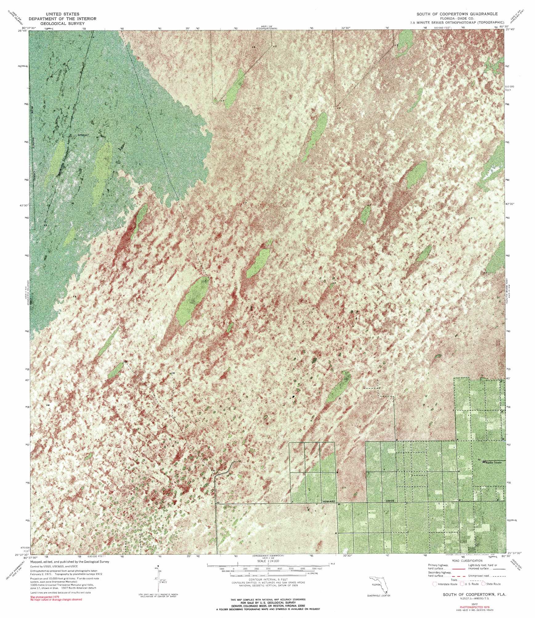
USGS Topo Quad 25080f5 - 1:24,000 scale
| Topo Map Name: | South Of Coopertown |
| USGS Topo Quad ID: | 25080f5 |
| Print Size: | ca. 21 1/4" wide x 27" high |
| Southeast Coordinates: | 25.625° N latitude / 80.5° W longitude |
| Map Center Coordinates: | 25.6875° N latitude / 80.5625° W longitude |
| U.S. State: | FL |
| Filename: | P25080F5.jpg |
| Download Map JPG Image: | South Of Coopertown topo map 1:24,000 scale |
| Map Type: | Orthophoto |
| Topo Series: | 7.5´ |
| Map Scale: | 1:24,000 |
| Source of Map Images: | United States Geological Survey (USGS) |
| Alternate Map Versions: |
South Of Coopertown FL 1972, updated 1976 Download PDF Buy paper map South Of Coopertown FL 1972, updated 1976 Download PDF Buy paper map South of Coopertown FL 2012 Download PDF Buy paper map South of Coopertown FL 2015 Download PDF Buy paper map |
1:24,000 Topo Quads surrounding South Of Coopertown
North Of Fortymile Bend |
Custard Apple Hammock |
West Of Pennsuco |
Pennsuco |
Opa-Locka |
Fortymile Bend |
Long Island |
Coopertown |
Hialeah Sw |
Hialeah |
Shark Valley Lookout Tower |
Chekika Island |
South Of Coopertown |
South Miami Nw |
South Miami |
Panther Mound |
Black Hammock |
Grossman Hammock |
Goulds |
Perrine |
Pa-Hay-Okee Lookout Tower |
Long Pine Key |
Royal Palm Ranger Station |
Homestead |
Arsenicker Keys |
> Back to 25080e1 at 1:100,000 scale
> Back to 25080a1 at 1:250,000 scale
> Back to U.S. Topo Maps home
South Of Coopertown topo map: Gazetteer
South Of Coopertown: Canals
Blue Shanty Canal elevation 1m 3′South Of Coopertown digital topo map on disk
Buy this South Of Coopertown topo map showing relief, roads, GPS coordinates and other geographical features, as a high-resolution digital map file on DVD: