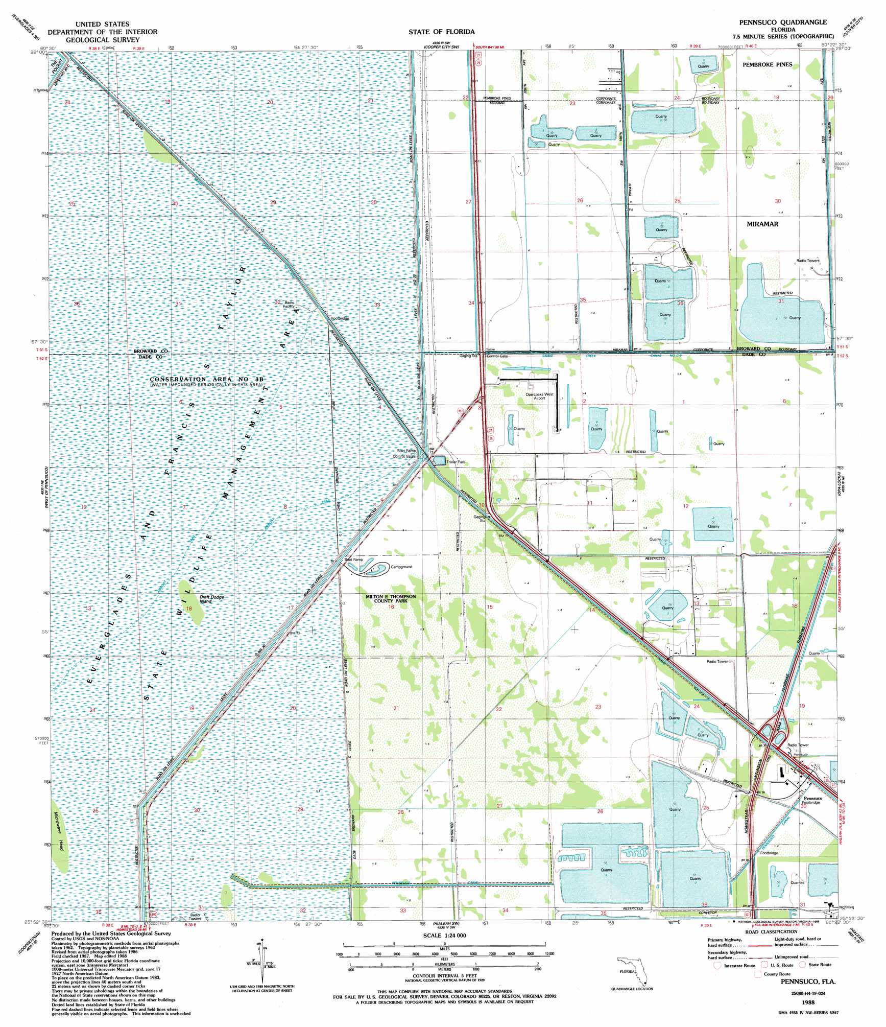
Pennsuco Topo Map Florida
To zoom in, hover over the map of Pennsuco
USGS Topo Quad 25080h4 - 1:24,000 scale
| Topo Map Name: | Pennsuco |
| USGS Topo Quad ID: | 25080h4 |
| Print Size: | ca. 21 1/4" wide x 27" high |
| Southeast Coordinates: | 25.875° N latitude / 80.375° W longitude |
| Map Center Coordinates: | 25.9375° N latitude / 80.4375° W longitude |
| U.S. State: | FL |
| Filename: | O25080H4.jpg |
| Download Map JPG Image: | Pennsuco topo map 1:24,000 scale |
| Map Type: | Topographic |
| Topo Series: | 7.5´ |
| Map Scale: | 1:24,000 |
| Source of Map Images: | United States Geological Survey (USGS) |
| Alternate Map Versions: |
Pennsuco FL 1963, updated 1964 Download PDF Buy paper map Pennsuco FL 1963, updated 1970 Download PDF Buy paper map Pennsuco FL 1963, updated 1974 Download PDF Buy paper map Pennsuco FL 1963, updated 1984 Download PDF Buy paper map Pennsuco FL 1988, updated 1988 Download PDF Buy paper map Pennsuco FL 1988, updated 1988 Download PDF Buy paper map Pennsuco FL 1994, updated 2000 Download PDF Buy paper map Pennsuco FL 2012 Download PDF Buy paper map Pennsuco FL 2015 Download PDF Buy paper map |
1:24,000 Topo Quads surrounding Pennsuco
Everglades 4 Nw |
Everglades 4 Ne |
Andytown |
Cooper City Ne |
Fort Lauderdale North |
Everglades 4 Sw |
Everglades 4 Se |
Cooper City Sw |
Cooper City |
Fort Lauderdale South |
Custard Apple Hammock |
West Of Pennsuco |
Pennsuco |
Opa-Locka |
North Miami |
Long Island |
Coopertown |
Hialeah Sw |
Hialeah |
Miami |
Chekika Island |
South Of Coopertown |
South Miami Nw |
South Miami |
Key Biscayne |
> Back to 25080e1 at 1:100,000 scale
> Back to 25080a1 at 1:250,000 scale
> Back to U.S. Topo Maps home
Pennsuco topo map: Gazetteer
Pennsuco: Airports
Opa Locka West Airport elevation 1m 3′Pennsuco: Canals
Miami Canal Number C-6 elevation 1m 3′Pennsuco Canal elevation 1m 3′
Pennsuco: Islands
Draft Dodge Island elevation 3m 9′Pennsuco: Levees
Levee 30 elevation 3m 9′Levee Number 33 elevation 3m 9′
Pennsuco: Parks
Everglades Wildlife Management Area Conservation Area Number 3 elevation 3m 9′Thompson Park elevation 2m 6′
Pennsuco: Populated Places
Pennsuco elevation 1m 3′Pennsuco digital topo map on disk
Buy this Pennsuco topo map showing relief, roads, GPS coordinates and other geographical features, as a high-resolution digital map file on DVD: