Shark Point Topo Map Florida
To zoom in, hover over the map of Shark Point
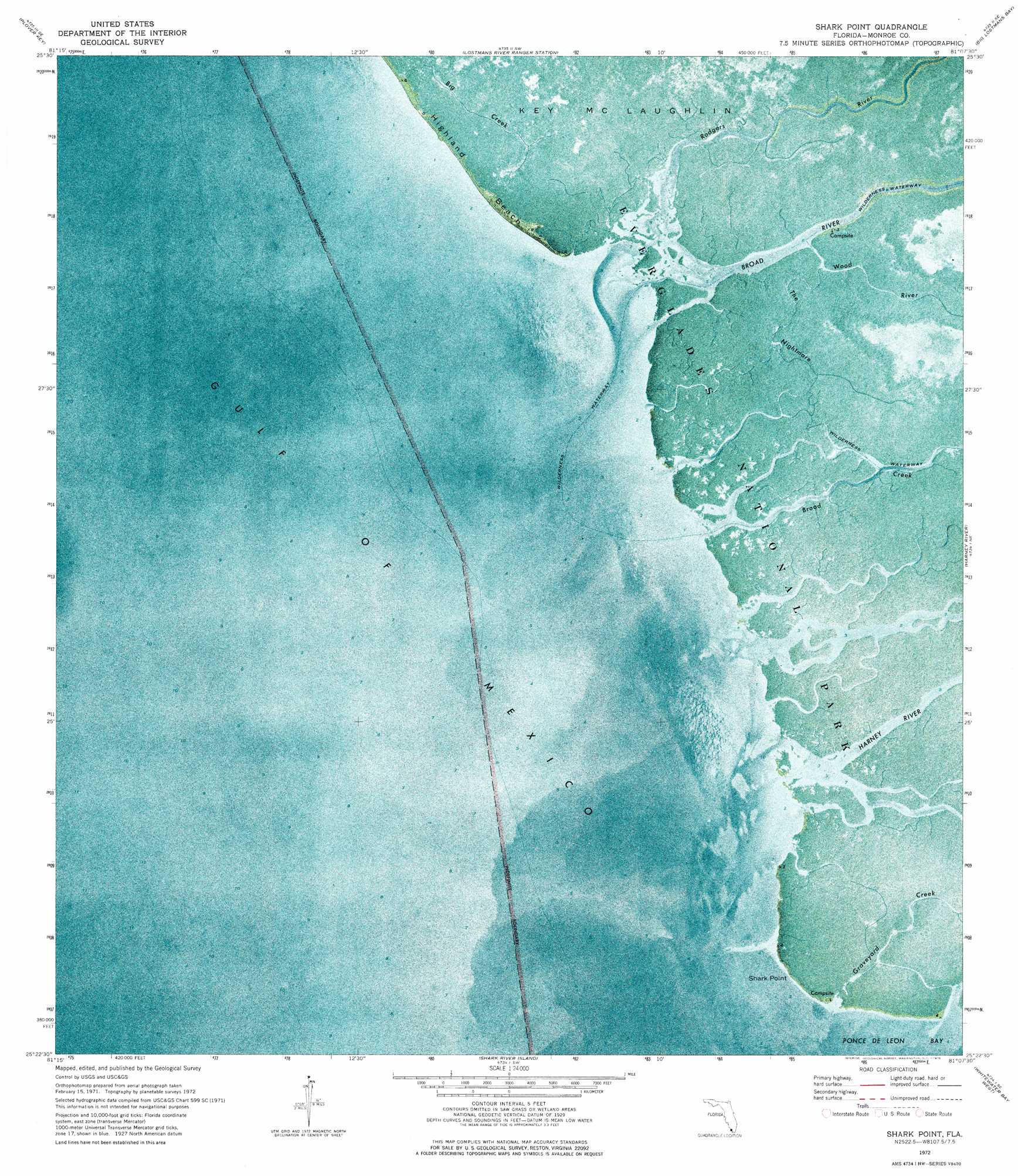
USGS Topo Quad 25081d2 - 1:24,000 scale
| Topo Map Name: | Shark Point |
| USGS Topo Quad ID: | 25081d2 |
| Print Size: | ca. 21 1/4" wide x 27" high |
| Southeast Coordinates: | 25.375° N latitude / 81.125° W longitude |
| Map Center Coordinates: | 25.4375° N latitude / 81.1875° W longitude |
| U.S. State: | FL |
| Filename: | P25081D2.jpg |
| Download Map JPG Image: | Shark Point topo map 1:24,000 scale |
| Map Type: | Orthophoto |
| Topo Series: | 7.5´ |
| Map Scale: | 1:24,000 |
| Source of Map Images: | United States Geological Survey (USGS) |
| Alternate Map Versions: |
Shark Point FL 1972, updated 1976 Download PDF Buy paper map Shark Point FL 2012 Download PDF Buy paper map Shark Point FL 2015 Download PDF Buy paper map |
1:24,000 Topo Quads surrounding Shark Point
Pavilion Key |
Alligator Bay |
Big Boy Lake |
Lostmans Trail |
|
Plover Key |
Lostmans River Ranger Station |
Big Lostmans Bay |
Indian Camp Creek |
|
Shark Point |
Harney River |
Tarpon Bay |
||
Shark River Island |
Whitewater Bay West |
Whitewater Bay East |
||
Lake Ingraham West |
Lake Ingraham East |
Flamingo |
> Back to 25081a1 at 1:100,000 scale
> Back to 25080a1 at 1:250,000 scale
> Back to U.S. Topo Maps home
Shark Point topo map: Gazetteer
Shark Point: Areas
The Nightmare elevation 0m 0′Shark Point: Beaches
Highland Beach elevation 0m 0′Shark Point: Capes
Shark Point elevation 0m 0′Shark Point: Streams
Big Creek elevation 1m 3′Broad Creek elevation 0m 0′
Broad River elevation 0m 0′
Graveyard Creek elevation 0m 0′
Harney River elevation 0m 0′
Rodgers River elevation 0m 0′
Wood River elevation 0m 0′
Shark Point digital topo map on disk
Buy this Shark Point topo map showing relief, roads, GPS coordinates and other geographical features, as a high-resolution digital map file on DVD: