Big Lostmans Bay Topo Map Florida
To zoom in, hover over the map of Big Lostmans Bay
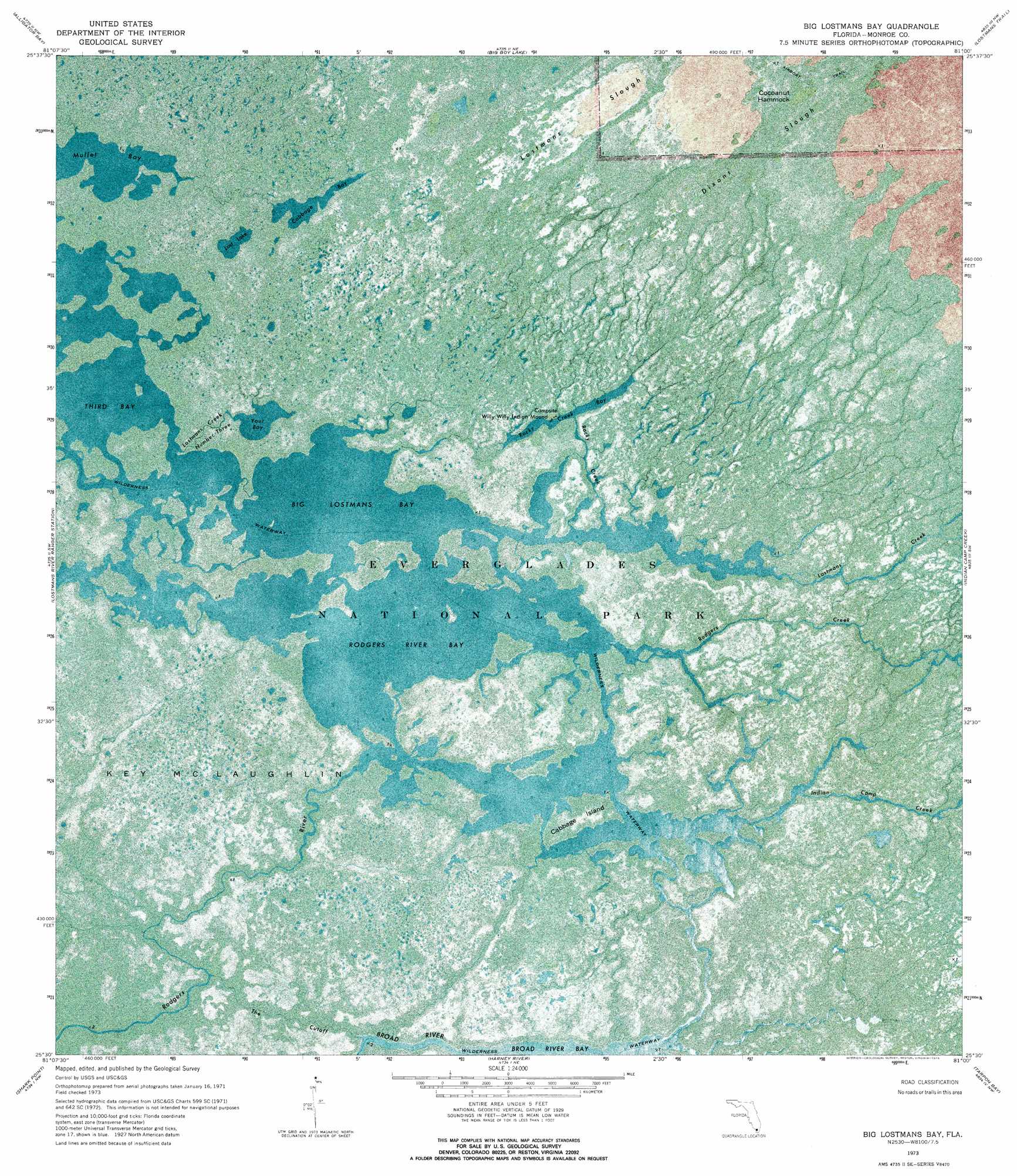
USGS Topo Quad 25081e1 - 1:24,000 scale
| Topo Map Name: | Big Lostmans Bay |
| USGS Topo Quad ID: | 25081e1 |
| Print Size: | ca. 21 1/4" wide x 27" high |
| Southeast Coordinates: | 25.5° N latitude / 81° W longitude |
| Map Center Coordinates: | 25.5625° N latitude / 81.0625° W longitude |
| U.S. State: | FL |
| Filename: | P25081E1.jpg |
| Download Map JPG Image: | Big Lostmans Bay topo map 1:24,000 scale |
| Map Type: | Orthophoto |
| Topo Series: | 7.5´ |
| Map Scale: | 1:24,000 |
| Source of Map Images: | United States Geological Survey (USGS) |
| Alternate Map Versions: |
Big Lostmans Bay FL 1973, updated 1976 Download PDF Buy paper map Big Lostmans Bay FL 2012 Download PDF Buy paper map Big Lostmans Bay FL 2015 Download PDF Buy paper map |
1:24,000 Topo Quads surrounding Big Lostmans Bay
Chokoloskee |
Gator Hook Swamp |
Monroe Station |
Fiftymile Bend |
Fortymile Bend |
Pavilion Key |
Alligator Bay |
Big Boy Lake |
Lostmans Trail |
Shark Valley Lookout Tower |
Plover Key |
Lostmans River Ranger Station |
Big Lostmans Bay |
Indian Camp Creek |
Panther Mound |
Shark Point |
Harney River |
Tarpon Bay |
Pa-Hay-Okee Lookout Tower |
|
Shark River Island |
Whitewater Bay West |
Whitewater Bay East |
Mahogany Hammock |
> Back to 25081e1 at 1:100,000 scale
> Back to 25080a1 at 1:250,000 scale
> Back to U.S. Topo Maps home
Big Lostmans Bay topo map: Gazetteer
Big Lostmans Bay: Bays
Big Lostmans Bay elevation 0m 0′Cabbage Bay elevation 0m 0′
Mullet Bay elevation 0m 0′
Rocky Creek Bay elevation 0m 0′
Rodgers River Bay elevation 0m 0′
Third Bay elevation 0m 0′
Your Bay elevation 0m 0′
Big Lostmans Bay: Channels
The Cutoff elevation 0m 0′Big Lostmans Bay: Islands
Cabbage Island elevation 0m 0′Cocoanut Hammock elevation 0m 0′
Big Lostmans Bay: Lakes
Lost Lake elevation 0m 0′Big Lostmans Bay: Streams
Indian Camp Creek elevation 0m 0′Lostmans Creek elevation 0m 0′
Lostmans Creek Number Three elevation 0m 0′
Rocky Creek elevation 0m 0′
Rodgers Creek elevation 0m 0′
Big Lostmans Bay digital topo map on disk
Buy this Big Lostmans Bay topo map showing relief, roads, GPS coordinates and other geographical features, as a high-resolution digital map file on DVD: