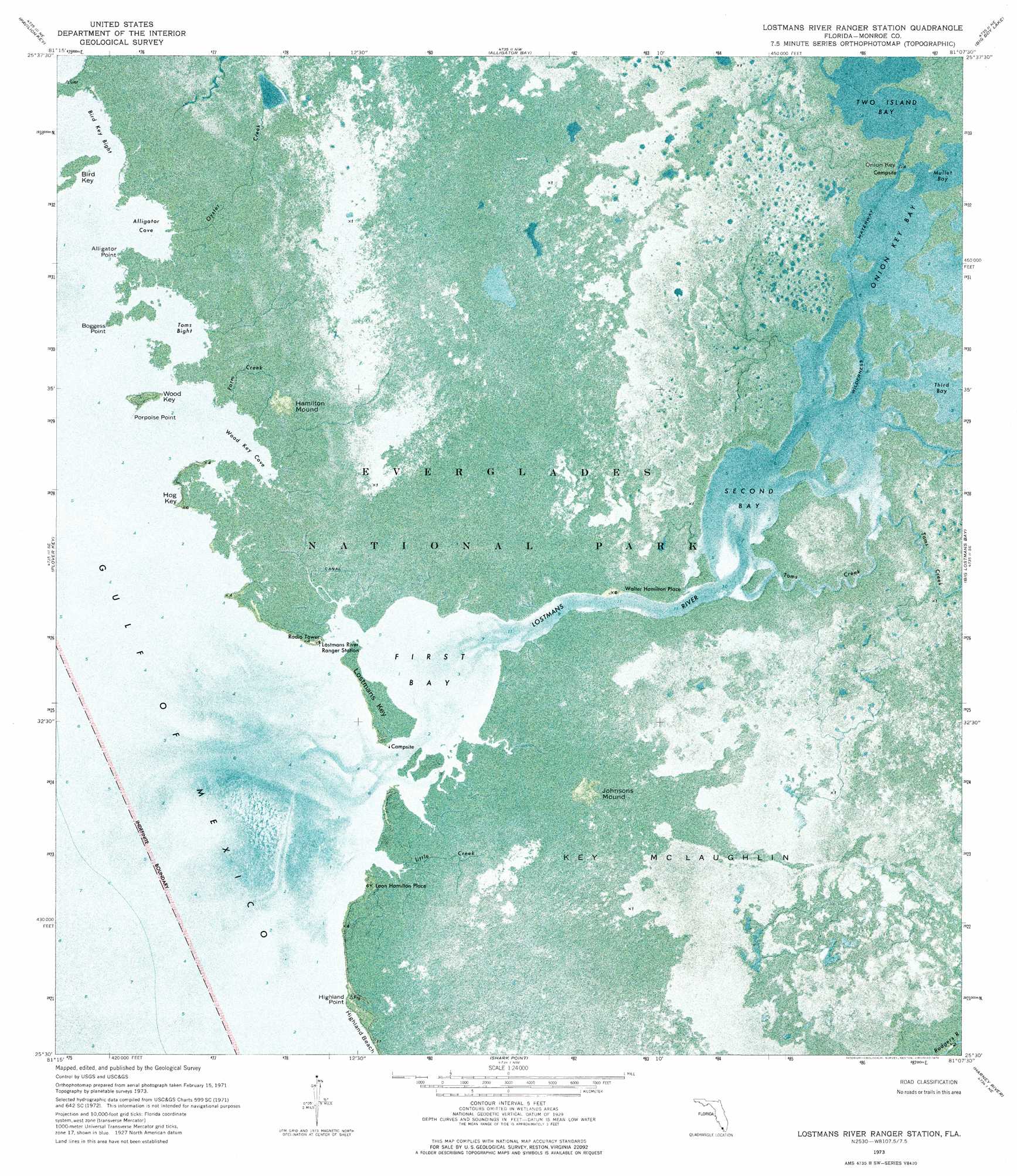
Lostmans River Ranger Station Topo Map Florida
To zoom in, hover over the map of Lostmans River Ranger Station
USGS Topo Quad 25081e2 - 1:24,000 scale
| Topo Map Name: | Lostmans River Ranger Station |
| USGS Topo Quad ID: | 25081e2 |
| Print Size: | ca. 21 1/4" wide x 27" high |
| Southeast Coordinates: | 25.5° N latitude / 81.125° W longitude |
| Map Center Coordinates: | 25.5625° N latitude / 81.1875° W longitude |
| U.S. State: | FL |
| Filename: | P25081E2.jpg |
| Download Map JPG Image: | Lostmans River Ranger Station topo map 1:24,000 scale |
| Map Type: | Orthophoto |
| Topo Series: | 7.5´ |
| Map Scale: | 1:24,000 |
| Source of Map Images: | United States Geological Survey (USGS) |
| Alternate Map Versions: |
Lostmans River Ranger Station FL 1973, updated 1976 Download PDF Buy paper map Lostmans River Ranger Station FL 2012 Download PDF Buy paper map Lostmans River Ranger Station FL 2015 Download PDF Buy paper map |
1:24,000 Topo Quads surrounding Lostmans River Ranger Station
Everglades City |
Chokoloskee |
Gator Hook Swamp |
Monroe Station |
Fiftymile Bend |
Pavilion Key |
Alligator Bay |
Big Boy Lake |
Lostmans Trail |
|
Plover Key |
Lostmans River Ranger Station |
Big Lostmans Bay |
Indian Camp Creek |
|
Shark Point |
Harney River |
Tarpon Bay |
||
Shark River Island |
Whitewater Bay West |
Whitewater Bay East |
> Back to 25081e1 at 1:100,000 scale
> Back to 25080a1 at 1:250,000 scale
> Back to U.S. Topo Maps home
Lostmans River Ranger Station topo map: Gazetteer
Lostmans River Ranger Station: Bays
Alligator Cove elevation 0m 0′Bird Key Bight elevation 0m 0′
First Bay elevation 0m 0′
Onion Key Bay elevation 0m 0′
Second Bay elevation 0m 0′
Toms Bight elevation 0m 0′
Two Island Bay elevation 0m 0′
Wood Key Cove elevation 0m 0′
Lostmans River Ranger Station: Capes
Alligator Point elevation 0m 0′Boggess Point elevation 1m 3′
Highland Point elevation 1m 3′
Porpoise Point elevation 0m 0′
Lostmans River Ranger Station: Guts
Farm Creek elevation 0m 0′Lostmans River Ranger Station: Islands
Bird Key elevation 0m 0′Hog Key elevation 1m 3′
Key McLaughlin elevation 0m 0′
Lostmans Key elevation 0m 0′
Wood Key elevation 1m 3′
Lostmans River Ranger Station: Populated Places
Leon Hamilton Place elevation 0m 0′Walter Hamilton Place elevation 0m 0′
Lostmans River Ranger Station: Streams
Little Creek elevation 0m 0′Lostmans River elevation 0m 0′
Oyster Creek elevation 0m 0′
Toms Creek elevation 0m 0′
Lostmans River Ranger Station: Summits
Hamilton Mound elevation 0m 0′Johnson Mound elevation 0m 0′
Lostmans River Ranger Station digital topo map on disk
Buy this Lostmans River Ranger Station topo map showing relief, roads, GPS coordinates and other geographical features, as a high-resolution digital map file on DVD: