Burns Lake Topo Map Florida
To zoom in, hover over the map of Burns Lake
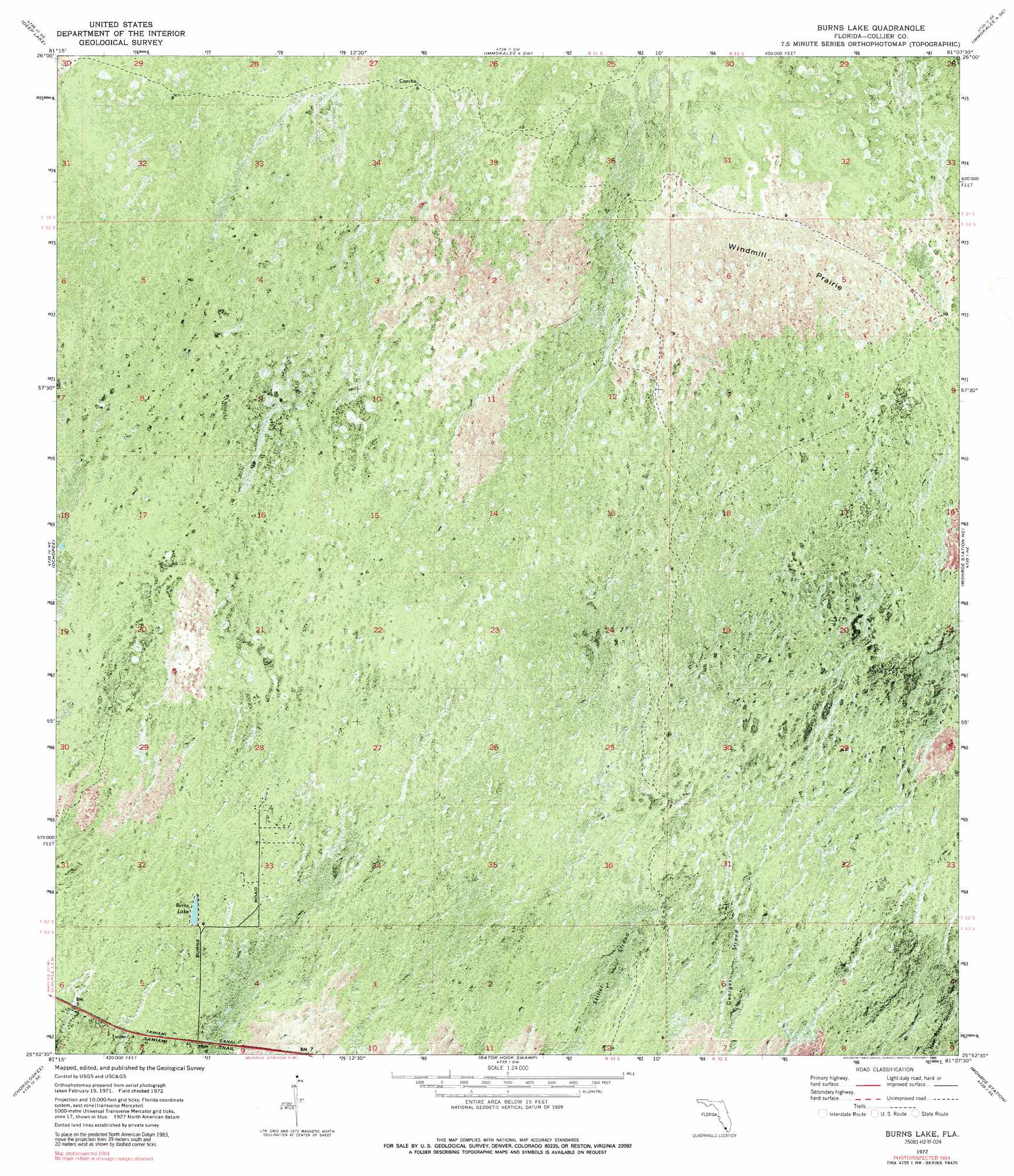
USGS Topo Quad 25081h2 - 1:24,000 scale
| Topo Map Name: | Burns Lake |
| USGS Topo Quad ID: | 25081h2 |
| Print Size: | ca. 21 1/4" wide x 27" high |
| Southeast Coordinates: | 25.875° N latitude / 81.125° W longitude |
| Map Center Coordinates: | 25.9375° N latitude / 81.1875° W longitude |
| U.S. State: | FL |
| Filename: | P25081H2.jpg |
| Download Map JPG Image: | Burns Lake topo map 1:24,000 scale |
| Map Type: | Orthophoto |
| Topo Series: | 7.5´ |
| Map Scale: | 1:24,000 |
| Source of Map Images: | United States Geological Survey (USGS) |
| Alternate Map Versions: |
Burns Lake FL 1972, updated 1976 Download PDF Buy paper map Burns Lake FL 1972, updated 1989 Download PDF Buy paper map Burns Lake FL 2012 Download PDF Buy paper map Burns Lake FL 2015 Download PDF Buy paper map |
1:24,000 Topo Quads surrounding Burns Lake
Catherine Island |
Miles City |
Immokalee 4 Nw |
Immokalee 4 Ne |
Everglades 3 Nw |
Deep Lake Sw |
Deep Lake |
Immokalee 4 Sw |
Immokalee 4 Se |
Everglades 3 Sw |
Weavers Station |
Ochopee |
Burns Lake |
Monroe Station Ne |
North Of Fiftymile Bend |
Everglades City |
Chokoloskee |
Gator Hook Swamp |
Monroe Station |
Fiftymile Bend |
Pavilion Key |
Alligator Bay |
Big Boy Lake |
Lostmans Trail |
> Back to 25081e1 at 1:100,000 scale
> Back to 25080a1 at 1:250,000 scale
> Back to U.S. Topo Maps home
Burns Lake topo map: Gazetteer
Burns Lake: Flats
Windmill Prairie elevation 2m 6′Burns Lake: Lakes
Burns Lake elevation 1m 3′Burns Lake: Trails
Tamiami Trail elevation 2m 6′Burns Lake digital topo map on disk
Buy this Burns Lake topo map showing relief, roads, GPS coordinates and other geographical features, as a high-resolution digital map file on DVD: