Everglades 4 Se Topo Map Florida
To zoom in, hover over the map of Everglades 4 Se
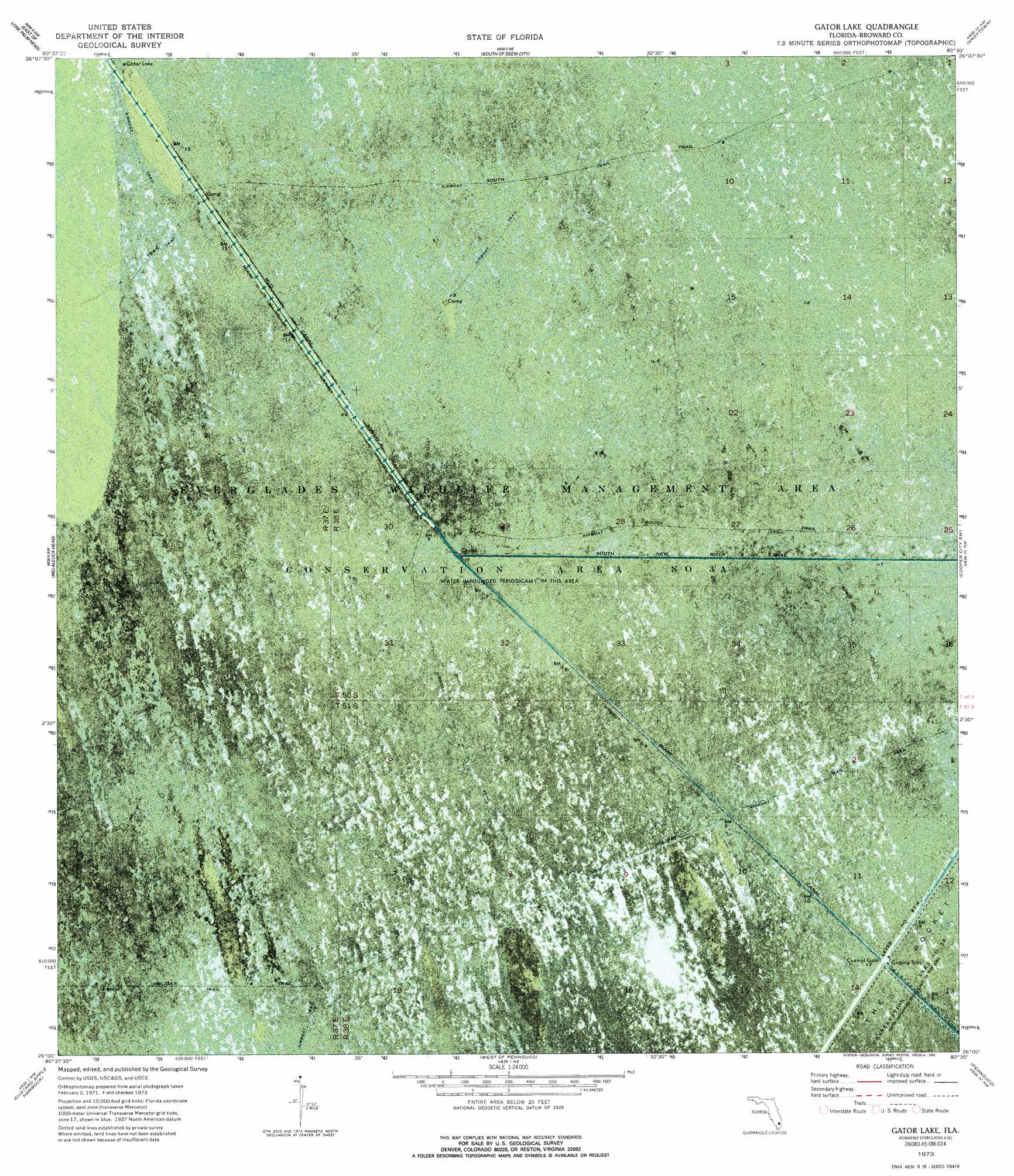
USGS Topo Quad 26080a5 - 1:24,000 scale
| Topo Map Name: | Everglades 4 Se |
| USGS Topo Quad ID: | 26080a5 |
| Print Size: | ca. 21 1/4" wide x 27" high |
| Southeast Coordinates: | 26° N latitude / 80.5° W longitude |
| Map Center Coordinates: | 26.0625° N latitude / 80.5625° W longitude |
| U.S. State: | FL |
| Filename: | P26080A5.jpg |
| Download Map JPG Image: | Everglades 4 Se topo map 1:24,000 scale |
| Map Type: | Orthophoto |
| Topo Series: | 7.5´ |
| Map Scale: | 1:24,000 |
| Source of Map Images: | United States Geological Survey (USGS) |
| Alternate Map Versions: |
Everglades 4 SE FL 1973, updated 1976 Download PDF Buy paper map Gator Lake FL 1973, updated 1993 Download PDF Buy paper map Gator Lake FL 2012 Download PDF Buy paper map Gator Lake FL 2015 Download PDF Buy paper map |
1:24,000 Topo Quads surrounding Everglades 4 Se
Everglades 2 Se |
Everglades 1 Sw |
Everglades 1 Se |
Fort Lauderdale 2 Sw |
Fort Lauderdale 2 Se |
Everglades 3 Ne |
Everglades 4 Nw |
Everglades 4 Ne |
Andytown |
Cooper City Ne |
Everglades 3 Se |
Everglades 4 Sw |
Everglades 4 Se |
Cooper City Sw |
Cooper City |
North Of Fortymile Bend |
Custard Apple Hammock |
West Of Pennsuco |
Pennsuco |
Opa-Locka |
Fortymile Bend |
Long Island |
Coopertown |
Hialeah Sw |
Hialeah |
> Back to 26080a1 at 1:100,000 scale
> Back to 26080a1 at 1:250,000 scale
> Back to U.S. Topo Maps home
Everglades 4 Se topo map: Gazetteer
Everglades 4 Se: Lakes
Gator Lake elevation 2m 6′Everglades 4 Se: Trails
South Trail elevation 2m 6′Everglades 4 Se digital topo map on disk
Buy this Everglades 4 Se topo map showing relief, roads, GPS coordinates and other geographical features, as a high-resolution digital map file on DVD: