Big Mound South Topo Map Florida
To zoom in, hover over the map of Big Mound South
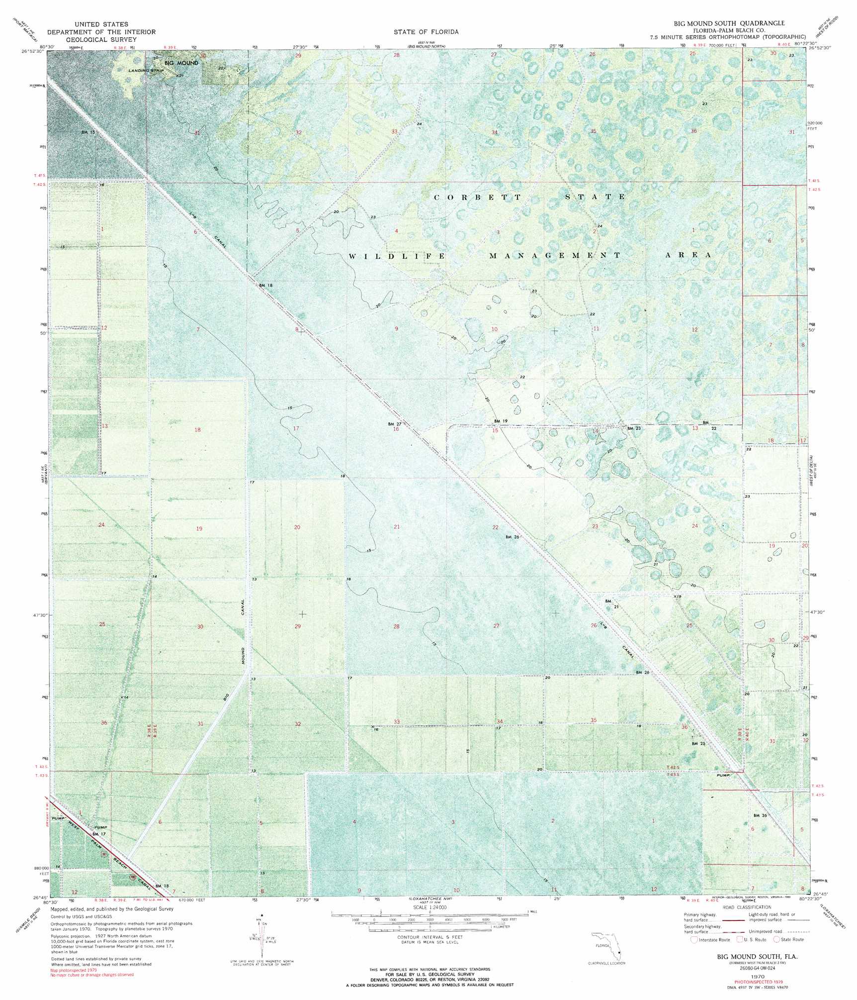
USGS Topo Quad 26080g4 - 1:24,000 scale
| Topo Map Name: | Big Mound South |
| USGS Topo Quad ID: | 26080g4 |
| Print Size: | ca. 21 1/4" wide x 27" high |
| Southeast Coordinates: | 26.75° N latitude / 80.375° W longitude |
| Map Center Coordinates: | 26.8125° N latitude / 80.4375° W longitude |
| U.S. State: | FL |
| Filename: | P26080G4.jpg |
| Download Map JPG Image: | Big Mound South topo map 1:24,000 scale |
| Map Type: | Orthophoto |
| Topo Series: | 7.5´ |
| Map Scale: | 1:24,000 |
| Source of Map Images: | United States Geological Survey (USGS) |
| Alternate Map Versions: |
West Palm Beach 2 SW FL 1970, updated 1976 Download PDF Buy paper map Big Mound South FL 1970, updated 1993 Download PDF Buy paper map West Palm Beach 2 SW FL 1971, updated 1984 Download PDF Buy paper map Big Mound South FL 2012 Download PDF Buy paper map Big Mound South FL 2015 Download PDF Buy paper map |
1:24,000 Topo Quads surrounding Big Mound South
Okeechobee 4 Sw |
Okeechobee 4 Se |
Indian Town |
Indiantown Se |
Gomez |
Port Mayaca |
West Palm Beach 2 Nw |
West Palm Beach 2 Ne |
Rood |
|
Pahokee |
Bryant |
Big Mound South |
West of Delta |
Delta |
Belle Glade |
Sixmile Bend |
Loxahatchee Nw |
Loxahatchee |
Palm Beach Farms |
Okeelanta |
Shawano |
Loxahatchee Sw |
Loxahatchee Se |
Greenacres City |
> Back to 26080e1 at 1:100,000 scale
> Back to 26080a1 at 1:250,000 scale
> Back to U.S. Topo Maps home
Big Mound South topo map: Gazetteer
Big Mound South: Canals
Big Mound Canal elevation 4m 13′L-8 Canal elevation 5m 16′
Big Mound South: Summits
Big Mound elevation 6m 19′Big Mound South digital topo map on disk
Buy this Big Mound South topo map showing relief, roads, GPS coordinates and other geographical features, as a high-resolution digital map file on DVD: