Belle Meade Topo Map Florida
To zoom in, hover over the map of Belle Meade
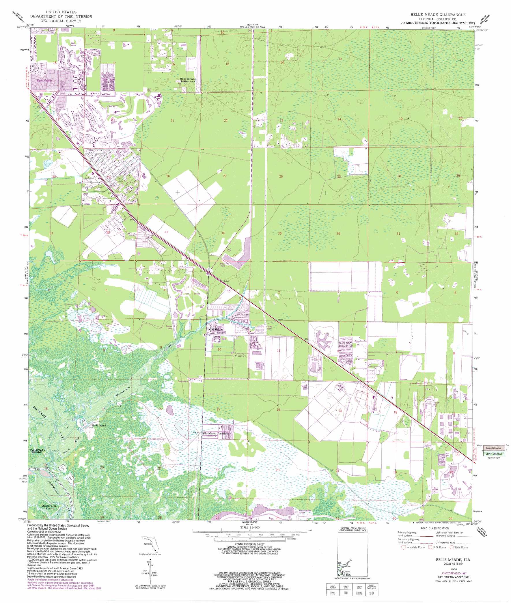
USGS Topo Quad 26081a6 - 1:24,000 scale
| Topo Map Name: | Belle Meade |
| USGS Topo Quad ID: | 26081a6 |
| Print Size: | ca. 21 1/4" wide x 27" high |
| Southeast Coordinates: | 26° N latitude / 81.625° W longitude |
| Map Center Coordinates: | 26.0625° N latitude / 81.6875° W longitude |
| U.S. State: | FL |
| Filename: | O26081A6.jpg |
| Download Map JPG Image: | Belle Meade topo map 1:24,000 scale |
| Map Type: | Topographic |
| Topo Series: | 7.5´ |
| Map Scale: | 1:24,000 |
| Source of Map Images: | United States Geological Survey (USGS) |
| Alternate Map Versions: |
Belle Meade FL 1958, updated 1959 Download PDF Buy paper map Belle Meade FL 1958, updated 1968 Download PDF Buy paper map Belle Meade FL 1958, updated 1974 Download PDF Buy paper map Belle Meade FL 1958, updated 1988 Download PDF Buy paper map Belle Meade FL 1958, updated 1991 Download PDF Buy paper map Belle Meade FL 2012 Download PDF Buy paper map Belle Meade FL 2015 Download PDF Buy paper map |
1:24,000 Topo Quads surrounding Belle Meade
Bonita Springs |
Corkscrew Sw |
Corkscrew Se |
Immokalee Sw |
|
Naples North |
Belle Meade Nw |
Belle Meade Ne |
Catherine Island |
|
Naples South |
Belle Meade |
Belle Meade Se |
Deep Lake Sw |
|
Marco Island |
Royal Palm Hammock |
Weavers Station |
||
Cape Romano |
Panther Key |
Everglades City |
> Back to 26081a1 at 1:100,000 scale
> Back to 26080a1 at 1:250,000 scale
> Back to U.S. Topo Maps home
Belle Meade topo map: Gazetteer
Belle Meade: Airports
Wing South Airpark elevation 3m 9′Belle Meade: Bays
Hall Bay elevation 0m 0′Johnson Bay elevation 0m 0′
Rookery Bay elevation 0m 0′
Belle Meade: Guts
Henderson Creek elevation 0m 0′Belle Meade: Islands
Cannon Island elevation 0m 0′Rattlesnake Hammock elevation 3m 9′
Shell Island elevation 0m 0′
The Woods elevation 0m 0′
Umbrella Island elevation 0m 0′
Belle Meade: Populated Places
Belle Meade elevation 1m 3′Bickford Trailer Park elevation 1m 3′
Enchanting Shores Mobile Home Park elevation 1m 3′
Iverson Trailer Park elevation 1m 3′
Kenyon Mobile Home Park elevation 1m 3′
Lely elevation 2m 6′
Lely Resort elevation 2m 6′
M and E Trailer Park elevation 1m 3′
Marco Shores Estates Mobile Home Park elevation 1m 3′
Naples Manor elevation 1m 3′
Old Marco Junction elevation 1m 3′
Pelican Lake Motorcoach Resort elevation 1m 3′
Shell Island elevation 1m 3′
Belle Meade: Streams
Whites River elevation 0m 0′Belle Meade digital topo map on disk
Buy this Belle Meade topo map showing relief, roads, GPS coordinates and other geographical features, as a high-resolution digital map file on DVD: