Belle Meade Nw Topo Map Florida
To zoom in, hover over the map of Belle Meade Nw
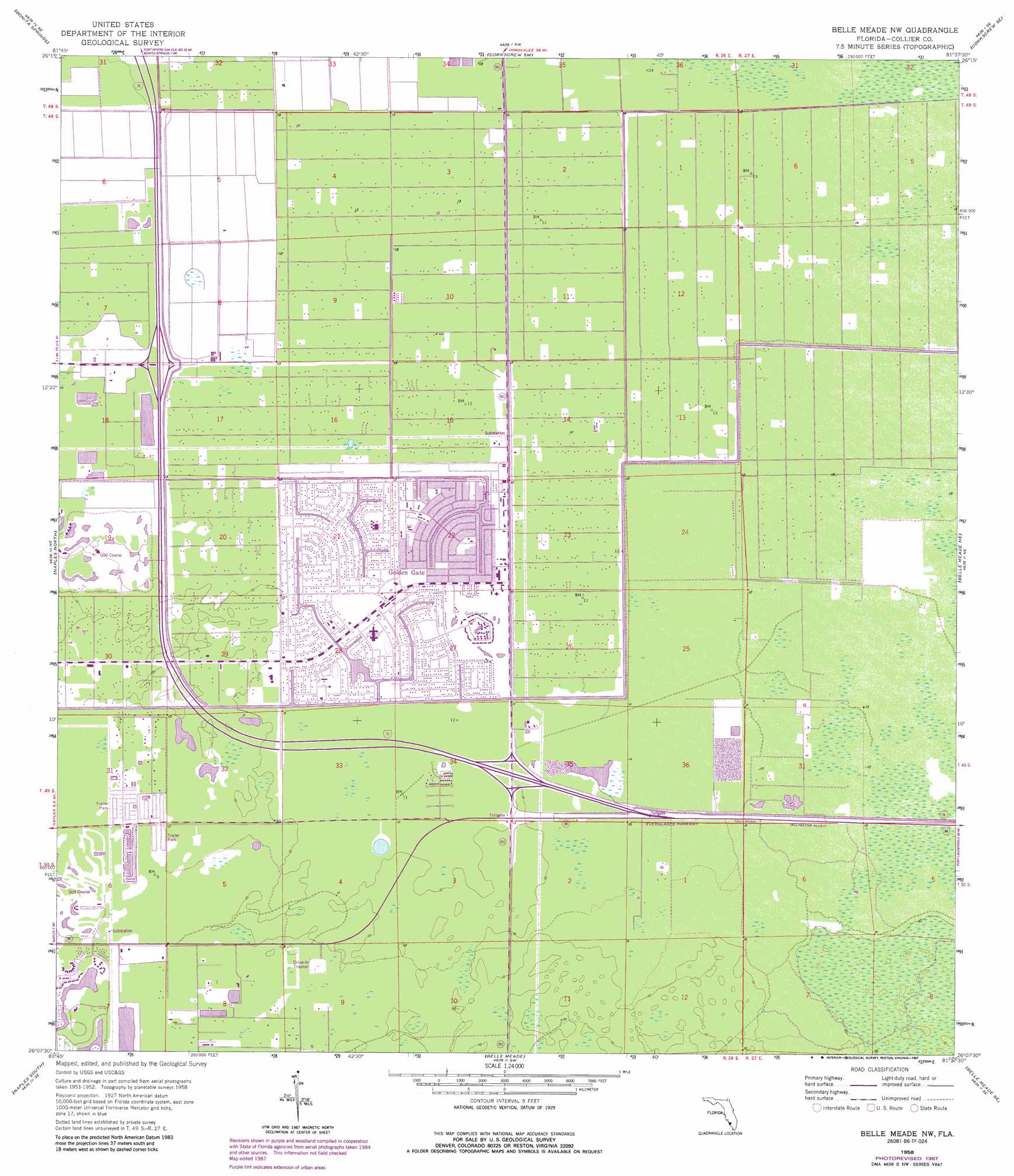
USGS Topo Quad 26081b6 - 1:24,000 scale
| Topo Map Name: | Belle Meade Nw |
| USGS Topo Quad ID: | 26081b6 |
| Print Size: | ca. 21 1/4" wide x 27" high |
| Southeast Coordinates: | 26.125° N latitude / 81.625° W longitude |
| Map Center Coordinates: | 26.1875° N latitude / 81.6875° W longitude |
| U.S. State: | FL |
| Filename: | O26081B6.jpg |
| Download Map JPG Image: | Belle Meade Nw topo map 1:24,000 scale |
| Map Type: | Topographic |
| Topo Series: | 7.5´ |
| Map Scale: | 1:24,000 |
| Source of Map Images: | United States Geological Survey (USGS) |
| Alternate Map Versions: |
Belle Meade NW FL 1958, updated 1959 Download PDF Buy paper map Belle Meade NW FL 1958, updated 1969 Download PDF Buy paper map Belle Meade NW FL 1958, updated 1974 Download PDF Buy paper map Belle Meade NW FL 1958, updated 1981 Download PDF Buy paper map Belle Meade NW FL 1958, updated 1987 Download PDF Buy paper map Belle Meade NW FL 1958, updated 1987 Download PDF Buy paper map Belle Meade NW FL 2012 Download PDF Buy paper map Belle Meade NW FL 2015 Download PDF Buy paper map |
1:24,000 Topo Quads surrounding Belle Meade Nw
Fort Myers Beach |
Estero |
Corkscrew Nw |
Corkscrew |
Immokalee |
Bonita Springs |
Corkscrew Sw |
Corkscrew Se |
Immokalee Sw |
|
Naples North |
Belle Meade Nw |
Belle Meade Ne |
Catherine Island |
|
Naples South |
Belle Meade |
Belle Meade Se |
Deep Lake Sw |
|
Marco Island |
Royal Palm Hammock |
Weavers Station |
> Back to 26081a1 at 1:100,000 scale
> Back to 26080a1 at 1:250,000 scale
> Back to U.S. Topo Maps home
Belle Meade Nw topo map: Gazetteer
Belle Meade Nw: Populated Places
Endless Summer Mobile Home Park elevation 2m 6′Golden Gate elevation 3m 9′
Southwind Mobile Village elevation 2m 6′
Vineyards elevation 3m 9′
Belle Meade Nw digital topo map on disk
Buy this Belle Meade Nw topo map showing relief, roads, GPS coordinates and other geographical features, as a high-resolution digital map file on DVD: