Immokalee 1 Sw Topo Map Florida
To zoom in, hover over the map of Immokalee 1 Sw
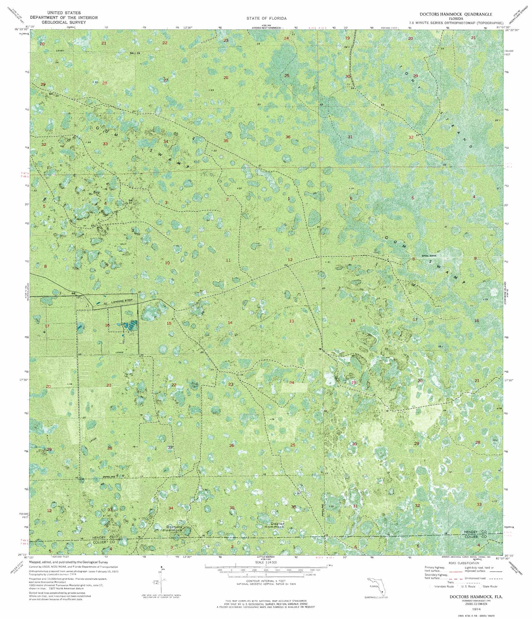
USGS Topo Quad 26081c2 - 1:24,000 scale
| Topo Map Name: | Immokalee 1 Sw |
| USGS Topo Quad ID: | 26081c2 |
| Print Size: | ca. 21 1/4" wide x 27" high |
| Southeast Coordinates: | 26.25° N latitude / 81.125° W longitude |
| Map Center Coordinates: | 26.3125° N latitude / 81.1875° W longitude |
| U.S. State: | FL |
| Filename: | P26081C2.jpg |
| Download Map JPG Image: | Immokalee 1 Sw topo map 1:24,000 scale |
| Map Type: | Orthophoto |
| Topo Series: | 7.5´ |
| Map Scale: | 1:24,000 |
| Source of Map Images: | United States Geological Survey (USGS) |
| Alternate Map Versions: |
Immokalee 1 SW FL 1974, updated 1976 Download PDF Buy paper map Doctors Hammock FL 1974, updated 1993 Download PDF Buy paper map Doctors Hammock FL 2012 Download PDF Buy paper map Doctors Hammock FL 2015 Download PDF Buy paper map |
1:24,000 Topo Quads surrounding Immokalee 1 Sw
Felda |
Felda Se |
La Belle 4 Sw |
La Belle 4 Se |
Lake Harbor Sw |
Immokalee |
Immokalee Ne |
Immokalee 1 Nw |
Immokalee 1 Ne |
Everglades 2 Nw |
Immokalee Sw |
Sunniland |
Immokalee 1 Sw |
Immokalee 1 Se |
Everglades 2 Sw |
Catherine Island |
Miles City |
Immokalee 4 Nw |
Immokalee 4 Ne |
Everglades 3 Nw |
Deep Lake Sw |
Deep Lake |
Immokalee 4 Sw |
Immokalee 4 Se |
Everglades 3 Sw |
> Back to 26081a1 at 1:100,000 scale
> Back to 26080a1 at 1:250,000 scale
> Back to U.S. Topo Maps home
Immokalee 1 Sw topo map: Gazetteer
Immokalee 1 Sw: Airports
Hendry Correctional Institute Airport elevation 6m 19′Immokalee 1 Sw: Islands
Doctors Hammock elevation 4m 13′Dozier Hammock elevation 4m 13′
Immokalee 1 Sw: Swamps
Gum Swamp elevation 6m 19′Tony Strand elevation 7m 22′
Immokalee 1 Sw digital topo map on disk
Buy this Immokalee 1 Sw topo map showing relief, roads, GPS coordinates and other geographical features, as a high-resolution digital map file on DVD: