La Belle 4 Ne Topo Map Florida
To zoom in, hover over the map of La Belle 4 Ne
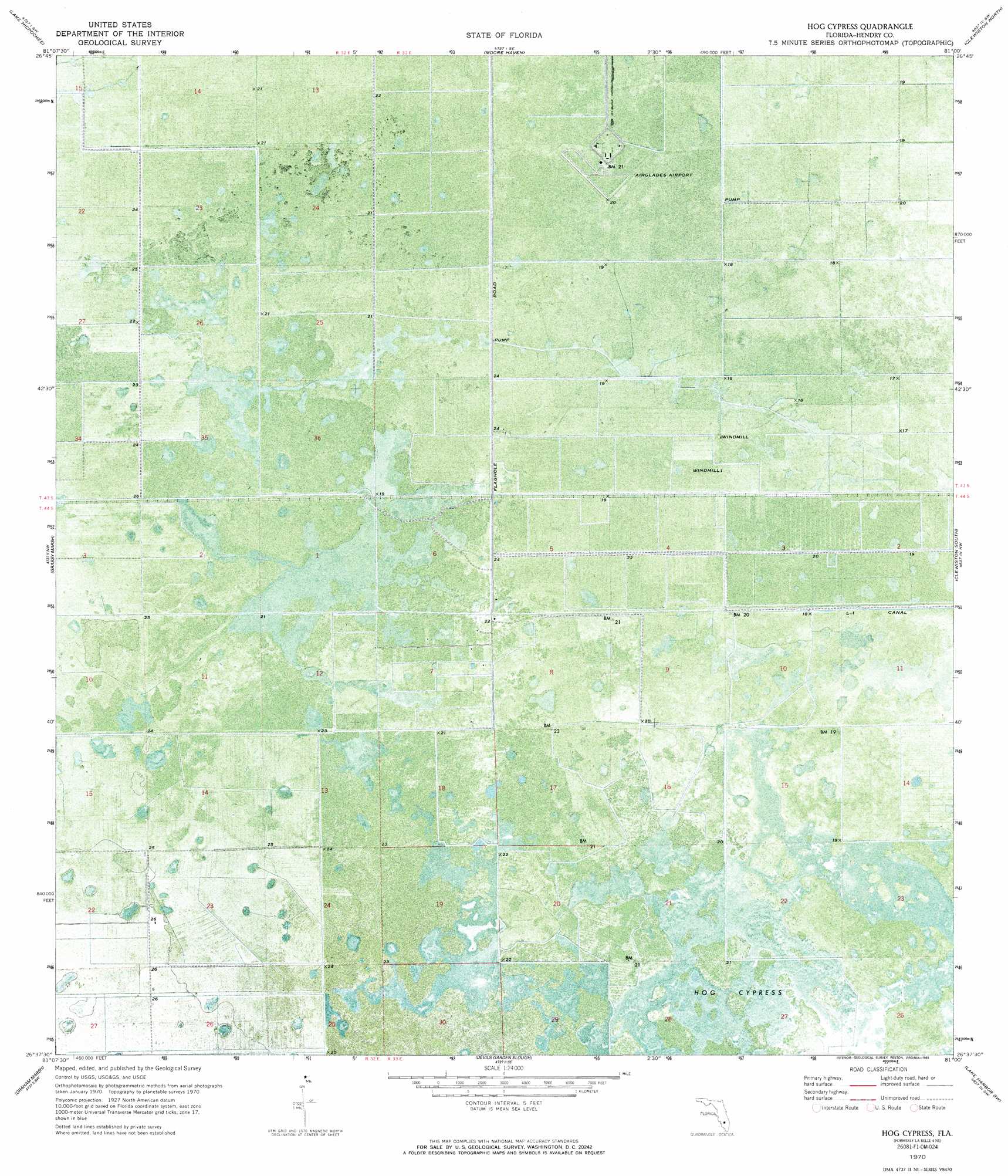
USGS Topo Quad 26081f1 - 1:24,000 scale
| Topo Map Name: | La Belle 4 Ne |
| USGS Topo Quad ID: | 26081f1 |
| Print Size: | ca. 21 1/4" wide x 27" high |
| Southeast Coordinates: | 26.625° N latitude / 81° W longitude |
| Map Center Coordinates: | 26.6875° N latitude / 81.0625° W longitude |
| U.S. State: | FL |
| Filename: | P26081F1.jpg |
| Download Map JPG Image: | La Belle 4 Ne topo map 1:24,000 scale |
| Map Type: | Orthophoto |
| Topo Series: | 7.5´ |
| Map Scale: | 1:24,000 |
| Source of Map Images: | United States Geological Survey (USGS) |
| Alternate Map Versions: |
La Belle 4 NE FL 1970, updated 1976 Download PDF Buy paper map Hog Cypress FL 1970, updated 1993 Download PDF Buy paper map Hog Cypress FL 2012 Download PDF Buy paper map Hog Cypress FL 2015 Download PDF Buy paper map |
1:24,000 Topo Quads surrounding La Belle 4 Ne
Palmdale |
Lakeport |
Fisheating Bay |
Cochrans Pass |
|
Goodno |
Lake Hicpochee |
Moore Haven |
Clewiston North |
|
Felda Ne |
La Belle 4 Nw |
La Belle 4 Ne |
Clewiston South |
Lake Harbor |
Felda Se |
La Belle 4 Sw |
La Belle 4 Se |
Lake Harbor Sw |
Lake Harbor Se |
Immokalee Ne |
Immokalee 1 Nw |
Immokalee 1 Ne |
Everglades 2 Nw |
Everglades 2 Ne |
> Back to 26081e1 at 1:100,000 scale
> Back to 26080a1 at 1:250,000 scale
> Back to U.S. Topo Maps home
La Belle 4 Ne topo map: Gazetteer
La Belle 4 Ne: Airports
Airglades Airport elevation 6m 19′La Belle 4 Ne: Swamps
Hog Cypress elevation 6m 19′La Belle 4 Ne digital topo map on disk
Buy this La Belle 4 Ne topo map showing relief, roads, GPS coordinates and other geographical features, as a high-resolution digital map file on DVD: