Lake Hicpochee Topo Map Florida
To zoom in, hover over the map of Lake Hicpochee
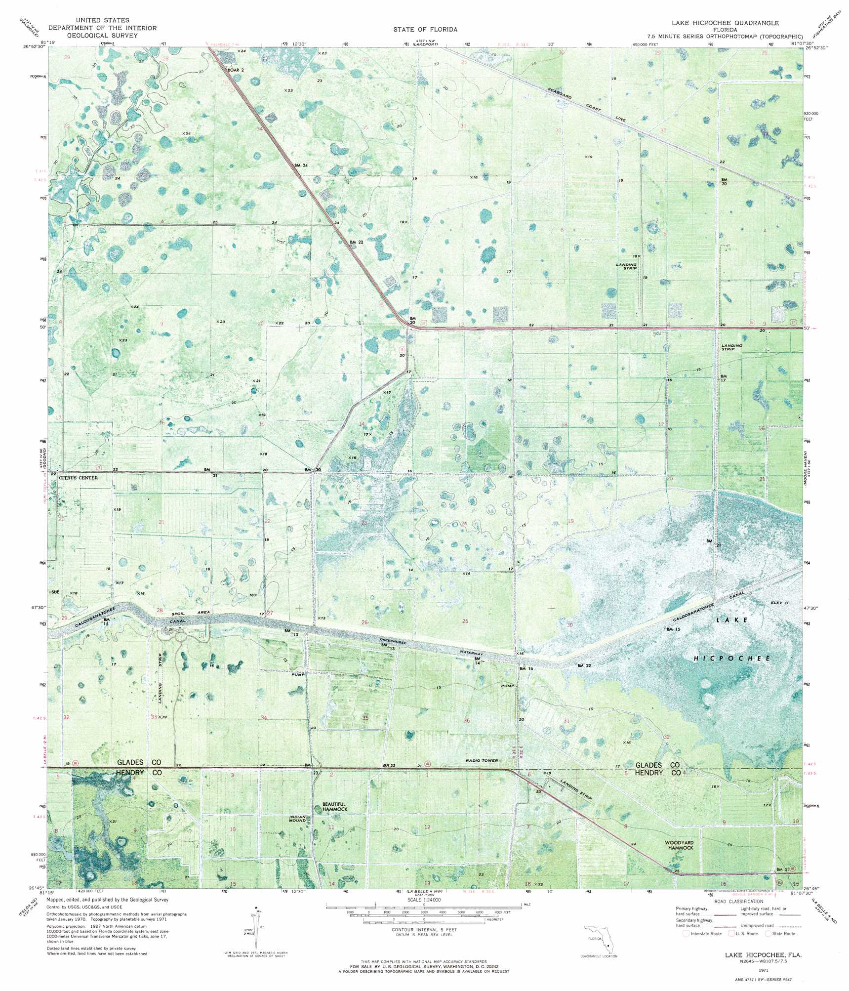
USGS Topo Quad 26081g2 - 1:24,000 scale
| Topo Map Name: | Lake Hicpochee |
| USGS Topo Quad ID: | 26081g2 |
| Print Size: | ca. 21 1/4" wide x 27" high |
| Southeast Coordinates: | 26.75° N latitude / 81.125° W longitude |
| Map Center Coordinates: | 26.8125° N latitude / 81.1875° W longitude |
| U.S. State: | FL |
| Filename: | P26081G2.jpg |
| Download Map JPG Image: | Lake Hicpochee topo map 1:24,000 scale |
| Map Type: | Orthophoto |
| Topo Series: | 7.5´ |
| Map Scale: | 1:24,000 |
| Source of Map Images: | United States Geological Survey (USGS) |
| Alternate Map Versions: |
Lake Hicpochee FL 1971, updated 1976 Download PDF Buy paper map Lake Hicpochee FL 2012 Download PDF Buy paper map Lake Hicpochee FL 2015 Download PDF Buy paper map |
1:24,000 Topo Quads surrounding Lake Hicpochee
Venus Sw |
Venus |
Brighton Sw |
Brighton Se |
Okeechobee Sw |
La Belle Nw |
Palmdale |
Lakeport |
Fisheating Bay |
Cochrans Pass |
La Belle |
Goodno |
Lake Hicpochee |
Moore Haven |
Clewiston North |
Sears |
Felda Ne |
La Belle 4 Nw |
La Belle 4 Ne |
Clewiston South |
Felda |
Felda Se |
La Belle 4 Sw |
La Belle 4 Se |
Lake Harbor Sw |
> Back to 26081e1 at 1:100,000 scale
> Back to 26080a1 at 1:250,000 scale
> Back to U.S. Topo Maps home
Lake Hicpochee topo map: Gazetteer
Lake Hicpochee: Airports
Moore Haven Airport elevation 5m 16′Lake Hicpochee: Bridges
Negro Jim Hammock Bridge elevation 6m 19′Lake Hicpochee: Islands
Beautiful Hammock elevation 6m 19′Woodyard Hammock elevation 6m 19′
Lake Hicpochee: Lakes
Donald Peeples Pond elevation 6m 19′Lake Hicpochee elevation 3m 9′
W H Peeples Pond One elevation 4m 13′
Lake Hicpochee digital topo map on disk
Buy this Lake Hicpochee topo map showing relief, roads, GPS coordinates and other geographical features, as a high-resolution digital map file on DVD: