La Belle Topo Map Florida
To zoom in, hover over the map of La Belle
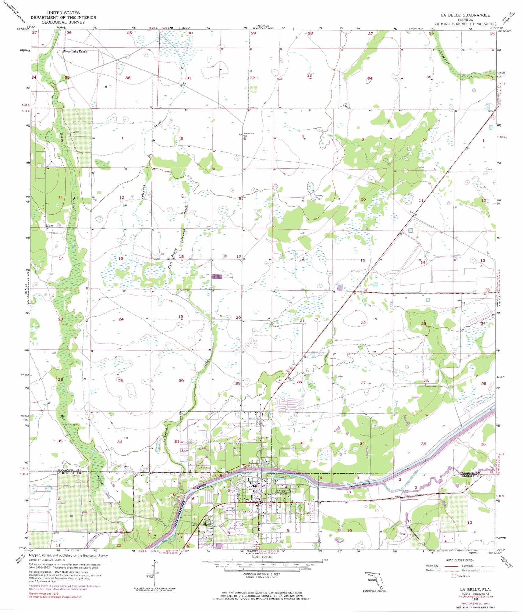
USGS Topo Quad 26081g4 - 1:24,000 scale
| Topo Map Name: | La Belle |
| USGS Topo Quad ID: | 26081g4 |
| Print Size: | ca. 21 1/4" wide x 27" high |
| Southeast Coordinates: | 26.75° N latitude / 81.375° W longitude |
| Map Center Coordinates: | 26.8125° N latitude / 81.4375° W longitude |
| U.S. State: | FL |
| Filename: | O26081G4.jpg |
| Download Map JPG Image: | La Belle topo map 1:24,000 scale |
| Map Type: | Topographic |
| Topo Series: | 7.5´ |
| Map Scale: | 1:24,000 |
| Source of Map Images: | United States Geological Survey (USGS) |
| Alternate Map Versions: |
La Belle FL 1958, updated 1959 Download PDF Buy paper map La Belle FL 1958, updated 1974 Download PDF Buy paper map La Belle FL 1958, updated 1984 Download PDF Buy paper map La Belle FL 2012 Download PDF Buy paper map La Belle FL 2015 Download PDF Buy paper map |
1:24,000 Topo Quads surrounding La Belle
Long Island Marsh Sw |
Long Island Marsh Se |
Venus Sw |
Venus |
Brighton Sw |
Telegraph Swamp Nw |
Telegraph Swamp Ne |
La Belle Nw |
Palmdale |
Lakeport |
Telegraph Swamp |
Telegraph Swamp Se |
La Belle |
Goodno |
Lake Hicpochee |
Olga |
Alva |
Sears |
Felda Ne |
La Belle 4 Nw |
Alva Sw |
Alva Se |
Felda |
Felda Se |
La Belle 4 Sw |
> Back to 26081e1 at 1:100,000 scale
> Back to 26080a1 at 1:250,000 scale
> Back to U.S. Topo Maps home
La Belle topo map: Gazetteer
La Belle: Airports
Colony Heliport elevation 5m 16′Sundance Farms Airport elevation 11m 36′
La Belle: Bridges
La Belle Bridge elevation 2m 6′La Belle: Guts
Okaloacoochee Branch elevation 4m 13′La Belle: Populated Places
County Line Trailer Park elevation 6m 19′Kellys Trailer Park Number 1 elevation 6m 19′
Kellys Trailer Park Number 3 elevation 6m 19′
LaBelle elevation 4m 13′
Marion Mobile Home Park elevation 6m 19′
Muce elevation 14m 45′
Port La Belle elevation 3m 9′
La Belle: Post Offices
Labelle Post Office elevation 3m 9′La Belle: Streams
Bee Branch elevation 2m 6′East Prong Pollywog Creek elevation 11m 36′
Pollywog Creek elevation 1m 3′
La Belle digital topo map on disk
Buy this La Belle topo map showing relief, roads, GPS coordinates and other geographical features, as a high-resolution digital map file on DVD: