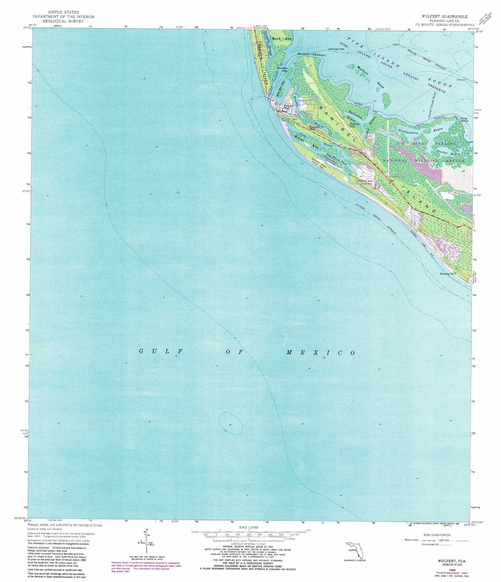
Wulfert Topo Map Florida
To zoom in, hover over the map of Wulfert
USGS Topo Quad 26082d2 - 1:24,000 scale
| Topo Map Name: | Wulfert |
| USGS Topo Quad ID: | 26082d2 |
| Print Size: | ca. 21 1/4" wide x 27" high |
| Southeast Coordinates: | 26.375° N latitude / 82.125° W longitude |
| Map Center Coordinates: | 26.4375° N latitude / 82.1875° W longitude |
| U.S. State: | FL |
| Filename: | O26082D2.jpg |
| Download Map JPG Image: | Wulfert topo map 1:24,000 scale |
| Map Type: | Topographic |
| Topo Series: | 7.5´ |
| Map Scale: | 1:24,000 |
| Source of Map Images: | United States Geological Survey (USGS) |
| Alternate Map Versions: |
Wulfert FL 1958, updated 1959 Download PDF Buy paper map Wulfert FL 1958, updated 1967 Download PDF Buy paper map Wulfert FL 1958, updated 1973 Download PDF Buy paper map Wulfert FL 1958, updated 1977 Download PDF Buy paper map Wulfert FL 1958, updated 1988 Download PDF Buy paper map Wulfert FL 2012 Download PDF Buy paper map Wulfert FL 2015 Download PDF Buy paper map |
1:24,000 Topo Quads surrounding Wulfert
Port Boca Grande |
Bokeelia |
Matlacha |
Fort Myers Nw |
|
Captiva |
Pine Island Center |
Fort Myers Sw |
||
Wulfert |
Sanibel |
Fort Myers Beach |
||
> Back to 26082a1 at 1:100,000 scale
> Back to 26082a1 at 1:250,000 scale
> Back to U.S. Topo Maps home
Wulfert topo map: Gazetteer
Wulfert: Airports
Bowmans Beach Helistop elevation 1m 3′Wulfert: Bars
Sanibel Rocks elevation 0m 0′Wulfert: Bays
Halloway Bayou elevation 0m 0′Kesson Bayou elevation 0m 0′
Sanibel Bayous elevation 0m 0′
Wulfert: Capes
Long Point elevation 0m 0′Wulfert: Channels
Blind Pass elevation 0m 0′Wulfert Channel elevation 0m 0′
Wulfert: Guts
Coral Creek Inlet elevation 0m 0′Wulfert: Islands
Albright Key elevation 0m 0′Runyan Key elevation 0m 0′
Silver Key elevation 0m 0′
Wulfert Keys elevation 0m 0′
Wulfert: Lakes
Clam Bayou elevation 0m 0′Dinken Bayou elevation 0m 0′
Hardworking Bayou elevation 0m 0′
Old Blind Pass elevation 0m 0′
Wulfert: Populated Places
Wulfert elevation 0m 0′Wulfert digital topo map on disk
Buy this Wulfert topo map showing relief, roads, GPS coordinates and other geographical features, as a high-resolution digital map file on DVD: