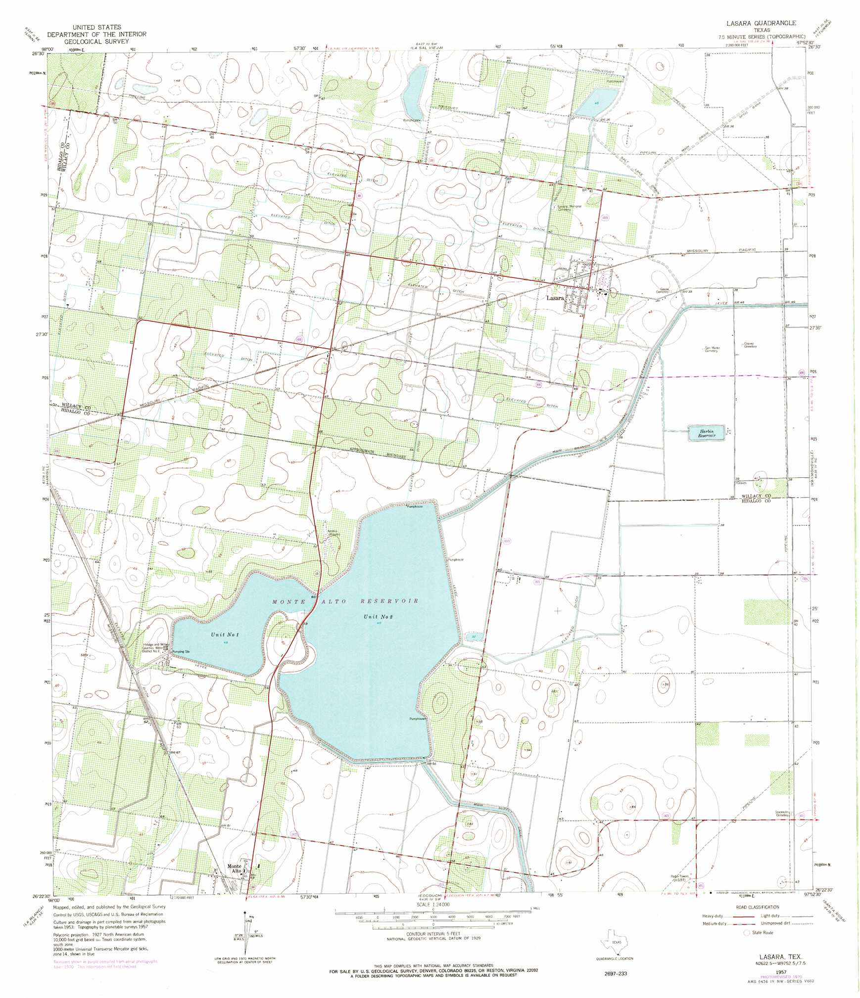
Lasara Topo Map Texas
To zoom in, hover over the map of Lasara
USGS Topo Quad 26097d8 - 1:24,000 scale
| Topo Map Name: | Lasara |
| USGS Topo Quad ID: | 26097d8 |
| Print Size: | ca. 21 1/4" wide x 27" high |
| Southeast Coordinates: | 26.375° N latitude / 97.875° W longitude |
| Map Center Coordinates: | 26.4375° N latitude / 97.9375° W longitude |
| U.S. State: | TX |
| Filename: | o26097d8.jpg |
| Download Map JPG Image: | Lasara topo map 1:24,000 scale |
| Map Type: | Topographic |
| Topo Series: | 7.5´ |
| Map Scale: | 1:24,000 |
| Source of Map Images: | United States Geological Survey (USGS) |
| Alternate Map Versions: |
Lasara TX 1957, updated 1958 Download PDF Buy paper map Lasara TX 1957, updated 1970 Download PDF Buy paper map Lasara TX 1957, updated 1977 Download PDF Buy paper map Lasara TX 2010 Download PDF Buy paper map Lasara TX 2013 Download PDF Buy paper map Lasara TX 2016 Download PDF Buy paper map |
1:24,000 Topo Quads surrounding Lasara
Linn Nw |
Linn Ne |
Andrea Ranch |
Rudolph |
Rosita Lake |
Linn Siding |
Linn |
La Sal Vieja |
Yturria |
San Perlita North |
Faysville |
Hargill |
Lasara |
Raymondville |
San Perlita South |
Edinburg |
La Blanca |
Edcouch |
Santa Rosa |
Willamar Sw |
Pharr |
Donna |
Mercedes |
La Feria |
Harlingen |
> Back to 26097a1 at 1:100,000 scale
> Back to 26096a1 at 1:250,000 scale
> Back to U.S. Topo Maps home
Lasara topo map: Gazetteer
Lasara: Canals
Main Branch Northeast Canal elevation 10m 32′Main Supply Canal elevation 11m 36′
Salt Lake Drain elevation 12m 39′
Lasara: Dams
Delta Lake Dam 2 elevation 14m 45′Delta Unit 1 Dam elevation 14m 45′
Harbin Levee elevation 12m 39′
Teniente Wid Number 1 Lake Dam elevation 12m 39′
Lasara: Populated Places
Lasara elevation 13m 42′Stockholm elevation 13m 42′
Lasara: Reservoirs
Delta Lake elevation 15m 49′Delta Lake 1 elevation 14m 45′
Delta Lake 2 elevation 14m 45′
Harbin Reservoir elevation 12m 39′
Teniente Wid Number 1 Lake elevation 12m 39′
Unit Number One elevation 14m 45′
Unit Number Two elevation 15m 49′
Lasara digital topo map on disk
Buy this Lasara topo map showing relief, roads, GPS coordinates and other geographical features, as a high-resolution digital map file on DVD: