Port Mansfield Topo Map Texas
To zoom in, hover over the map of Port Mansfield
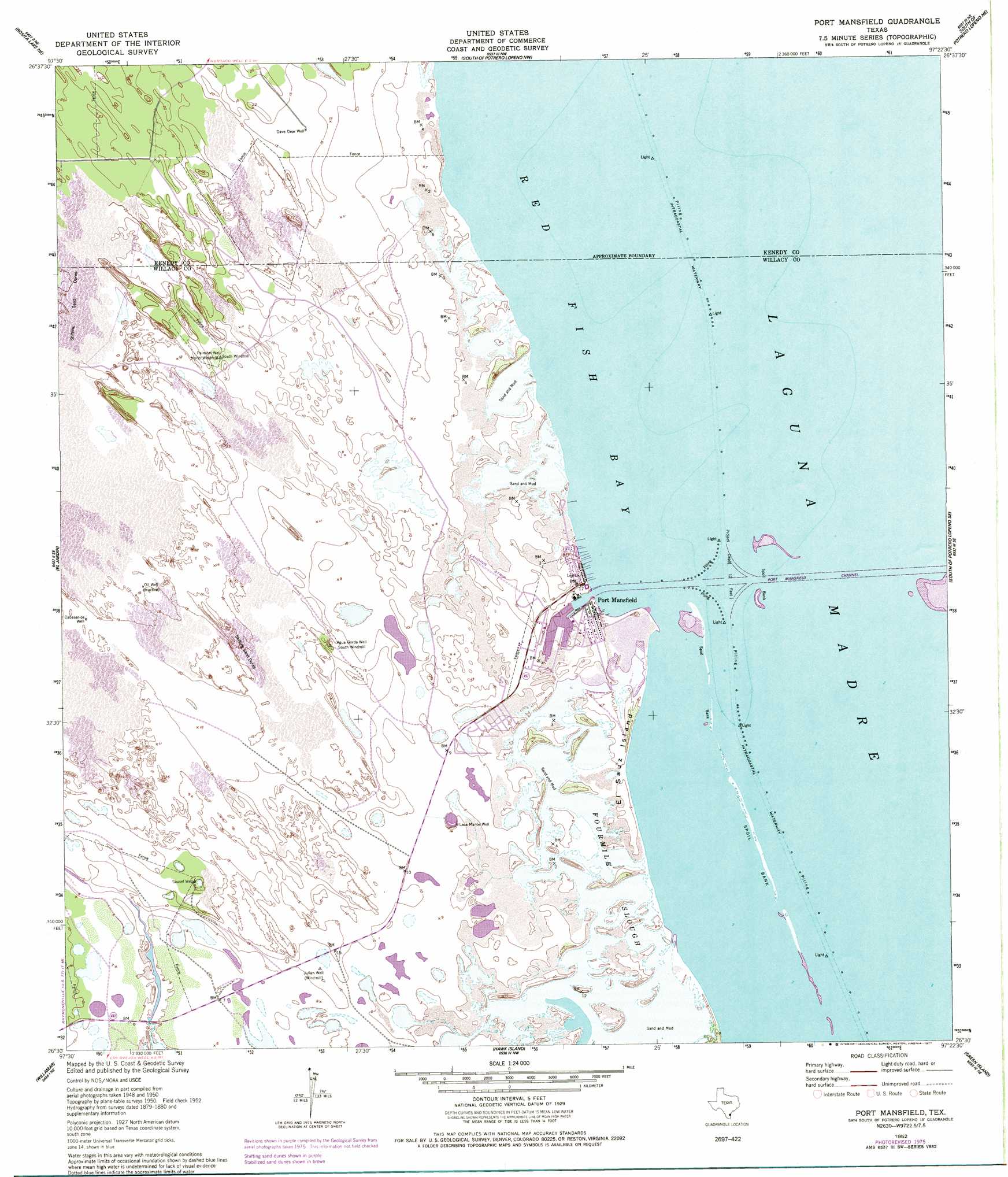
USGS Topo Quad 26097e4 - 1:24,000 scale
| Topo Map Name: | Port Mansfield |
| USGS Topo Quad ID: | 26097e4 |
| Print Size: | ca. 21 1/4" wide x 27" high |
| Southeast Coordinates: | 26.5° N latitude / 97.375° W longitude |
| Map Center Coordinates: | 26.5625° N latitude / 97.4375° W longitude |
| U.S. State: | TX |
| Filename: | o26097e4.jpg |
| Download Map JPG Image: | Port Mansfield topo map 1:24,000 scale |
| Map Type: | Topographic |
| Topo Series: | 7.5´ |
| Map Scale: | 1:24,000 |
| Source of Map Images: | United States Geological Survey (USGS) |
| Alternate Map Versions: |
Port Mansfield TX 1952, updated 1953 Download PDF Buy paper map Port Mansfield TX 1952, updated 1977 Download PDF Buy paper map Port Mansfield TX 2010 Download PDF Buy paper map Port Mansfield TX 2013 Download PDF Buy paper map Port Mansfield TX 2016 Download PDF Buy paper map |
1:24,000 Topo Quads surrounding Port Mansfield
Saltillo Well |
Los Amigos Windmill |
Potrero Lopeno Sw |
Potrero Lopino Se |
|
Rosita Lake |
Rosita Lake Ne |
South Of Potrero Lopeno Nw |
South Of Potrero Lopeno Ne |
|
San Perlita North |
El Jardin |
Port Mansfield |
South Of Potrero Lopeno Se |
|
San Perlita South |
Willamar |
Hawk Island |
Green Island |
North Of Port Isabel Nw |
Willamar Sw |
Paso Real |
La Leona |
Three Islands |
North Of Port Isabel Sw |
> Back to 26097e1 at 1:100,000 scale
> Back to 26096a1 at 1:250,000 scale
> Back to U.S. Topo Maps home
Port Mansfield topo map: Gazetteer
Port Mansfield: Airports
Charles R Johnson Airport elevation 2m 6′Port Mansfield: Bays
Red Fish Bay elevation 0m 0′Port Mansfield: Guts
Fourmile Slough elevation 1m 3′Port Mansfield: Islands
El Sauz Island elevation 2m 6′Port Mansfield: Populated Places
Port Mansfield elevation 1m 3′Port Mansfield: Wells
Cabasenios Well elevation 5m 16′Dave Dear Well elevation 4m 13′
Lava Manos Well elevation 2m 6′
Sausel Well elevation 3m 9′
Port Mansfield digital topo map on disk
Buy this Port Mansfield topo map showing relief, roads, GPS coordinates and other geographical features, as a high-resolution digital map file on DVD: