Yturria Topo Map Texas
To zoom in, hover over the map of Yturria
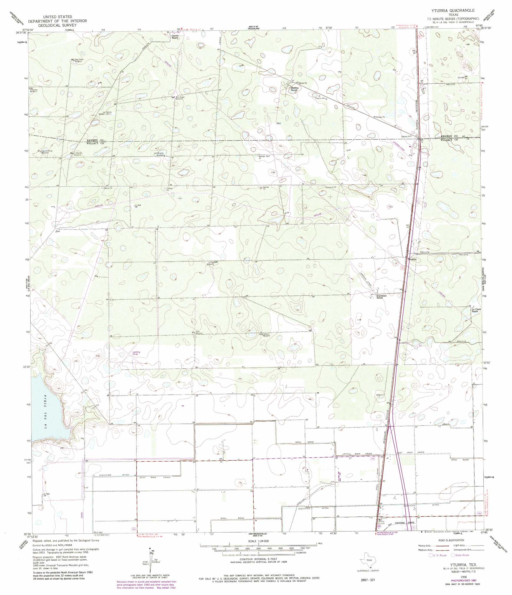
USGS Topo Quad 26097e7 - 1:24,000 scale
| Topo Map Name: | Yturria |
| USGS Topo Quad ID: | 26097e7 |
| Print Size: | ca. 21 1/4" wide x 27" high |
| Southeast Coordinates: | 26.5° N latitude / 97.75° W longitude |
| Map Center Coordinates: | 26.5625° N latitude / 97.8125° W longitude |
| U.S. State: | TX |
| Filename: | o26097e7.jpg |
| Download Map JPG Image: | Yturria topo map 1:24,000 scale |
| Map Type: | Topographic |
| Topo Series: | 7.5´ |
| Map Scale: | 1:24,000 |
| Source of Map Images: | United States Geological Survey (USGS) |
| Alternate Map Versions: |
Yturria TX 1956, updated 1958 Download PDF Buy paper map Yturria TX 1956, updated 1984 Download PDF Buy paper map Yturria TX 2010 Download PDF Buy paper map Yturria TX 2013 Download PDF Buy paper map Yturria TX 2016 Download PDF Buy paper map |
1:24,000 Topo Quads surrounding Yturria
Callo Padrones |
Julian |
Norias |
Saltillo Well |
Los Amigos Windmill |
Linn Ne |
Andrea Ranch |
Rudolph |
Rosita Lake |
Rosita Lake Ne |
Linn |
La Sal Vieja |
Yturria |
San Perlita North |
El Jardin |
Hargill |
Lasara |
Raymondville |
San Perlita South |
Willamar |
La Blanca |
Edcouch |
Santa Rosa |
Willamar Sw |
Paso Real |
> Back to 26097e1 at 1:100,000 scale
> Back to 26096a1 at 1:250,000 scale
> Back to U.S. Topo Maps home
Yturria topo map: Gazetteer
Yturria: Canals
West Main Drain elevation 9m 29′Yturria: Populated Places
Benitez Colonia elevation 9m 29′El Chapote Colonia elevation 9m 29′
Lisa Colonia elevation 9m 29′
Willacy Acres Colonia elevation 11m 36′
Yturria elevation 12m 39′
Yturria: Wells
Los Cedros Artesian Wells elevation 11m 36′Yturria digital topo map on disk
Buy this Yturria topo map showing relief, roads, GPS coordinates and other geographical features, as a high-resolution digital map file on DVD: