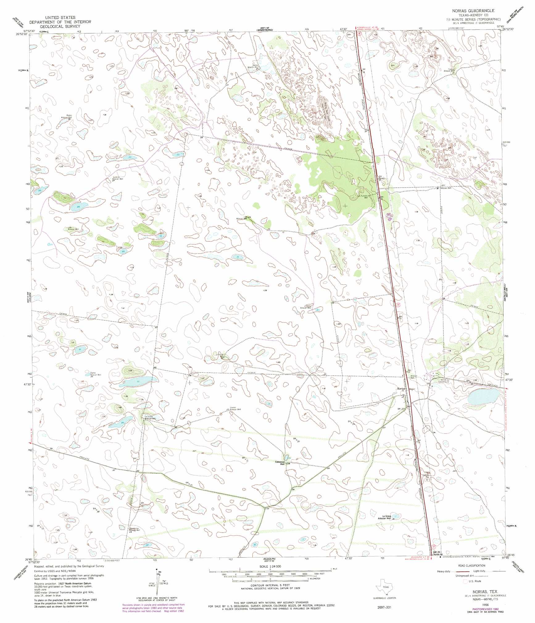
Norias Topo Map Texas
To zoom in, hover over the map of Norias
USGS Topo Quad 26097g7 - 1:24,000 scale
| Topo Map Name: | Norias |
| USGS Topo Quad ID: | 26097g7 |
| Print Size: | ca. 21 1/4" wide x 27" high |
| Southeast Coordinates: | 26.75° N latitude / 97.75° W longitude |
| Map Center Coordinates: | 26.8125° N latitude / 97.8125° W longitude |
| U.S. State: | TX |
| Filename: | o26097g7.jpg |
| Download Map JPG Image: | Norias topo map 1:24,000 scale |
| Map Type: | Topographic |
| Topo Series: | 7.5´ |
| Map Scale: | 1:24,000 |
| Source of Map Images: | United States Geological Survey (USGS) |
| Alternate Map Versions: |
Norias TX 1956, updated 1958 Download PDF Buy paper map Norias TX 1956, updated 1984 Download PDF Buy paper map Norias TX 2010 Download PDF Buy paper map Norias TX 2013 Download PDF Buy paper map Norias TX 2016 Download PDF Buy paper map |
1:24,000 Topo Quads surrounding Norias
Falfurrias Se |
Sarita Sw |
Turcotte |
La Parra Ranch Sw |
La Parra Ranch Se |
San Tomas Camp |
Pita Camp |
Armstrong |
San Pedro Ranch |
Maria Estella Well |
Callo Padrones |
Julian |
Norias |
Saltillo Well |
Los Amigos Windmill |
Linn Ne |
Andrea Ranch |
Rudolph |
Rosita Lake |
Rosita Lake Ne |
Linn |
La Sal Vieja |
Yturria |
San Perlita North |
El Jardin |
> Back to 26097e1 at 1:100,000 scale
> Back to 26096a1 at 1:250,000 scale
> Back to U.S. Topo Maps home
Norias topo map: Gazetteer
Norias: Populated Places
Norias elevation 6m 19′Norias: Wells
Banderitas Artesian Well elevation 8m 26′Boton Artesian Well elevation 6m 19′
Calaveras Well elevation 8m 26′
Cantu Artesian Well elevation 8m 26′
Diame Artesian Well elevation 9m 29′
Ferman Artesian Well elevation 6m 19′
La Grava Artesian Well elevation 6m 19′
La Grulla Artesian Well elevation 8m 26′
La Grulla Well elevation 9m 29′
Lola Artesian Well elevation 7m 22′
Lola Artesian Well elevation 9m 29′
Lopez Artesian Well elevation 6m 19′
Lorenzo Artesian Well elevation 8m 26′
Los Tullidos Well elevation 6m 19′
Rodeo Artesian Well elevation 8m 26′
Uvence Artesian Well elevation 8m 26′
Norias digital topo map on disk
Buy this Norias topo map showing relief, roads, GPS coordinates and other geographical features, as a high-resolution digital map file on DVD: