El Chapote Creek Topo Map Texas
To zoom in, hover over the map of El Chapote Creek
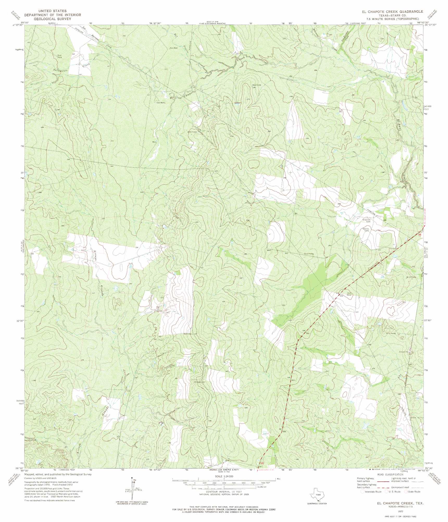
USGS Topo Quad 26098e8 - 1:24,000 scale
| Topo Map Name: | El Chapote Creek |
| USGS Topo Quad ID: | 26098e8 |
| Print Size: | ca. 21 1/4" wide x 27" high |
| Southeast Coordinates: | 26.5° N latitude / 98.875° W longitude |
| Map Center Coordinates: | 26.5625° N latitude / 98.9375° W longitude |
| U.S. State: | TX |
| Filename: | o26098e8.jpg |
| Download Map JPG Image: | El Chapote Creek topo map 1:24,000 scale |
| Map Type: | Topographic |
| Topo Series: | 7.5´ |
| Map Scale: | 1:24,000 |
| Source of Map Images: | United States Geological Survey (USGS) |
| Alternate Map Versions: |
El Chapote Creek TX 1972, updated 1975 Download PDF Buy paper map El Chapote Creek TX 2010 Download PDF Buy paper map El Chapote Creek TX 2012 Download PDF Buy paper map El Chapote Creek TX 2016 Download PDF Buy paper map |
1:24,000 Topo Quads surrounding El Chapote Creek
Arroyo Clareno |
Arroyo Miguel |
Cuevitas Sw |
Cuevitas |
Borregos Ranch |
Beckwith Arm |
Lopeno |
Las Escobas Ranch |
Viboras |
Las Islas Ranch |
Falcon Village |
Salineno |
El Chapote Creek |
El Sauz |
La Gloria Sw |
Roma-Los Saenz West |
Roma-Los Saenz East |
Rio Grande City North |
Sagunada Ranch |
|
Los Garzas |
Rio Grande City South |
La Grulla |
> Back to 26098e1 at 1:100,000 scale
> Back to 26098a1 at 1:250,000 scale
> Back to U.S. Topo Maps home
El Chapote Creek topo map: Gazetteer
El Chapote Creek: Streams
Del Puerto Creek elevation 91m 298′El Chapote Creek elevation 82m 269′
Las Escobas Creek elevation 84m 275′
Los Barrosos Creek elevation 98m 321′
Retamoso Creek elevation 82m 269′
Saremente Creek elevation 98m 321′
El Chapote Creek digital topo map on disk
Buy this El Chapote Creek topo map showing relief, roads, GPS coordinates and other geographical features, as a high-resolution digital map file on DVD: