Agua Nueva Topo Map Texas
To zoom in, hover over the map of Agua Nueva
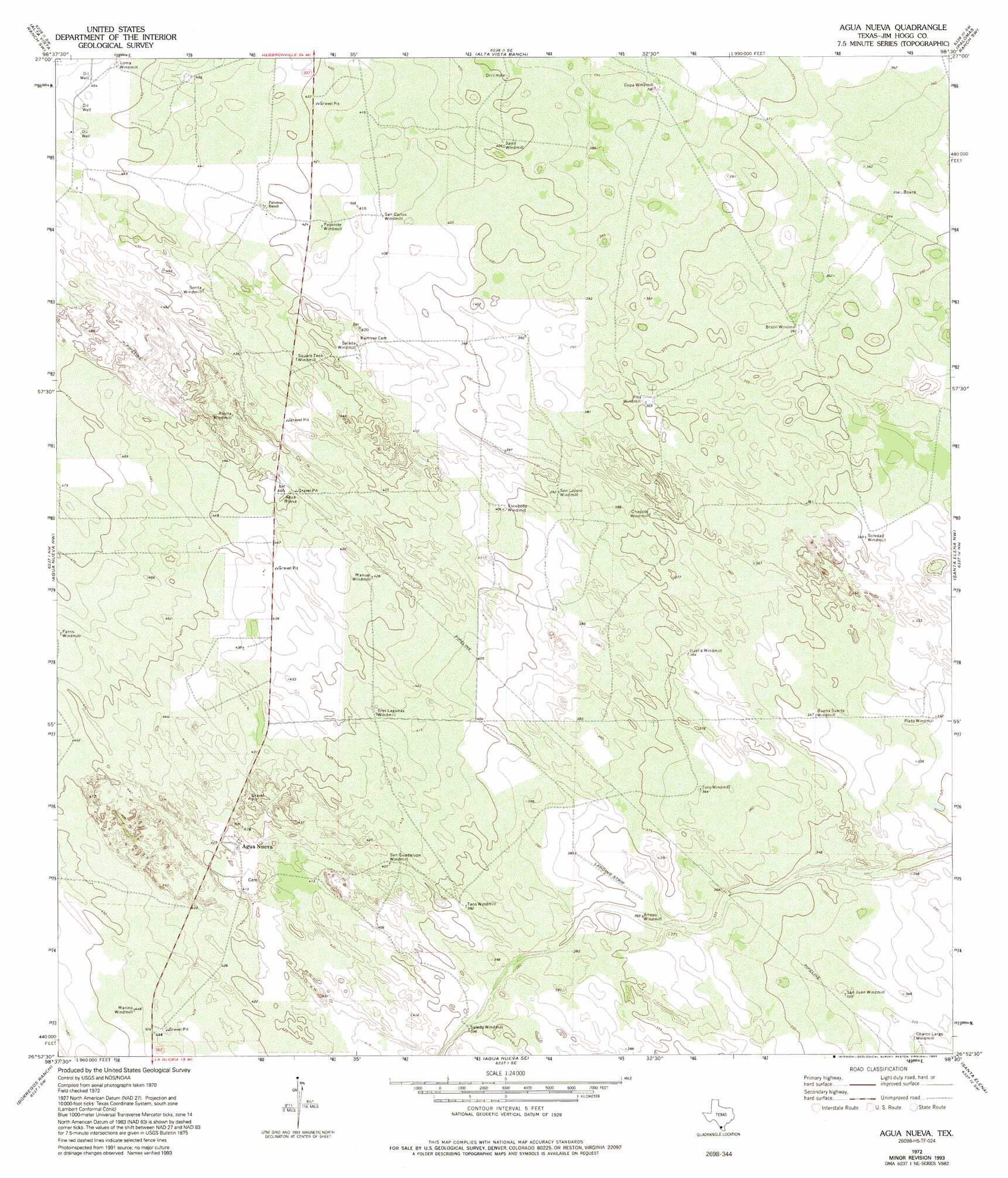
USGS Topo Quad 26098h5 - 1:24,000 scale
| Topo Map Name: | Agua Nueva |
| USGS Topo Quad ID: | 26098h5 |
| Print Size: | ca. 21 1/4" wide x 27" high |
| Southeast Coordinates: | 26.875° N latitude / 98.5° W longitude |
| Map Center Coordinates: | 26.9375° N latitude / 98.5625° W longitude |
| U.S. State: | TX |
| Filename: | o26098h5.jpg |
| Download Map JPG Image: | Agua Nueva topo map 1:24,000 scale |
| Map Type: | Topographic |
| Topo Series: | 7.5´ |
| Map Scale: | 1:24,000 |
| Source of Map Images: | United States Geological Survey (USGS) |
| Alternate Map Versions: |
Agua Nueva TX 1972, updated 1975 Download PDF Buy paper map Agua Nueva TX 1972, updated 1993 Download PDF Buy paper map Agua Nueva TX 2010 Download PDF Buy paper map Agua Nueva TX 2012 Download PDF Buy paper map Agua Nueva TX 2016 Download PDF Buy paper map |
1:24,000 Topo Quads surrounding Agua Nueva
Armstrong Ranch |
Mccampbell Ranch |
Baluarte Ranch |
Palomas Ranch Nw |
Palomas Ranch |
San Pablo Ranch |
Alta Vista Ranch Sw |
Alta Vista Ranch |
Palomas Ranch Sw |
Palomas Ranch Se |
San Antonio Viejo |
Agua Nueva Nw |
Agua Nueva |
Santa Elena Nw |
Tacubaya |
Cuevitas |
Borregos Ranch |
Agua Nueva Se |
Santa Elena |
Santa Elena Se |
Viboras |
Las Islas Ranch |
La Gloria |
San Isidro |
La Reforma |
> Back to 26098e1 at 1:100,000 scale
> Back to 26098a1 at 1:250,000 scale
> Back to U.S. Topo Maps home
Agua Nueva topo map: Gazetteer
Agua Nueva: Airports
Puesta Del Sol Airport elevation 103m 337′Agua Nueva: Populated Places
Agua Nueva elevation 127m 416′Agua Nueva digital topo map on disk
Buy this Agua Nueva topo map showing relief, roads, GPS coordinates and other geographical features, as a high-resolution digital map file on DVD: