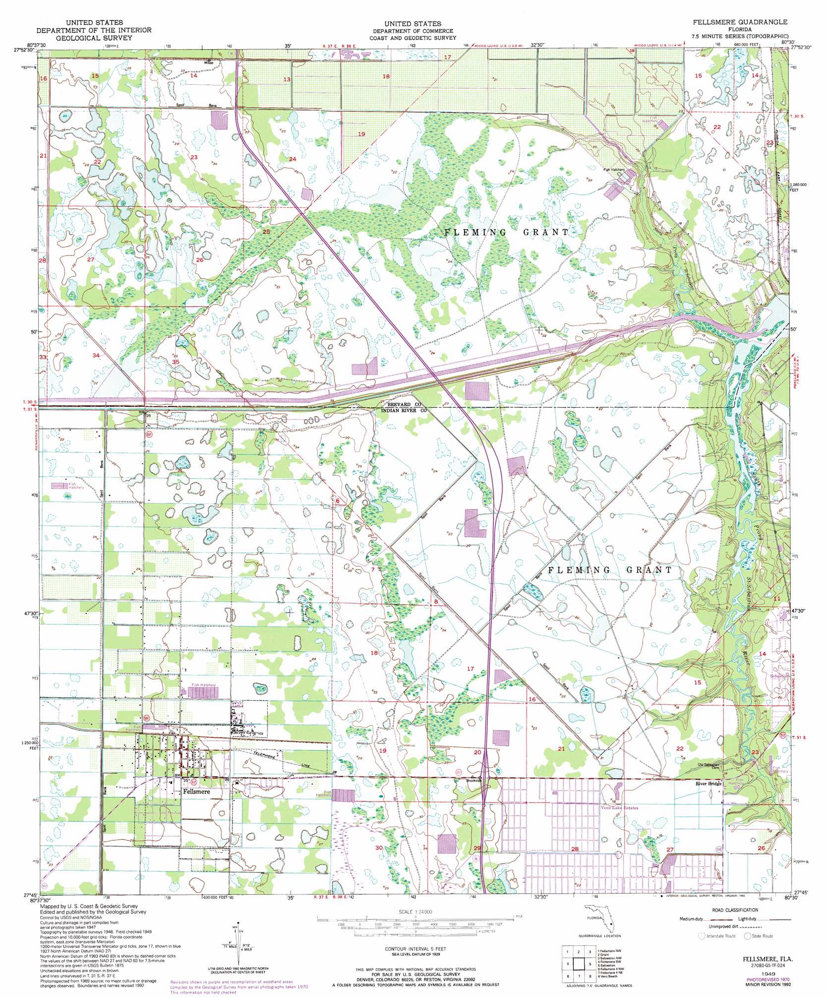
Fellsmere Topo Map Florida
To zoom in, hover over the map of Fellsmere
USGS Topo Quad 27080g5 - 1:24,000 scale
| Topo Map Name: | Fellsmere |
| USGS Topo Quad ID: | 27080g5 |
| Print Size: | ca. 21 1/4" wide x 27" high |
| Southeast Coordinates: | 27.75° N latitude / 80.5° W longitude |
| Map Center Coordinates: | 27.8125° N latitude / 80.5625° W longitude |
| U.S. State: | FL |
| Filename: | O27080G5.jpg |
| Download Map JPG Image: | Fellsmere topo map 1:24,000 scale |
| Map Type: | Topographic |
| Topo Series: | 7.5´ |
| Map Scale: | 1:24,000 |
| Source of Map Images: | United States Geological Survey (USGS) |
| Alternate Map Versions: |
Fellsmere FL 1949, updated 1959 Download PDF Buy paper map Fellsmere FL 1949, updated 1963 Download PDF Buy paper map Fellsmere FL 1949, updated 1971 Download PDF Buy paper map Fellsmere FL 1949, updated 1992 Download PDF Buy paper map Fellsmere FL 1949, updated 1992 Download PDF Buy paper map Fellsmere FL 1951 Download PDF Buy paper map Fellsmere FL 2012 Download PDF Buy paper map Fellsmere FL 2015 Download PDF Buy paper map |
1:24,000 Topo Quads surrounding Fellsmere
Deer Park Se |
Melbourne West |
Melbourne East |
||
Kenansville Ne |
Fellsmere Nw |
Grant |
Sebastian Nw |
|
Kenansville Se |
Fellsmere Sw |
Fellsmere |
Sebastian |
|
Fort Drum Ne |
Fellsmere 4 Nw |
Fellsmere 4 Ne |
Vero Beach |
Riomar |
Fort Drum |
Fellsmere 4 Sw |
Fellsmere 4 Se |
Oslo |
Indrio |
> Back to 27080e1 at 1:100,000 scale
> Back to 27080a1 at 1:250,000 scale
> Back to U.S. Topo Maps home
Fellsmere topo map: Gazetteer
Fellsmere: Lakes
General Developers Lake elevation 6m 19′Fellsmere: Populated Places
Brookside elevation 7m 22′Emily's Glen Mobile Home Park elevation 6m 19′
Fellsmere elevation 7m 22′
River Grove Mobile Home Village elevation 7m 22′
Fellsmere: Post Offices
Fellsmere Post Office elevation 7m 22′Fellsmere digital topo map on disk
Buy this Fellsmere topo map showing relief, roads, GPS coordinates and other geographical features, as a high-resolution digital map file on DVD: