Venus Nw Topo Map Florida
To zoom in, hover over the map of Venus Nw
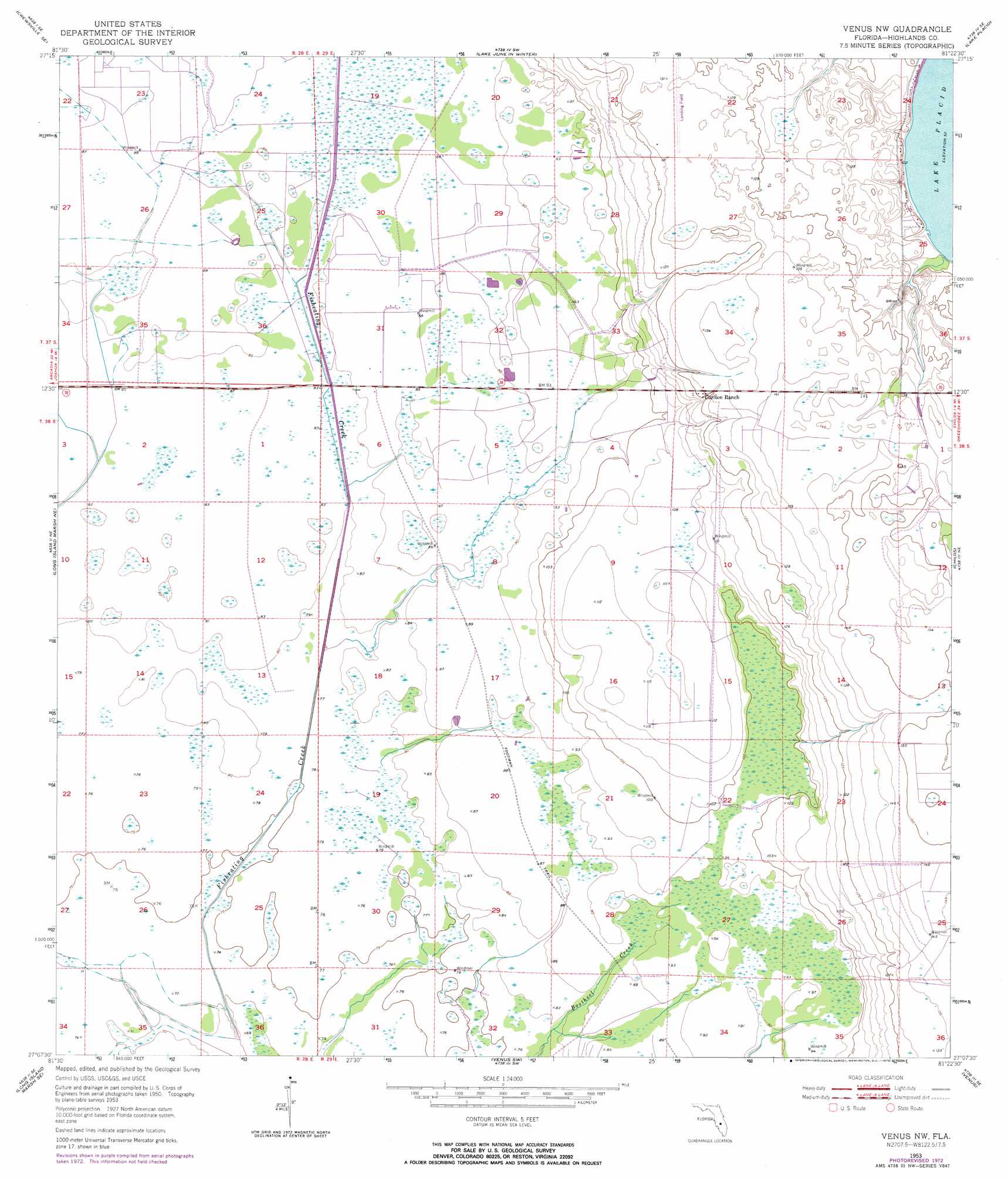
USGS Topo Quad 27081b4 - 1:24,000 scale
| Topo Map Name: | Venus Nw |
| USGS Topo Quad ID: | 27081b4 |
| Print Size: | ca. 21 1/4" wide x 27" high |
| Southeast Coordinates: | 27.125° N latitude / 81.375° W longitude |
| Map Center Coordinates: | 27.1875° N latitude / 81.4375° W longitude |
| U.S. State: | FL |
| Filename: | O27081B4.jpg |
| Download Map JPG Image: | Venus Nw topo map 1:24,000 scale |
| Map Type: | Topographic |
| Topo Series: | 7.5´ |
| Map Scale: | 1:24,000 |
| Source of Map Images: | United States Geological Survey (USGS) |
| Alternate Map Versions: |
Venus NW FL 1953, updated 1954 Download PDF Buy paper map Venus NW FL 1953, updated 1966 Download PDF Buy paper map Venus NW FL 1953, updated 1973 Download PDF Buy paper map Venus NW FL 2012 Download PDF Buy paper map Venus NW FL 2015 Download PDF Buy paper map |
1:24,000 Topo Quads surrounding Venus Nw
Sweetwater |
Crewsville |
Sebring |
Lorida |
Basinger Nw |
Crewsville Sw |
Crewsville Se |
Lake June In Winter |
Lake Placid |
Basinger Sw |
Long Island Marsh Nw |
Long Island Marsh Ne |
Venus Nw |
Childs |
Brighton Nw |
Long Island Marsh Sw |
Long Island Marsh Se |
Venus Sw |
Venus |
Brighton Sw |
Telegraph Swamp Nw |
Telegraph Swamp Ne |
La Belle Nw |
Palmdale |
Lakeport |
> Back to 27081a1 at 1:100,000 scale
> Back to 27080a1 at 1:250,000 scale
> Back to U.S. Topo Maps home
Venus Nw topo map: Gazetteer
Venus Nw: Airports
Kings Port Airport elevation 45m 147′Placid Lakes Airport elevation 40m 131′
Vinces Airport elevation 35m 114′
Venus Nw: Populated Places
Placid Lakes elevation 39m 127′Venus Nw digital topo map on disk
Buy this Venus Nw topo map showing relief, roads, GPS coordinates and other geographical features, as a high-resolution digital map file on DVD: