Nocatee Topo Map Florida
To zoom in, hover over the map of Nocatee
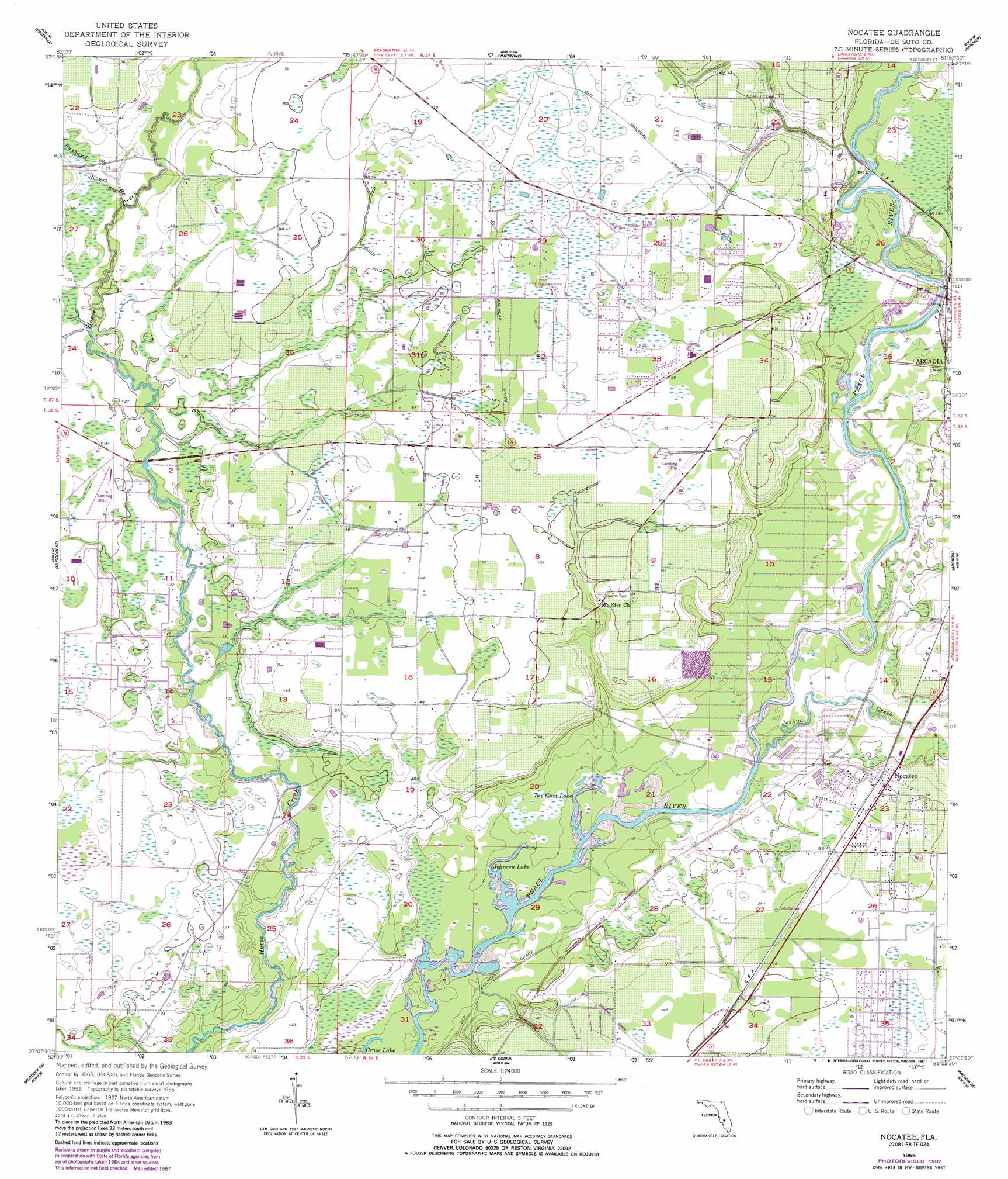
USGS Topo Quad 27081b8 - 1:24,000 scale
| Topo Map Name: | Nocatee |
| USGS Topo Quad ID: | 27081b8 |
| Print Size: | ca. 21 1/4" wide x 27" high |
| Southeast Coordinates: | 27.125° N latitude / 81.875° W longitude |
| Map Center Coordinates: | 27.1875° N latitude / 81.9375° W longitude |
| U.S. State: | FL |
| Filename: | O27081B8.jpg |
| Download Map JPG Image: | Nocatee topo map 1:24,000 scale |
| Map Type: | Topographic |
| Topo Series: | 7.5´ |
| Map Scale: | 1:24,000 |
| Source of Map Images: | United States Geological Survey (USGS) |
| Alternate Map Versions: |
Nocatee FL 1956, updated 1957 Download PDF Buy paper map Nocatee FL 1956, updated 1975 Download PDF Buy paper map Nocatee FL 1956, updated 1987 Download PDF Buy paper map Nocatee FL 2012 Download PDF Buy paper map Nocatee FL 2015 Download PDF Buy paper map |
1:24,000 Topo Quads surrounding Nocatee
Myakka City Nw |
Myakka Head |
Ona |
Zolfo Springs |
Sweetwater |
Myakka City |
Edgeville |
Limestone |
Gardner |
Crewsville Sw |
Murdock Nw |
Murdock Ne |
Nocatee |
Arcadia |
Long Island Marsh Nw |
Murdock |
Murdock Se |
Fort Ogden |
Arcadia Se |
Long Island Marsh Sw |
El Jobean |
Punta Gorda |
Cleveland |
Bermont |
Telegraph Swamp Nw |
> Back to 27081a1 at 1:100,000 scale
> Back to 27080a1 at 1:250,000 scale
> Back to U.S. Topo Maps home
Nocatee topo map: Gazetteer
Nocatee: Airports
McDonalds Field elevation 16m 52′Nocatee: Lakes
Bee Gum Lake elevation 2m 6′Grass Lake elevation 1m 3′
Johnson Lake elevation 1m 3′
Nocatee: Populated Places
Arcadia Village Adult Mobile Home Community elevation 7m 22′Belgium (historical) elevation 8m 26′
Nocatee elevation 13m 42′
Tryon elevation 18m 59′
Nocatee: Streams
Buzzard Roost Branch elevation 7m 22′Joshua Creek elevation 4m 13′
McBride Branch elevation 4m 13′
Nocatee digital topo map on disk
Buy this Nocatee topo map showing relief, roads, GPS coordinates and other geographical features, as a high-resolution digital map file on DVD: