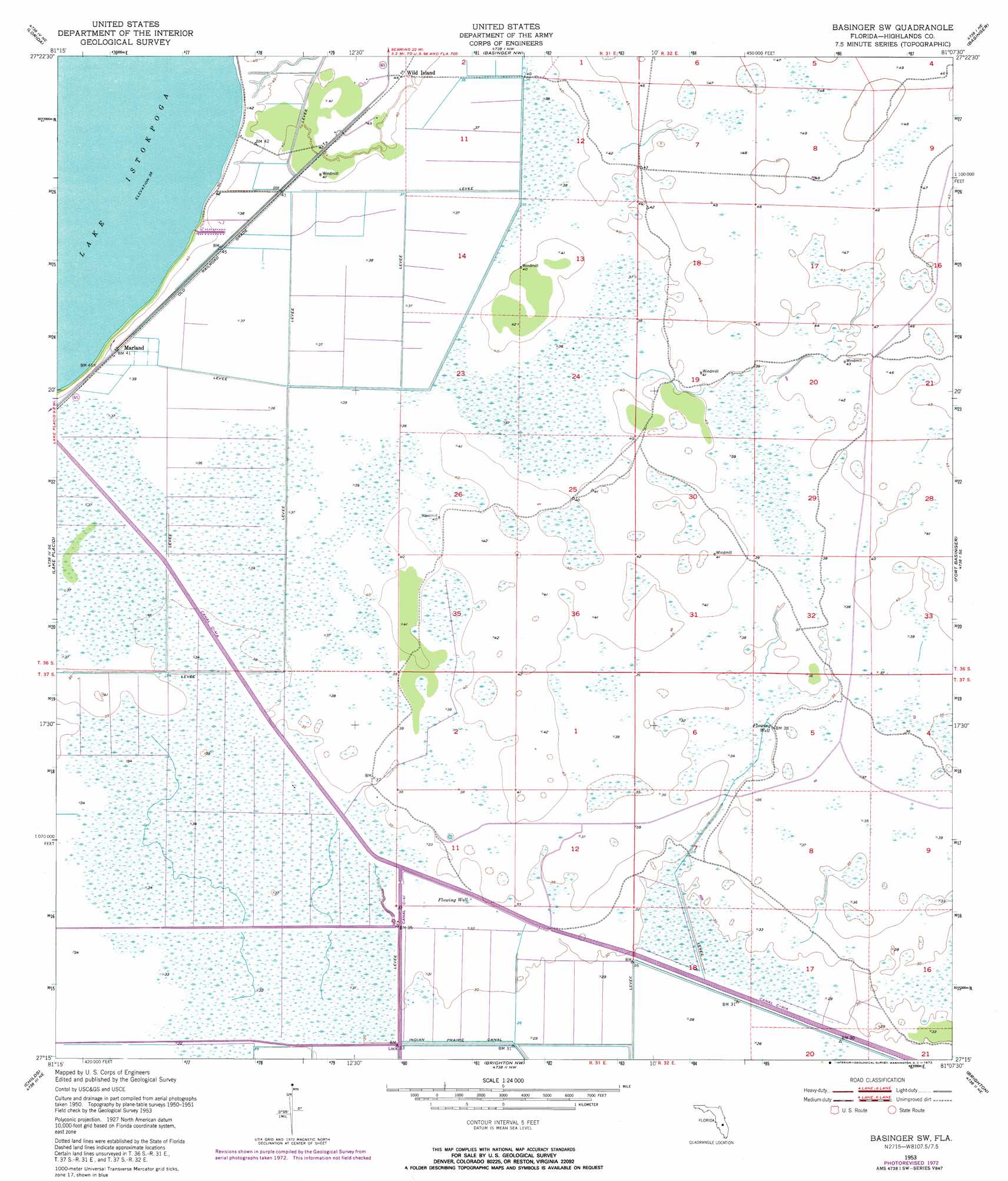
Basinger Sw Topo Map Florida
To zoom in, hover over the map of Basinger Sw
USGS Topo Quad 27081c2 - 1:24,000 scale
| Topo Map Name: | Basinger Sw |
| USGS Topo Quad ID: | 27081c2 |
| Print Size: | ca. 21 1/4" wide x 27" high |
| Southeast Coordinates: | 27.25° N latitude / 81.125° W longitude |
| Map Center Coordinates: | 27.3125° N latitude / 81.1875° W longitude |
| U.S. State: | FL |
| Filename: | O27081C2.jpg |
| Download Map JPG Image: | Basinger Sw topo map 1:24,000 scale |
| Map Type: | Topographic |
| Topo Series: | 7.5´ |
| Map Scale: | 1:24,000 |
| Source of Map Images: | United States Geological Survey (USGS) |
| Alternate Map Versions: |
Basinger SW FL 1953, updated 1954 Download PDF Buy paper map Basinger SW FL 1953, updated 1973 Download PDF Buy paper map Basinger SW FL 2012 Download PDF Buy paper map Basinger SW FL 2015 Download PDF Buy paper map |
1:24,000 Topo Quads surrounding Basinger Sw
Lake Arbuckle Sw |
Lake Arbuckle Se |
Fort Kissimmee |
Fort Kissimmee Se |
Fort Drum Sw |
Sebring |
Lorida |
Basinger Nw |
Basinger |
Taylor Creek Nw |
Lake June In Winter |
Lake Placid |
Basinger Sw |
Fort Basinger |
Taylor Creek Sw |
Venus Nw |
Childs |
Brighton Nw |
Brighton |
Okeechobee Nw |
Venus Sw |
Venus |
Brighton Sw |
Brighton Se |
Okeechobee Sw |
> Back to 27081a1 at 1:100,000 scale
> Back to 27080a1 at 1:250,000 scale
> Back to U.S. Topo Maps home
Basinger Sw topo map: Gazetteer
Basinger Sw: Canals
Canal C-41A elevation 8m 26′Basinger Sw: Islands
Fish Branch Island elevation 12m 39′Basinger Sw: Populated Places
Marland elevation 12m 39′Wild Island elevation 12m 39′
Basinger Sw digital topo map on disk
Buy this Basinger Sw topo map showing relief, roads, GPS coordinates and other geographical features, as a high-resolution digital map file on DVD: