Lake June In Winter Topo Map Florida
To zoom in, hover over the map of Lake June In Winter
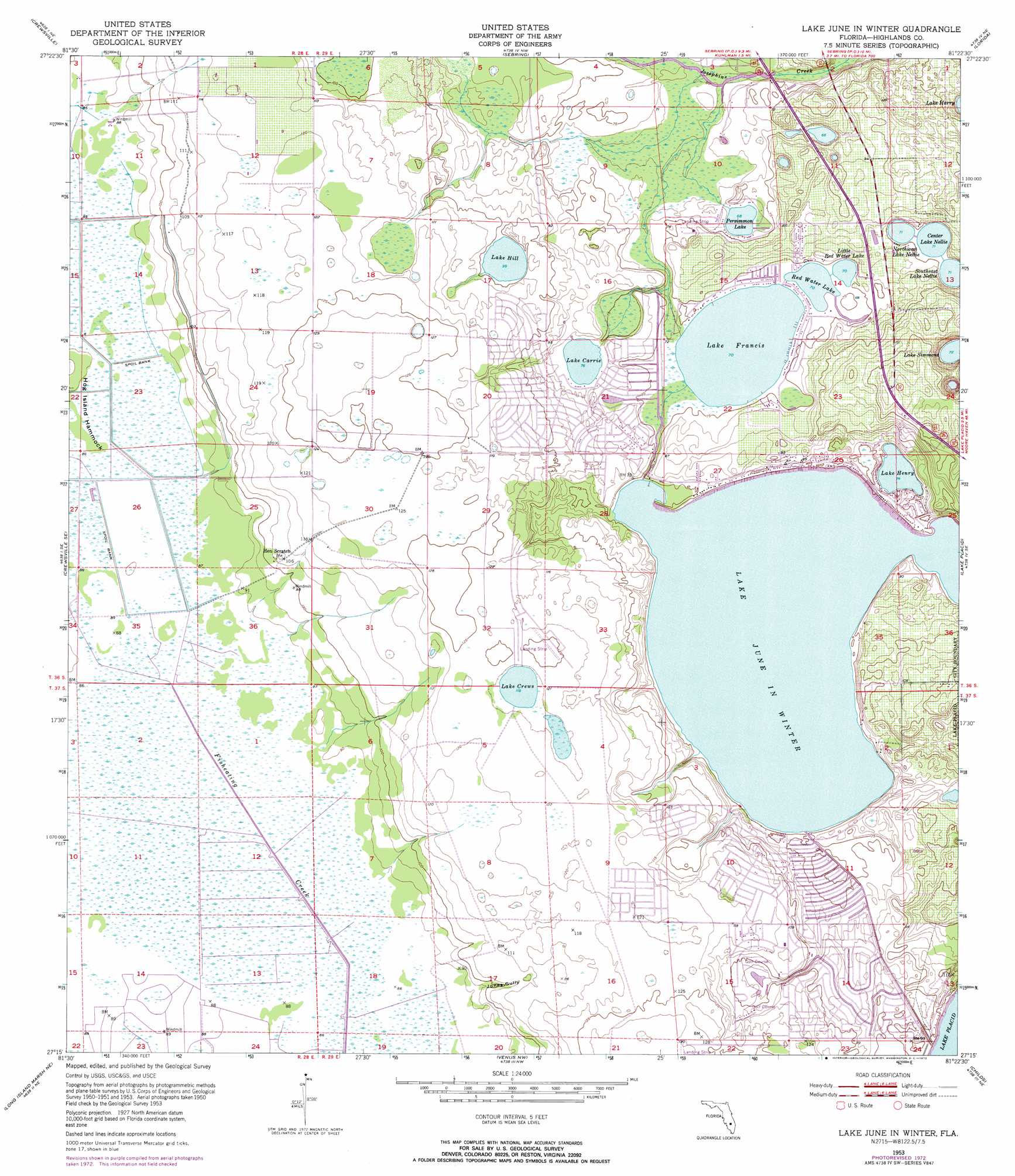
USGS Topo Quad 27081c4 - 1:24,000 scale
| Topo Map Name: | Lake June In Winter |
| USGS Topo Quad ID: | 27081c4 |
| Print Size: | ca. 21 1/4" wide x 27" high |
| Southeast Coordinates: | 27.25° N latitude / 81.375° W longitude |
| Map Center Coordinates: | 27.3125° N latitude / 81.4375° W longitude |
| U.S. State: | FL |
| Filename: | O27081C4.jpg |
| Download Map JPG Image: | Lake June In Winter topo map 1:24,000 scale |
| Map Type: | Topographic |
| Topo Series: | 7.5´ |
| Map Scale: | 1:24,000 |
| Source of Map Images: | United States Geological Survey (USGS) |
| Alternate Map Versions: |
Lake June In Winter FL 1953, updated 1954 Download PDF Buy paper map Lake June In Winter FL 1953, updated 1972 Download PDF Buy paper map Lake June In Winter FL 1953, updated 1973 Download PDF Buy paper map Lake June In Winter FL 2012 Download PDF Buy paper map Lake June In Winter FL 2015 Download PDF Buy paper map |
1:24,000 Topo Quads surrounding Lake June In Winter
Griffins Corner |
Avon Park |
Lake Arbuckle Sw |
Lake Arbuckle Se |
Fort Kissimmee |
Sweetwater |
Crewsville |
Sebring |
Lorida |
Basinger Nw |
Crewsville Sw |
Crewsville Se |
Lake June In Winter |
Lake Placid |
Basinger Sw |
Long Island Marsh Nw |
Long Island Marsh Ne |
Venus Nw |
Childs |
Brighton Nw |
Long Island Marsh Sw |
Long Island Marsh Se |
Venus Sw |
Venus |
Brighton Sw |
> Back to 27081a1 at 1:100,000 scale
> Back to 27080a1 at 1:250,000 scale
> Back to U.S. Topo Maps home
Lake June In Winter topo map: Gazetteer
Lake June In Winter: Airports
Lake Persimmon Airstrip elevation 23m 75′Sunshine Ranchettes Airport elevation 32m 104′
Lake June In Winter: Islands
Hog Island Hammock elevation 27m 88′Lake June In Winter: Lakes
Center Lake Nellie elevation 21m 68′Lake Carrie elevation 23m 75′
Lake Crews elevation 36m 118′
Lake Francis elevation 21m 68′
Lake Henry elevation 22m 72′
Lake Hill elevation 30m 98′
Lake June in Winter elevation 22m 72′
Lake Simmons elevation 22m 72′
Little Red Water Lake elevation 21m 68′
Northwest Lake Nellie elevation 21m 68′
Persimmon Lake elevation 20m 65′
Red Water Lake elevation 21m 68′
Southeast Lake Nellie elevation 21m 68′
Lake June In Winter: Parks
Lake June-in-Winter Scrub State Park elevation 29m 95′Lake June In Winter: Populated Places
Hen Scratch elevation 33m 108′Lake Redwater Mobile Home Park elevation 22m 72′
Lake June In Winter: Streams
Jack Creek elevation 18m 59′Lake June In Winter: Valleys
Jones Gully elevation 26m 85′Lake June In Winter digital topo map on disk
Buy this Lake June In Winter topo map showing relief, roads, GPS coordinates and other geographical features, as a high-resolution digital map file on DVD: