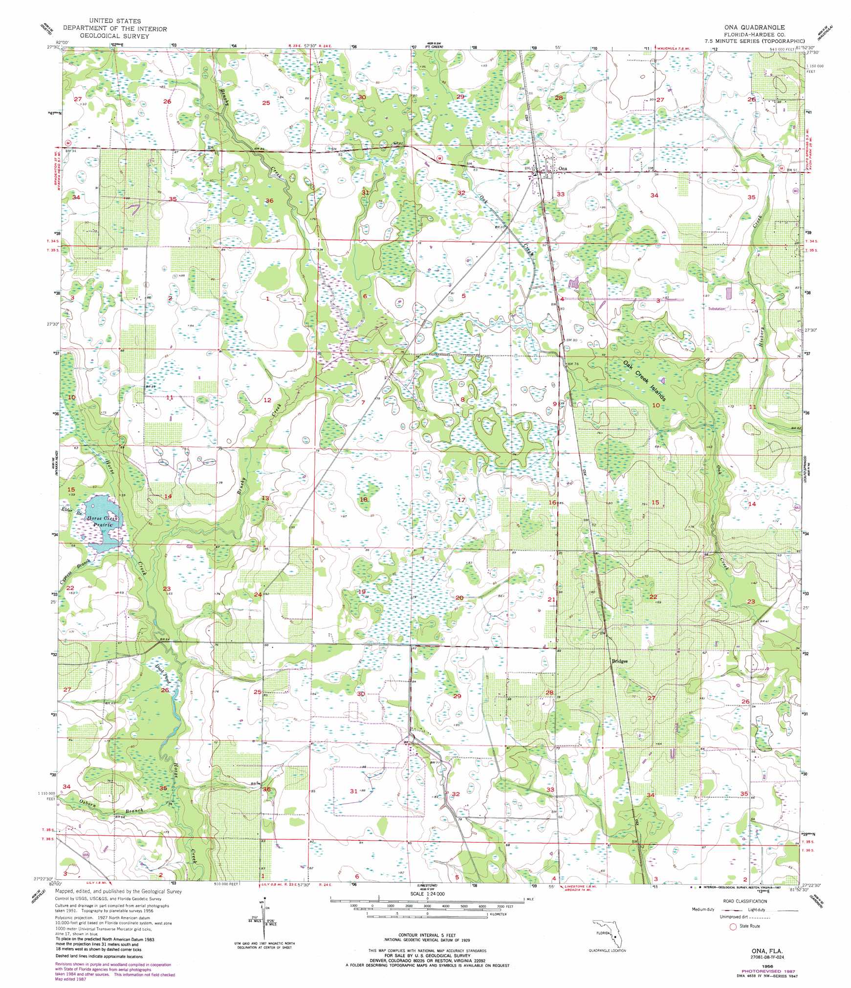
Ona Topo Map Florida
To zoom in, hover over the map of Ona
USGS Topo Quad 27081d8 - 1:24,000 scale
| Topo Map Name: | Ona |
| USGS Topo Quad ID: | 27081d8 |
| Print Size: | ca. 21 1/4" wide x 27" high |
| Southeast Coordinates: | 27.375° N latitude / 81.875° W longitude |
| Map Center Coordinates: | 27.4375° N latitude / 81.9375° W longitude |
| U.S. State: | FL |
| Filename: | O27081D8.jpg |
| Download Map JPG Image: | Ona topo map 1:24,000 scale |
| Map Type: | Topographic |
| Topo Series: | 7.5´ |
| Map Scale: | 1:24,000 |
| Source of Map Images: | United States Geological Survey (USGS) |
| Alternate Map Versions: |
Ona FL 1956, updated 1957 Download PDF Buy paper map Ona FL 1956, updated 1957 Download PDF Buy paper map Ona FL 1956, updated 1987 Download PDF Buy paper map Ona FL 2012 Download PDF Buy paper map Ona FL 2015 Download PDF Buy paper map |
1:24,000 Topo Quads surrounding Ona
Fort Lonesome |
Duette Ne |
Baird |
Bowling Green |
Bereah |
Keentown |
Duette |
Fort Green |
Wauchula |
Griffins Corner |
Myakka City Nw |
Myakka Head |
Ona |
Zolfo Springs |
Sweetwater |
Myakka City |
Edgeville |
Limestone |
Gardner |
Crewsville Sw |
Murdock Nw |
Murdock Ne |
Nocatee |
Arcadia |
Long Island Marsh Nw |
> Back to 27081a1 at 1:100,000 scale
> Back to 27080a1 at 1:250,000 scale
> Back to U.S. Topo Maps home
Ona topo map: Gazetteer
Ona: Islands
Oak Creek Islands elevation 21m 68′Ona: Lakes
Horse Creek Prairie elevation 17m 55′Ona: Populated Places
Bridges elevation 23m 75′Ona elevation 27m 88′
Ona: Streams
Brushy Creek elevation 17m 55′Cypress Branch elevation 18m 59′
Elder Branch elevation 18m 59′
Osborn Branch elevation 16m 52′
Ona: Swamps
Duck Pond elevation 17m 55′Ona digital topo map on disk
Buy this Ona topo map showing relief, roads, GPS coordinates and other geographical features, as a high-resolution digital map file on DVD: