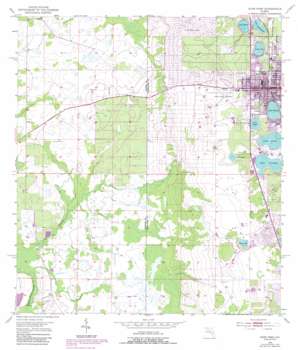
Avon Park Topo Map Florida
To zoom in, hover over the map of Avon Park
USGS Topo Quad 27081e5 - 1:24,000 scale
| Topo Map Name: | Avon Park |
| USGS Topo Quad ID: | 27081e5 |
| Print Size: | ca. 21 1/4" wide x 27" high |
| Southeast Coordinates: | 27.5° N latitude / 81.5° W longitude |
| Map Center Coordinates: | 27.5625° N latitude / 81.5625° W longitude |
| U.S. State: | FL |
| Filename: | O27081E5.jpg |
| Download Map JPG Image: | Avon Park topo map 1:24,000 scale |
| Map Type: | Topographic |
| Topo Series: | 7.5´ |
| Map Scale: | 1:24,000 |
| Source of Map Images: | United States Geological Survey (USGS) |
| Alternate Map Versions: |
Avon Park FL 1953, updated 1954 Download PDF Buy paper map Avon Park FL 1953, updated 1968 Download PDF Buy paper map Avon Park FL 1953, updated 1973 Download PDF Buy paper map Avon Park FL 1953, updated 1987 Download PDF Buy paper map Avon Park FL 2012 Download PDF Buy paper map Avon Park FL 2015 Download PDF Buy paper map |
1:24,000 Topo Quads surrounding Avon Park
> Back to 27081e1 at 1:100,000 scale
> Back to 27080a1 at 1:250,000 scale
> Back to U.S. Topo Maps home
Avon Park topo map: Gazetteer
Avon Park: Airports
Avon Park Municipal Airport elevation 47m 154′Florida Hospital Sebring Heliport elevation 46m 150′
Avon Park: Lakes
Hog Lake elevation 49m 160′Lake Anoka elevation 36m 118′
Lake Brentwood elevation 31m 101′
Lake Byrd elevation 31m 101′
Lake Glenada elevation 35m 114′
Lake Isis elevation 34m 111′
Lake Lelia elevation 34m 111′
Lake Tulane elevation 35m 114′
Silver Lake elevation 41m 134′
Avon Park: Populated Places
Avon Mobile Home Park elevation 40m 131′Avon Park elevation 46m 150′
Bonnie Brae Mobile Home Estates elevation 46m 150′
Brentwood Mobile Home Park elevation 37m 121′
Lake Glenada Mobile Home Park elevation 35m 114′
Orange Blossom Fellowship Community Mobile Home Park elevation 37m 121′
Reflections on Silver Lake Mobile Home Park elevation 41m 134′
Ridge Trailer Park elevation 34m 111′
Sebring Village Mobile Home Park elevation 50m 164′
Southland Mobile Home Park elevation 51m 167′
Stewart Mobile Village elevation 41m 134′
Sunny Ridge Mobile Home Park elevation 50m 164′
Tanglewood Mobile Home Park elevation 50m 164′
Villa del Sol Mobile Home Park elevation 46m 150′
Avon Park: Post Offices
Avon Park Post Office elevation 43m 141′Avon Park digital topo map on disk
Buy this Avon Park topo map showing relief, roads, GPS coordinates and other geographical features, as a high-resolution digital map file on DVD:


