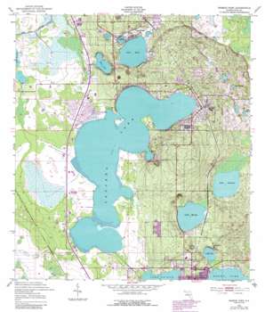
Babson Park Topo Map Florida
To zoom in, hover over the map of Babson Park
USGS Topo Quad 27081g5 - 1:24,000 scale
| Topo Map Name: | Babson Park |
| USGS Topo Quad ID: | 27081g5 |
| Print Size: | ca. 21 1/4" wide x 27" high |
| Southeast Coordinates: | 27.75° N latitude / 81.5° W longitude |
| Map Center Coordinates: | 27.8125° N latitude / 81.5625° W longitude |
| U.S. State: | FL |
| Filename: | O27081G5.jpg |
| Download Map JPG Image: | Babson Park topo map 1:24,000 scale |
| Map Type: | Topographic |
| Topo Series: | 7.5´ |
| Map Scale: | 1:24,000 |
| Source of Map Images: | United States Geological Survey (USGS) |
| Alternate Map Versions: |
Babson Park FL 1952, updated 1953 Download PDF Buy paper map Babson Park FL 1952, updated 1973 Download PDF Buy paper map Babson Park FL 1952, updated 1988 Download PDF Buy paper map Babson Park FL 2012 Download PDF Buy paper map Babson Park FL 2015 Download PDF Buy paper map |
1:24,000 Topo Quads surrounding Babson Park
> Back to 27081e1 at 1:100,000 scale
> Back to 27080a1 at 1:250,000 scale
> Back to U.S. Topo Maps home
Babson Park topo map: Gazetteer
Babson Park: Airports
Goddard Seadrome elevation 24m 78′Lake Clinch Airpark elevation 34m 111′
Babson Park: Lakes
Blue Lake elevation 35m 114′Crooked Lake elevation 36m 118′
Lake Amoret elevation 34m 111′
Lake Easy elevation 34m 111′
Lake Helen elevation 27m 88′
Lake Ida elevation 24m 78′
Lake Leonore elevation 26m 85′
Lake Loralin elevation 29m 95′
Lake Moody elevation 28m 91′
Babson Park: Populated Places
Babson Park elevation 44m 144′Bobs Landing Mobile Home Park elevation 37m 121′
College Park Mobile Home Park elevation 40m 131′
Crooked Lake Park elevation 38m 124′
Frostproof Mobile Home Park elevation 34m 111′
Highland Park elevation 40m 131′
Hillcrest Heights elevation 72m 236′
Lake Clinch Manor Mobile Home Park elevation 34m 111′
Lakeside Gardens Mobile Home Park elevation 38m 124′
Pleasant View Mobile Home Park elevation 41m 134′
Reed Mobile Home Park elevation 41m 134′
Southern Pines Mobile Home Resort elevation 40m 131′
Southern Pines Recreational Vehicle Park elevation 41m 134′
Sunrise Trailer Park elevation 24m 78′
Whidden Mobile Home Park elevation 41m 134′
Whidden Mobile Home Park Number 2 elevation 41m 134′
Babson Park digital topo map on disk
Buy this Babson Park topo map showing relief, roads, GPS coordinates and other geographical features, as a high-resolution digital map file on DVD:


