Murdock Se Topo Map Florida
To zoom in, hover over the map of Murdock Se
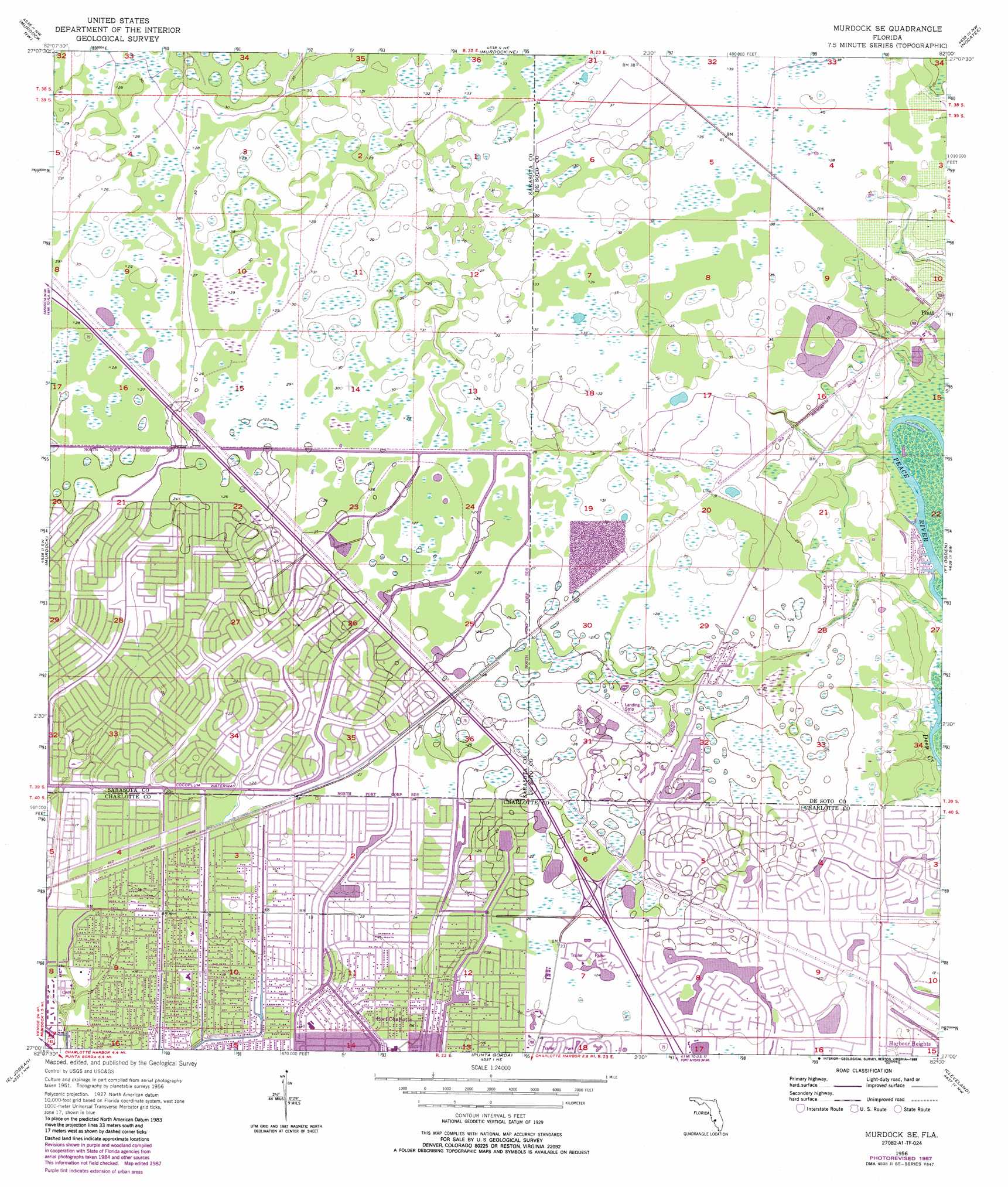
USGS Topo Quad 27082a1 - 1:24,000 scale
| Topo Map Name: | Murdock Se |
| USGS Topo Quad ID: | 27082a1 |
| Print Size: | ca. 21 1/4" wide x 27" high |
| Southeast Coordinates: | 27° N latitude / 82° W longitude |
| Map Center Coordinates: | 27.0625° N latitude / 82.0625° W longitude |
| U.S. State: | FL |
| Filename: | O27082A1.jpg |
| Download Map JPG Image: | Murdock Se topo map 1:24,000 scale |
| Map Type: | Topographic |
| Topo Series: | 7.5´ |
| Map Scale: | 1:24,000 |
| Source of Map Images: | United States Geological Survey (USGS) |
| Alternate Map Versions: |
Murdock SE FL 1956, updated 1957 Download PDF Buy paper map Murdock SE FL 1956, updated 1973 Download PDF Buy paper map Murdock SE FL 1956, updated 1988 Download PDF Buy paper map Murdock SE FL 2012 Download PDF Buy paper map Murdock SE FL 2015 Download PDF Buy paper map |
1:24,000 Topo Quads surrounding Murdock Se
Old Myakka |
Myakka City |
Edgeville |
Limestone |
Gardner |
Lower Myakka Lake |
Murdock Nw |
Murdock Ne |
Nocatee |
Arcadia |
Myakka River |
Murdock |
Murdock Se |
Fort Ogden |
Arcadia Se |
Englewood |
El Jobean |
Punta Gorda |
Cleveland |
Bermont |
Placida |
Punta Gorda Sw |
Punta Gorda Se |
Gilchrist |
Tuckers Corner |
> Back to 27082a1 at 1:100,000 scale
> Back to 27082a1 at 1:250,000 scale
> Back to U.S. Topo Maps home
Murdock Se topo map: Gazetteer
Murdock Se: Airports
Lake Suzy Estates Airport elevation 8m 26′Murdock Se: Populated Places
Deep Creek elevation 7m 22′Lake Suzy (not official) elevation 8m 26′
Platt elevation 6m 19′
Port Charlotte Village Mobile Home Park elevation 7m 22′
Sidell elevation 9m 29′
Murdock Se digital topo map on disk
Buy this Murdock Se topo map showing relief, roads, GPS coordinates and other geographical features, as a high-resolution digital map file on DVD: