Lorraine Topo Map Florida
To zoom in, hover over the map of Lorraine
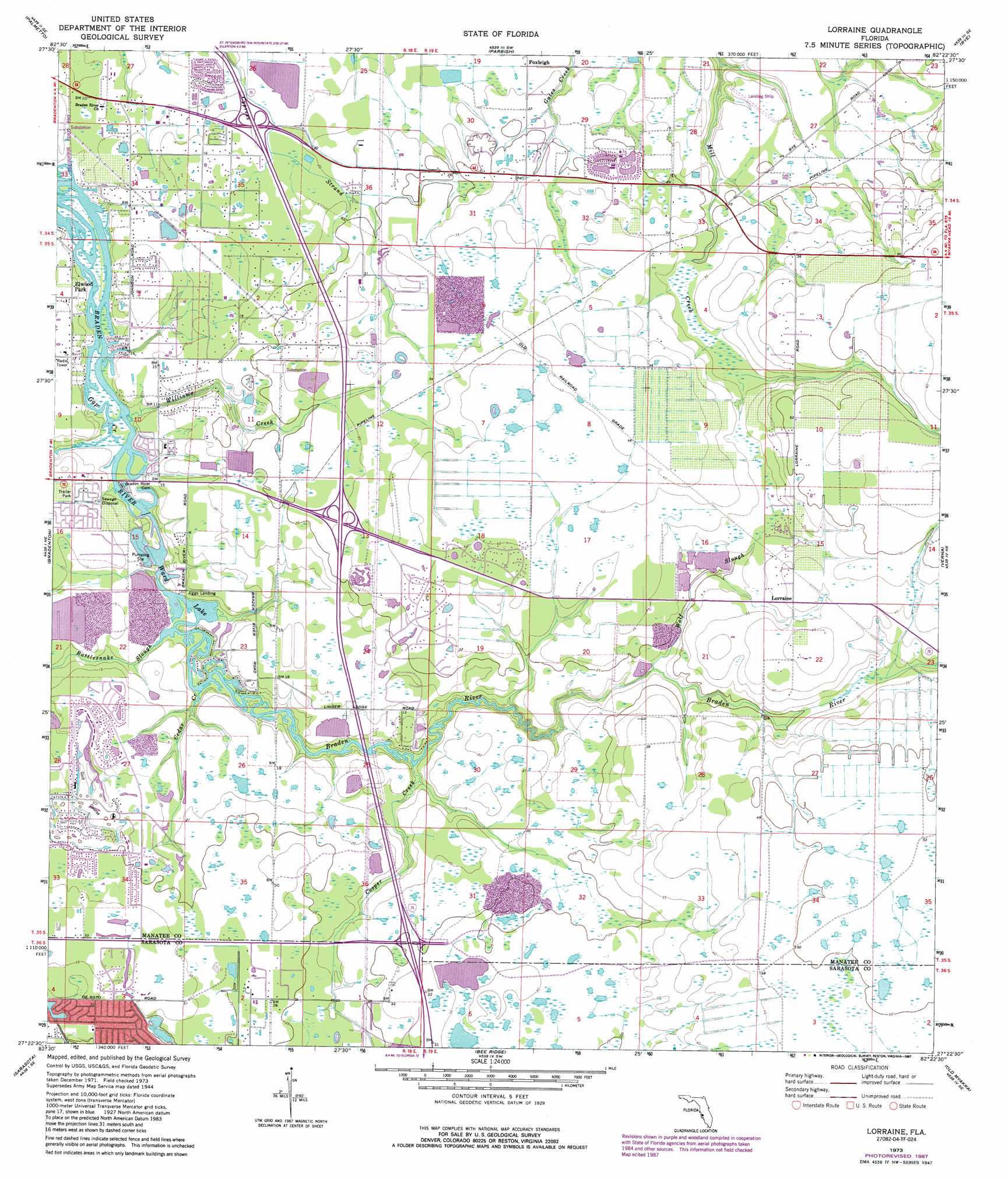
USGS Topo Quad 27082d4 - 1:24,000 scale
| Topo Map Name: | Lorraine |
| USGS Topo Quad ID: | 27082d4 |
| Print Size: | ca. 21 1/4" wide x 27" high |
| Southeast Coordinates: | 27.375° N latitude / 82.375° W longitude |
| Map Center Coordinates: | 27.4375° N latitude / 82.4375° W longitude |
| U.S. State: | FL |
| Filename: | O27082D4.jpg |
| Download Map JPG Image: | Lorraine topo map 1:24,000 scale |
| Map Type: | Topographic |
| Topo Series: | 7.5´ |
| Map Scale: | 1:24,000 |
| Source of Map Images: | United States Geological Survey (USGS) |
| Alternate Map Versions: |
Lorraine FL 1944, updated 1961 Download PDF Buy paper map Lorraine FL 1973, updated 1987 Download PDF Buy paper map Lorraine FL 1973, updated 1988 Download PDF Buy paper map Lorraine FL 2012 Download PDF Buy paper map Lorraine FL 2015 Download PDF Buy paper map |
1:24,000 Topo Quads surrounding Lorraine
Pass-A-Grille Beach |
Cockroach Bay |
Ruskin |
Wimauma |
Fort Lonesome |
Anna Maria |
Palmetto |
Parrish |
Rye |
Keentown |
Bradenton Beach |
Bradenton |
Lorraine |
Verna |
Myakka City Nw |
Sarasota |
Bee Ridge |
Old Myakka |
Myakka City |
|
Bird Keys |
Laurel |
Lower Myakka Lake |
Murdock Nw |
> Back to 27082a1 at 1:100,000 scale
> Back to 27082a1 at 1:250,000 scale
> Back to U.S. Topo Maps home
Lorraine topo map: Gazetteer
Lorraine: Populated Places
Foxleigh elevation 5m 16′Lakewood Ranch elevation 9m 29′
Lorraine elevation 12m 39′
Lorraine: Reservoirs
Ward Lake elevation 1m 3′Lorraine: Streams
Cedar Creek elevation 1m 3′Cooper Creek elevation 1m 3′
Gap Creek elevation 0m 0′
Rattlesnake Slough elevation 1m 3′
Williams Creek elevation 0m 0′
Wolf Slough elevation 4m 13′
Lorraine digital topo map on disk
Buy this Lorraine topo map showing relief, roads, GPS coordinates and other geographical features, as a high-resolution digital map file on DVD: