Bradenton Topo Map Florida
To zoom in, hover over the map of Bradenton
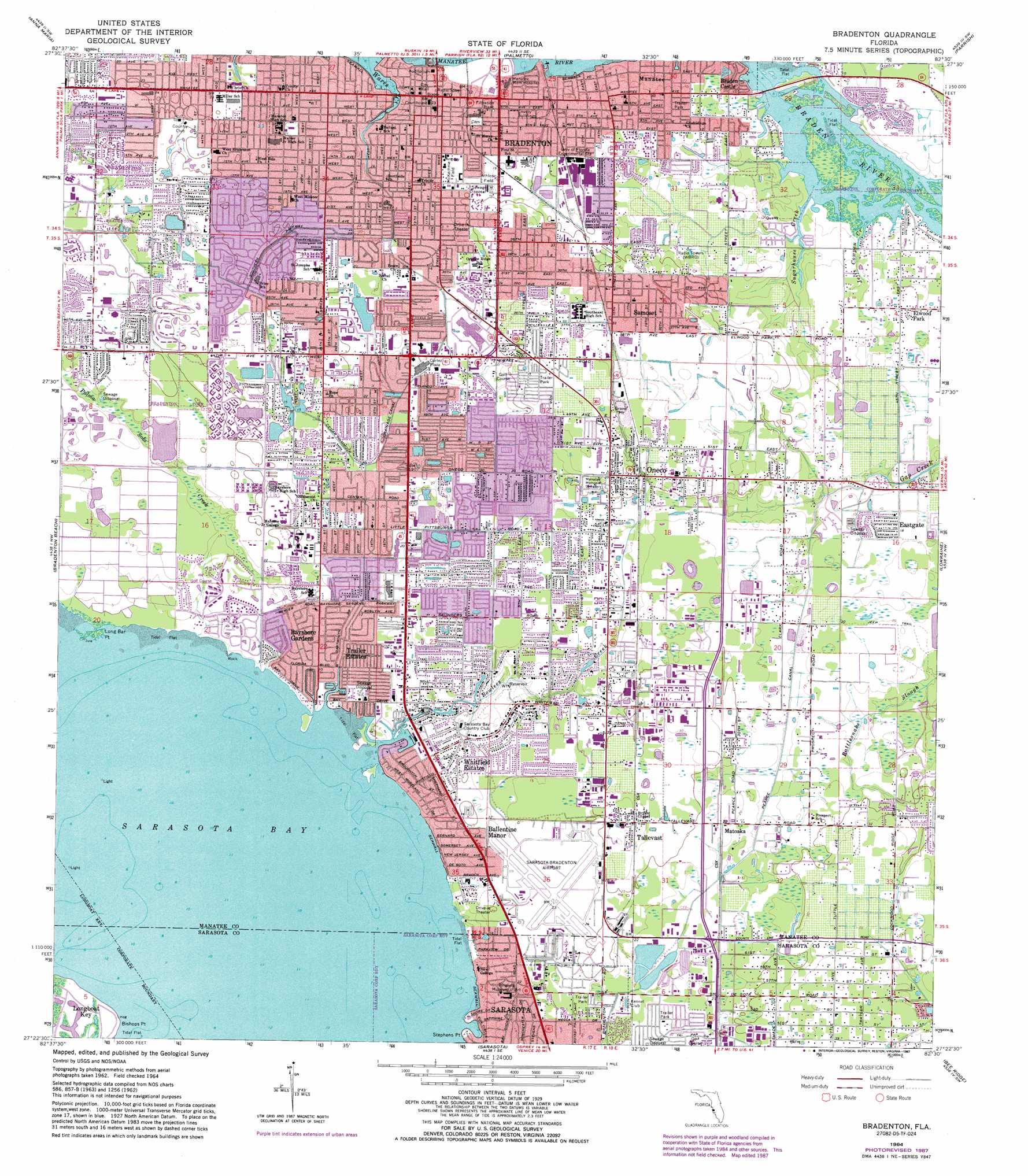
USGS Topo Quad 27082d5 - 1:24,000 scale
| Topo Map Name: | Bradenton |
| USGS Topo Quad ID: | 27082d5 |
| Print Size: | ca. 21 1/4" wide x 27" high |
| Southeast Coordinates: | 27.375° N latitude / 82.5° W longitude |
| Map Center Coordinates: | 27.4375° N latitude / 82.5625° W longitude |
| U.S. State: | FL |
| Filename: | O27082D5.jpg |
| Download Map JPG Image: | Bradenton topo map 1:24,000 scale |
| Map Type: | Topographic |
| Topo Series: | 7.5´ |
| Map Scale: | 1:24,000 |
| Source of Map Images: | United States Geological Survey (USGS) |
| Alternate Map Versions: |
Bradenton FL 1947 Download PDF Buy paper map Bradenton FL 1964, updated 1966 Download PDF Buy paper map Bradenton FL 1964, updated 1970 Download PDF Buy paper map Bradenton FL 1964, updated 1982 Download PDF Buy paper map Bradenton FL 1994, updated 2000 Download PDF Buy paper map Bradenton FL 2012 Download PDF Buy paper map Bradenton FL 2015 Download PDF Buy paper map |
1:24,000 Topo Quads surrounding Bradenton
Pass-A-Grille Beach |
Cockroach Bay |
Ruskin |
Wimauma |
|
Egmont Key |
Anna Maria |
Palmetto |
Parrish |
Rye |
Bradenton Beach |
Bradenton |
Lorraine |
Verna |
|
Sarasota |
Bee Ridge |
Old Myakka |
||
Bird Keys |
Laurel |
Lower Myakka Lake |
> Back to 27082a1 at 1:100,000 scale
> Back to 27082a1 at 1:250,000 scale
> Back to U.S. Topo Maps home
Bradenton topo map: Gazetteer
Bradenton: Airports
HCA-L W Blake Hospital Heliport elevation 3m 9′Sarasota-Bradenton International Airport elevation 6m 19′
Bradenton: Canals
Cedar Hammock Drainage Canal elevation 6m 19′Pearce Canal elevation 4m 13′
Bradenton: Capes
Bishops Point elevation 0m 0′Long Bar Point elevation 0m 0′
Stephens Point elevation 2m 6′
Bradenton: Parks
McKechnie Field elevation 5m 16′Bradenton: Populated Places
Ballentine Manor elevation 7m 22′Bayshore Gardens elevation 4m 13′
Braden Castle elevation 1m 3′
Bradenton elevation 1m 3′
Cedar Hammock elevation 6m 19′
Eastgate elevation 5m 16′
Elwood Park elevation 4m 13′
Manatee elevation 3m 9′
Matoaka elevation 6m 19′
Oneco elevation 10m 32′
Samoset elevation 9m 29′
South Bradenton elevation 6m 19′
Tallevast elevation 10m 32′
Trailer Estates elevation 4m 13′
West Samoset elevation 12m 39′
Whitfield elevation 5m 16′
Whitfield Estates elevation 7m 22′
Bradenton: Streams
Bowlees Creek elevation 0m 0′Jeffs Cowpen Creek elevation 0m 0′
Sugarhouse Creek elevation 0m 0′
Bradenton digital topo map on disk
Buy this Bradenton topo map showing relief, roads, GPS coordinates and other geographical features, as a high-resolution digital map file on DVD: