Rye Topo Map Florida
To zoom in, hover over the map of Rye
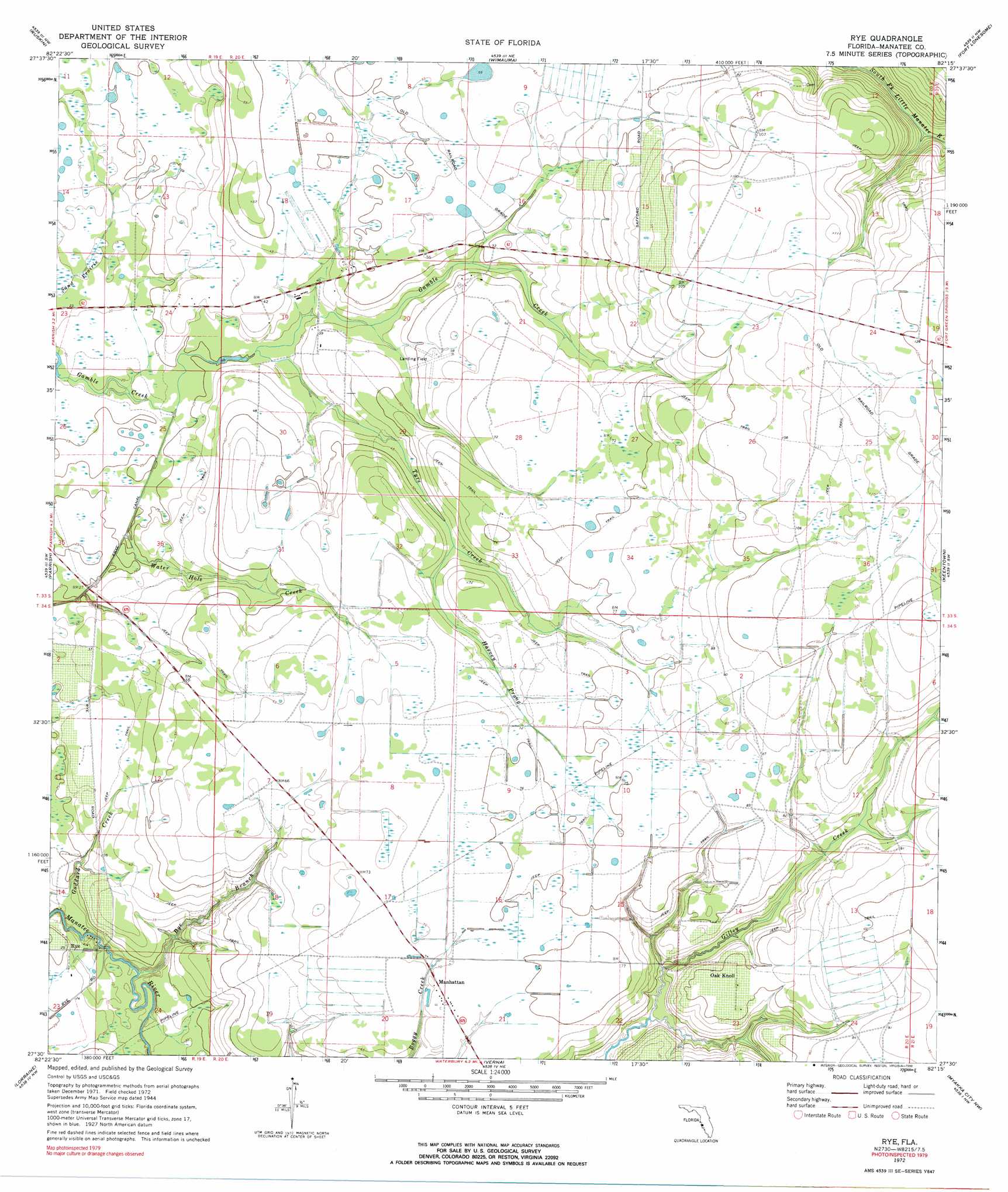
USGS Topo Quad 27082e3 - 1:24,000 scale
| Topo Map Name: | Rye |
| USGS Topo Quad ID: | 27082e3 |
| Print Size: | ca. 21 1/4" wide x 27" high |
| Southeast Coordinates: | 27.5° N latitude / 82.25° W longitude |
| Map Center Coordinates: | 27.5625° N latitude / 82.3125° W longitude |
| U.S. State: | FL |
| Filename: | O27082E3.jpg |
| Download Map JPG Image: | Rye topo map 1:24,000 scale |
| Map Type: | Topographic |
| Topo Series: | 7.5´ |
| Map Scale: | 1:24,000 |
| Source of Map Images: | United States Geological Survey (USGS) |
| Alternate Map Versions: |
Rye FL 1944, updated 1961 Download PDF Buy paper map Rye FL 1972, updated 1974 Download PDF Buy paper map Rye FL 1972, updated 1990 Download PDF Buy paper map Rye FL 2012 Download PDF Buy paper map Rye FL 2015 Download PDF Buy paper map |
1:24,000 Topo Quads surrounding Rye
Port Tampa |
Gibsonton |
Riverview |
Lithia |
Keysville |
Cockroach Bay |
Ruskin |
Wimauma |
Fort Lonesome |
Duette Ne |
Palmetto |
Parrish |
Rye |
Keentown |
Duette |
Bradenton |
Lorraine |
Verna |
Myakka City Nw |
Myakka Head |
Sarasota |
Bee Ridge |
Old Myakka |
Myakka City |
Edgeville |
> Back to 27082e1 at 1:100,000 scale
> Back to 27082a1 at 1:250,000 scale
> Back to U.S. Topo Maps home
Rye topo map: Gazetteer
Rye: Canals
Frye Canal elevation 8m 26′Rye: Lakes
Gilly Lakes elevation 11m 36′Rye: Parks
Rye Wilderness Park elevation 8m 26′Rye: Populated Places
Manhattan elevation 21m 68′Oak Knoll elevation 23m 75′
Rye elevation 2m 6′
Rye: Streams
Harvey Prong elevation 16m 52′Rye Branch elevation 1m 3′
Tyre Creek elevation 8m 26′
Water Hole Creek elevation 7m 22′
Rye digital topo map on disk
Buy this Rye topo map showing relief, roads, GPS coordinates and other geographical features, as a high-resolution digital map file on DVD: