Duette Ne Topo Map Florida
To zoom in, hover over the map of Duette Ne
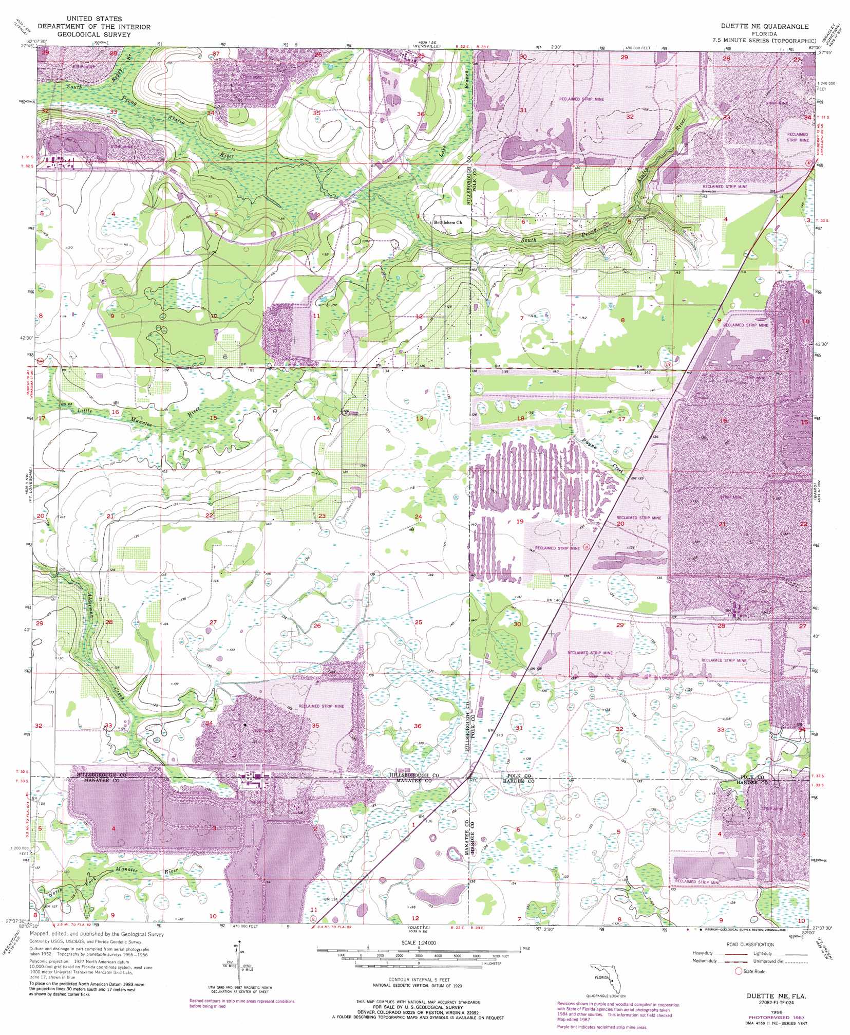
USGS Topo Quad 27082f1 - 1:24,000 scale
| Topo Map Name: | Duette Ne |
| USGS Topo Quad ID: | 27082f1 |
| Print Size: | ca. 21 1/4" wide x 27" high |
| Southeast Coordinates: | 27.625° N latitude / 82° W longitude |
| Map Center Coordinates: | 27.6875° N latitude / 82.0625° W longitude |
| U.S. State: | FL |
| Filename: | O27082F1.jpg |
| Download Map JPG Image: | Duette Ne topo map 1:24,000 scale |
| Map Type: | Topographic |
| Topo Series: | 7.5´ |
| Map Scale: | 1:24,000 |
| Source of Map Images: | United States Geological Survey (USGS) |
| Alternate Map Versions: |
Duette NE FL 1956, updated 1957 Download PDF Buy paper map Duette NE FL 1956, updated 1968 Download PDF Buy paper map Duette NE FL 1956, updated 1973 Download PDF Buy paper map Duette NE FL 1956, updated 1988 Download PDF Buy paper map Duette NE FL 2012 Download PDF Buy paper map Duette NE FL 2015 Download PDF Buy paper map |
1:24,000 Topo Quads surrounding Duette Ne
Brandon |
Dover |
Nichols |
Mulberry |
Bartow |
Riverview |
Lithia |
Keysville |
Bradley Junction |
Homeland |
Wimauma |
Fort Lonesome |
Duette Ne |
Baird |
Bowling Green |
Rye |
Keentown |
Duette |
Fort Green |
Wauchula |
Verna |
Myakka City Nw |
Myakka Head |
Ona |
Zolfo Springs |
> Back to 27082e1 at 1:100,000 scale
> Back to 27082a1 at 1:250,000 scale
> Back to U.S. Topo Maps home
Duette Ne topo map: Gazetteer
Duette Ne: Areas
Little Dry Prairie elevation 41m 134′Duette Ne: Streams
Boggy Branch elevation 19m 62′Lake Branch elevation 24m 78′
Duette Ne digital topo map on disk
Buy this Duette Ne topo map showing relief, roads, GPS coordinates and other geographical features, as a high-resolution digital map file on DVD: