Potrero Cortado Topo Map Texas
To zoom in, hover over the map of Potrero Cortado
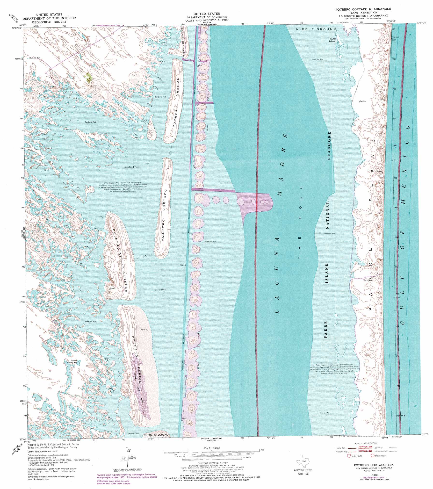
USGS Topo Quad 27097a4 - 1:24,000 scale
| Topo Map Name: | Potrero Cortado |
| USGS Topo Quad ID: | 27097a4 |
| Print Size: | ca. 21 1/4" wide x 27" high |
| Southeast Coordinates: | 27° N latitude / 97.375° W longitude |
| Map Center Coordinates: | 27.0625° N latitude / 97.4375° W longitude |
| U.S. State: | TX |
| Filename: | o27097a4.jpg |
| Download Map JPG Image: | Potrero Cortado topo map 1:24,000 scale |
| Map Type: | Topographic |
| Topo Series: | 7.5´ |
| Map Scale: | 1:24,000 |
| Source of Map Images: | United States Geological Survey (USGS) |
| Alternate Map Versions: |
Potrero Cortado TX 1952, updated 1953 Download PDF Buy paper map Potrero Cortado TX 1952, updated 1953 Download PDF Buy paper map Potrero Cortado TX 1952, updated 1978 Download PDF Buy paper map Potrero Cortado TX 2010 Download PDF Buy paper map Potrero Cortado TX 2013 Download PDF Buy paper map Potrero Cortado TX 2016 Download PDF Buy paper map |
1:24,000 Topo Quads surrounding Potrero Cortado
Riviera Beach |
Kleberg Point |
Point Of Rocks |
South Bird Island Se |
|
La Parra Ranch |
La Parra Ranch Ne |
Yarborough Pass |
||
La Parra Ranch Sw |
La Parra Ranch Se |
Potrero Cortado |
||
San Pedro Ranch |
Maria Estella Well |
Potrero Lopeno Nw |
||
Saltillo Well |
Los Amigos Windmill |
Potrero Lopeno Sw |
Potrero Lopino Se |
> Back to 27097a1 at 1:100,000 scale
> Back to 27096a1 at 1:250,000 scale
> Back to U.S. Topo Maps home
Potrero Cortado topo map: Gazetteer
Potrero Cortado: Channels
Land Cut elevation 2m 6′The Hole elevation 0m 0′
Potrero Cortado: Islands
Cuba Island elevation 1m 3′Potrero Cortado: Summits
Potrero Cortado elevation 5m 16′Potrero de las Canelas elevation 4m 13′
Potrero Farias elevation 4m 13′
Potrero Grande elevation 4m 13′
Potrero Cortado: Wells
Lopena Artesian Well elevation 3m 9′Medanito Well elevation 3m 9′
Potrero Cortado digital topo map on disk
Buy this Potrero Cortado topo map showing relief, roads, GPS coordinates and other geographical features, as a high-resolution digital map file on DVD: