Turcotte Topo Map Texas
To zoom in, hover over the map of Turcotte
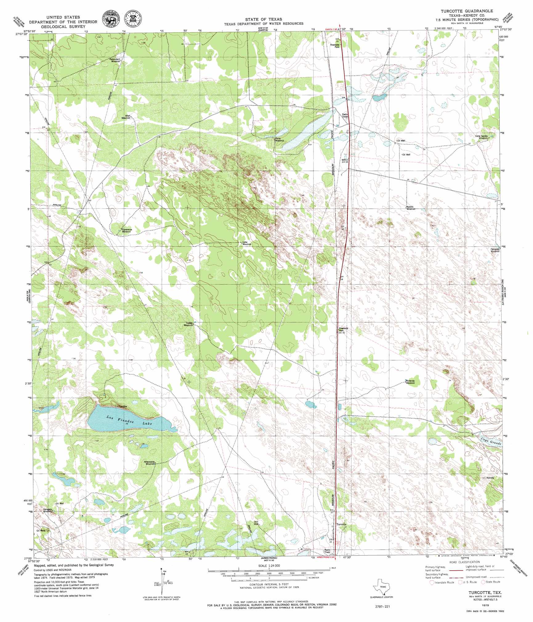
USGS Topo Quad 27097a7 - 1:24,000 scale
| Topo Map Name: | Turcotte |
| USGS Topo Quad ID: | 27097a7 |
| Print Size: | ca. 21 1/4" wide x 27" high |
| Southeast Coordinates: | 27° N latitude / 97.75° W longitude |
| Map Center Coordinates: | 27.0625° N latitude / 97.8125° W longitude |
| U.S. State: | TX |
| Filename: | o27097a7.jpg |
| Download Map JPG Image: | Turcotte topo map 1:24,000 scale |
| Map Type: | Topographic |
| Topo Series: | 7.5´ |
| Map Scale: | 1:24,000 |
| Source of Map Images: | United States Geological Survey (USGS) |
| Alternate Map Versions: |
Turcotte TX 2010 Download PDF Buy paper map Turcotte TX 2013 Download PDF Buy paper map Turcotte TX 2016 Download PDF Buy paper map |
1:24,000 Topo Quads surrounding Turcotte
Premont East |
Paisano Lake |
Riviera |
Riviera Beach |
Kleberg Point |
Flowella |
La Paloma Ranch |
Sarita |
La Parra Ranch |
La Parra Ranch Ne |
Falfurrias Se |
Sarita Sw |
Turcotte |
La Parra Ranch Sw |
La Parra Ranch Se |
San Tomas Camp |
Pita Camp |
Armstrong |
San Pedro Ranch |
Maria Estella Well |
Callo Padrones |
Julian |
Norias |
Saltillo Well |
Los Amigos Windmill |
> Back to 27097a1 at 1:100,000 scale
> Back to 27096a1 at 1:250,000 scale
> Back to U.S. Topo Maps home
Turcotte topo map: Gazetteer
Turcotte: Lakes
Los Finados Lake elevation 8m 26′Turcotte: Populated Places
Turcotte elevation 11m 36′Turcotte digital topo map on disk
Buy this Turcotte topo map showing relief, roads, GPS coordinates and other geographical features, as a high-resolution digital map file on DVD: