South Bird Island Topo Map Texas
To zoom in, hover over the map of South Bird Island
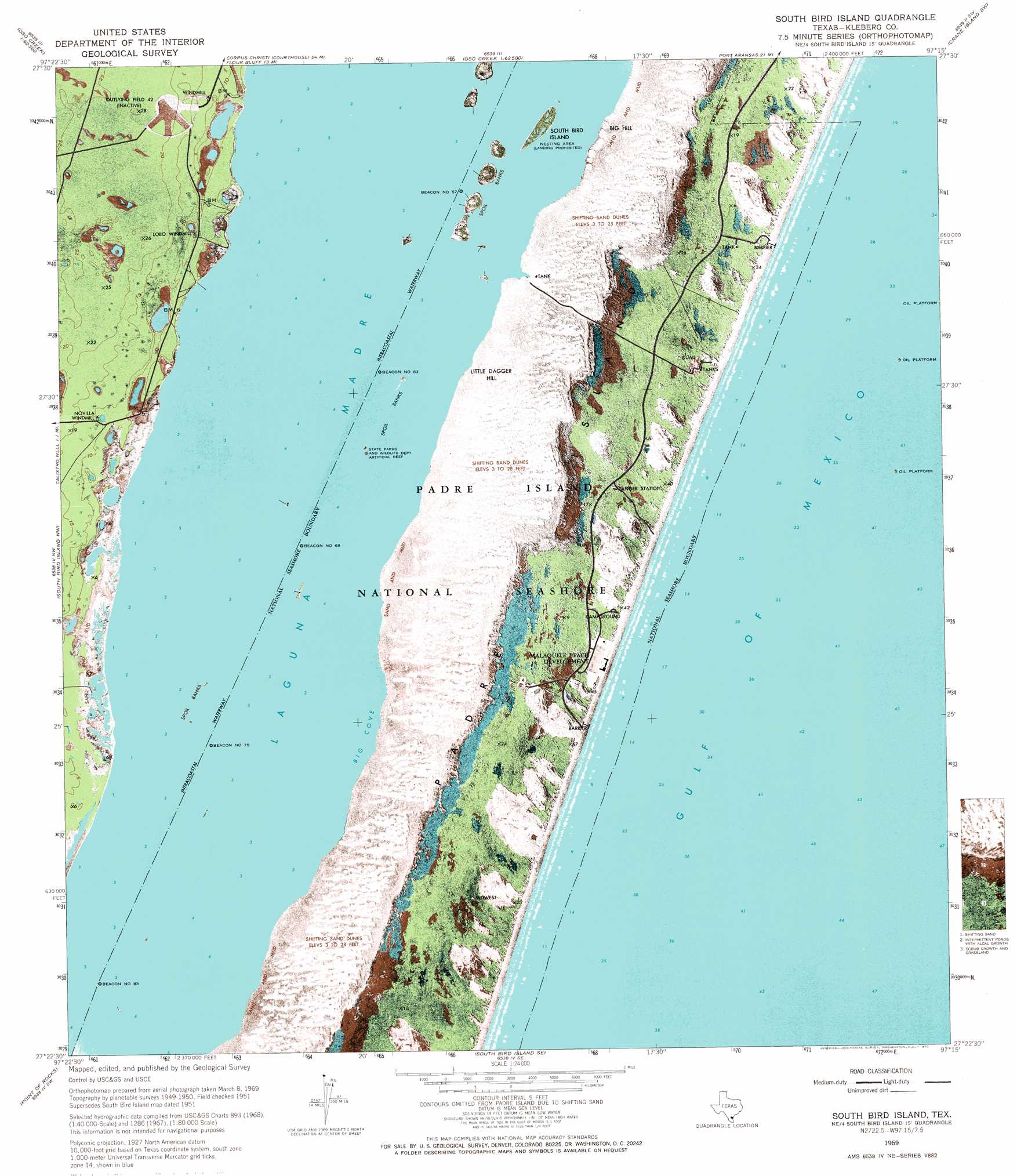
USGS Topo Quad 27097d3 - 1:24,000 scale
| Topo Map Name: | South Bird Island |
| USGS Topo Quad ID: | 27097d3 |
| Print Size: | ca. 21 1/4" wide x 27" high |
| Southeast Coordinates: | 27.375° N latitude / 97.25° W longitude |
| Map Center Coordinates: | 27.4375° N latitude / 97.3125° W longitude |
| U.S. State: | TX |
| Filename: | o27097d3.jpg |
| Download Map JPG Image: | South Bird Island topo map 1:24,000 scale |
| Map Type: | Topographic |
| Topo Series: | 7.5´ |
| Map Scale: | 1:24,000 |
| Source of Map Images: | United States Geological Survey (USGS) |
| Alternate Map Versions: |
South Bird Island TX 1951, updated 1953 Download PDF Buy paper map South Bird Island TX 1969, updated 1970 Download PDF Buy paper map South Bird Island TX 2010 Download PDF Buy paper map South Bird Island TX 2013 Download PDF Buy paper map South Bird Island TX 2016 Download PDF Buy paper map |
1:24,000 Topo Quads surrounding South Bird Island
Petronila Ne |
Oso Creek Nw |
Oso Creek Ne |
Crane Islands Nw |
|
Laureles Ranch |
Chapman Ranch |
Pita Island |
Crane Islands Sw |
|
Riviera Beach Ne |
South Bird Island Nw |
South Bird Island |
||
Kleberg Point |
Point Of Rocks |
South Bird Island Se |
||
La Parra Ranch Ne |
Yarborough Pass |
> Back to 27097a1 at 1:100,000 scale
> Back to 27096a1 at 1:250,000 scale
> Back to U.S. Topo Maps home
South Bird Island topo map: Gazetteer
South Bird Island: Bars
Little Bar elevation 0m 0′Little Harbor elevation 0m 0′
South Bird Island: Basins
Bird Island Basin elevation 0m 0′South Bird Island: Bays
Big Cove elevation 0m 0′South Bird Island: Beaches
Malaquite Beach elevation 1m 3′South Bird Island: Islands
Rock Island elevation 0m 0′South Bird Island elevation 1m 3′
South Bird Island: Summits
Big Hill elevation 1m 3′Little Dagger Hill elevation 1m 3′
South Bird Island digital topo map on disk
Buy this South Bird Island topo map showing relief, roads, GPS coordinates and other geographical features, as a high-resolution digital map file on DVD: