Chapman Ranch Topo Map Texas
To zoom in, hover over the map of Chapman Ranch
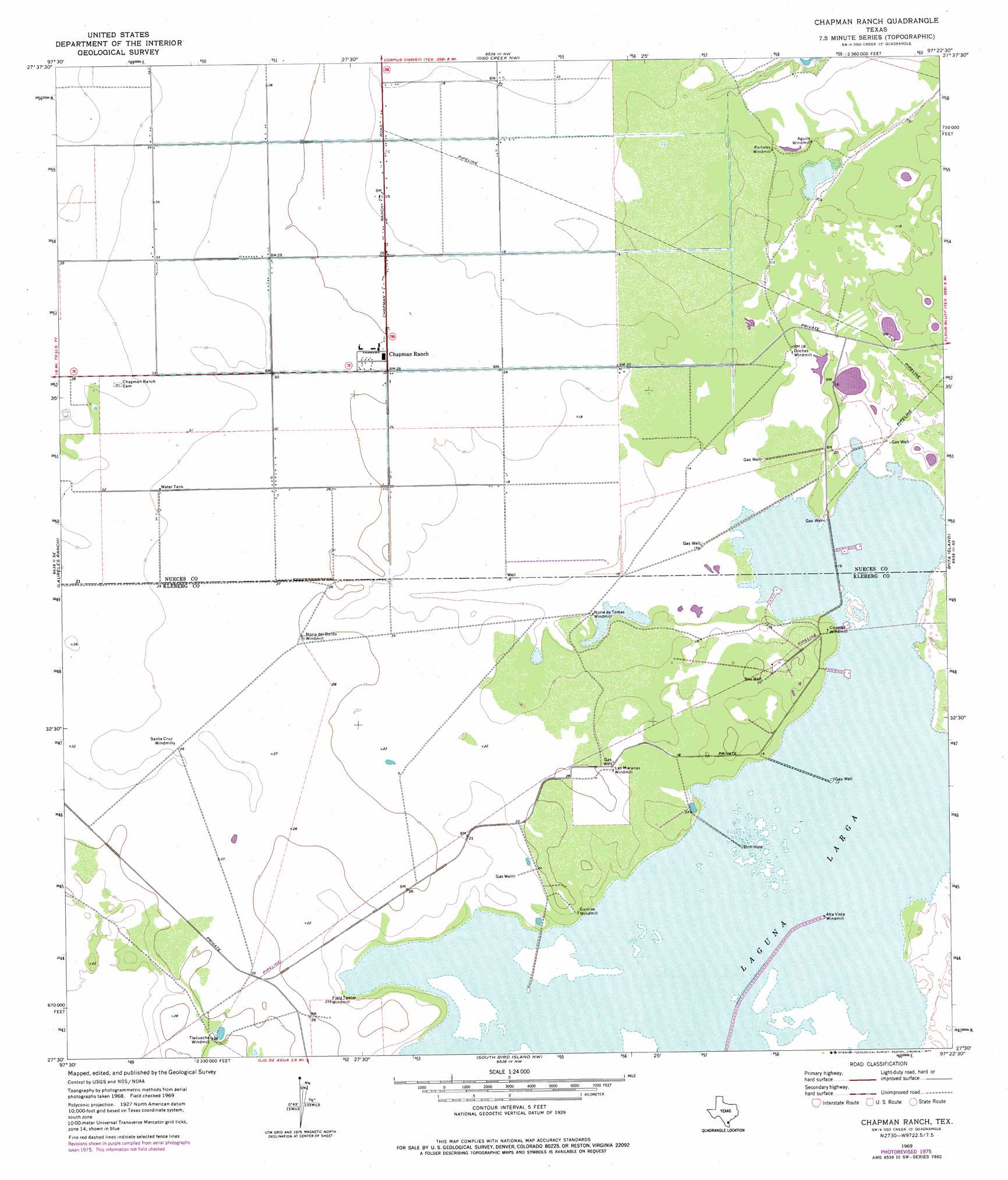
USGS Topo Quad 27097e4 - 1:24,000 scale
| Topo Map Name: | Chapman Ranch |
| USGS Topo Quad ID: | 27097e4 |
| Print Size: | ca. 21 1/4" wide x 27" high |
| Southeast Coordinates: | 27.5° N latitude / 97.375° W longitude |
| Map Center Coordinates: | 27.5625° N latitude / 97.4375° W longitude |
| U.S. State: | TX |
| Filename: | o27097e4.jpg |
| Download Map JPG Image: | Chapman Ranch topo map 1:24,000 scale |
| Map Type: | Topographic |
| Topo Series: | 7.5´ |
| Map Scale: | 1:24,000 |
| Source of Map Images: | United States Geological Survey (USGS) |
| Alternate Map Versions: |
Chapin Ranch TX 1969, updated 1972 Download PDF Buy paper map Chapman Ranch TX 1969, updated 1977 Download PDF Buy paper map Chapman Ranch TX 2010 Download PDF Buy paper map Chapman Ranch TX 2013 Download PDF Buy paper map Chapman Ranch TX 2016 Download PDF Buy paper map |
1:24,000 Topo Quads surrounding Chapman Ranch
Robstown |
Annaville |
Corpus Christi |
Portland |
Port Ingleside |
Driscoll East |
Petronila Ne |
Oso Creek Nw |
Oso Creek Ne |
Crane Islands Nw |
Concordia |
Laureles Ranch |
Chapman Ranch |
Pita Island |
Crane Islands Sw |
Riviera Beach Nw |
Riviera Beach Ne |
South Bird Island Nw |
South Bird Island |
|
Riviera Beach |
Kleberg Point |
Point Of Rocks |
South Bird Island Se |
> Back to 27097e1 at 1:100,000 scale
> Back to 27096a1 at 1:250,000 scale
> Back to U.S. Topo Maps home
Chapman Ranch topo map: Gazetteer
Chapman Ranch: Lakes
Laguna Larga elevation 4m 13′Chapman Ranch: Populated Places
Chapman Ranch elevation 7m 22′Chapman Ranch digital topo map on disk
Buy this Chapman Ranch topo map showing relief, roads, GPS coordinates and other geographical features, as a high-resolution digital map file on DVD: