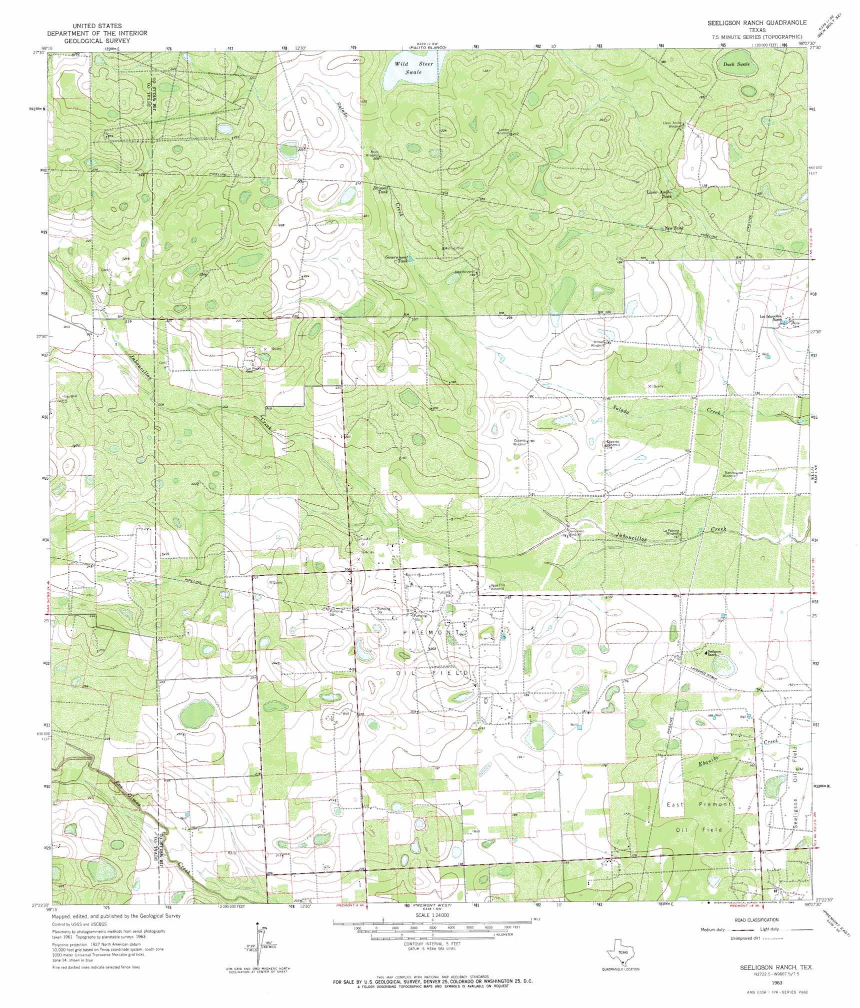
Seeligson Ranch Topo Map Texas
To zoom in, hover over the map of Seeligson Ranch
USGS Topo Quad 27098d2 - 1:24,000 scale
| Topo Map Name: | Seeligson Ranch |
| USGS Topo Quad ID: | 27098d2 |
| Print Size: | ca. 21 1/4" wide x 27" high |
| Southeast Coordinates: | 27.375° N latitude / 98.125° W longitude |
| Map Center Coordinates: | 27.4375° N latitude / 98.1875° W longitude |
| U.S. State: | TX |
| Filename: | o27098d2.jpg |
| Download Map JPG Image: | Seeligson Ranch topo map 1:24,000 scale |
| Map Type: | Topographic |
| Topo Series: | 7.5´ |
| Map Scale: | 1:24,000 |
| Source of Map Images: | United States Geological Survey (USGS) |
| Alternate Map Versions: |
Seeligson Ranch TX 1963, updated 1965 Download PDF Buy paper map Seeligson Ranch TX 2010 Download PDF Buy paper map Seeligson Ranch TX 2013 Download PDF Buy paper map Seeligson Ranch TX 2016 Download PDF Buy paper map |
1:24,000 Topo Quads surrounding Seeligson Ranch
Benavides Nw |
Benavides Ne |
Ben Bolt Nw |
Alice South |
Kingsville Nw |
Benavides |
San Jose |
Palito Blanco |
Ben Bolt Se |
Kingsville West |
Concepcion Nw |
Concepcion |
Seeligson Ranch |
Ella |
Escondido Lake |
Ramirez |
Laguna Del Toro |
Premont West |
Premont East |
Paisano Lake |
Palomas Ranch Nw |
Palomas Ranch |
Falfurrias |
Flowella |
La Paloma Ranch |
> Back to 27098a1 at 1:100,000 scale
> Back to 27098a1 at 1:250,000 scale
> Back to U.S. Topo Maps home
Seeligson Ranch topo map: Gazetteer
Seeligson Ranch: Airports
Seeligson Ranch Airport elevation 51m 167′Seeligson Ranch: Oilfields
East Premont Oil Field elevation 52m 170′Premont Oil Field elevation 63m 206′
Seeligson Oil Field elevation 48m 157′
Seeligson Ranch: Reservoirs
Driscoll Tank elevation 61m 200′Government Tank elevation 59m 193′
Llano Ancho Tank elevation 52m 170′
New Tank elevation 52m 170′
Seeligson Ranch: Streams
Salado Creek elevation 46m 150′Seeligson Ranch: Swamps
Duck Swale elevation 53m 173′Wild Steer Swale elevation 62m 203′
Seeligson Ranch digital topo map on disk
Buy this Seeligson Ranch topo map showing relief, roads, GPS coordinates and other geographical features, as a high-resolution digital map file on DVD: