Concepcion Topo Map Texas
To zoom in, hover over the map of Concepcion
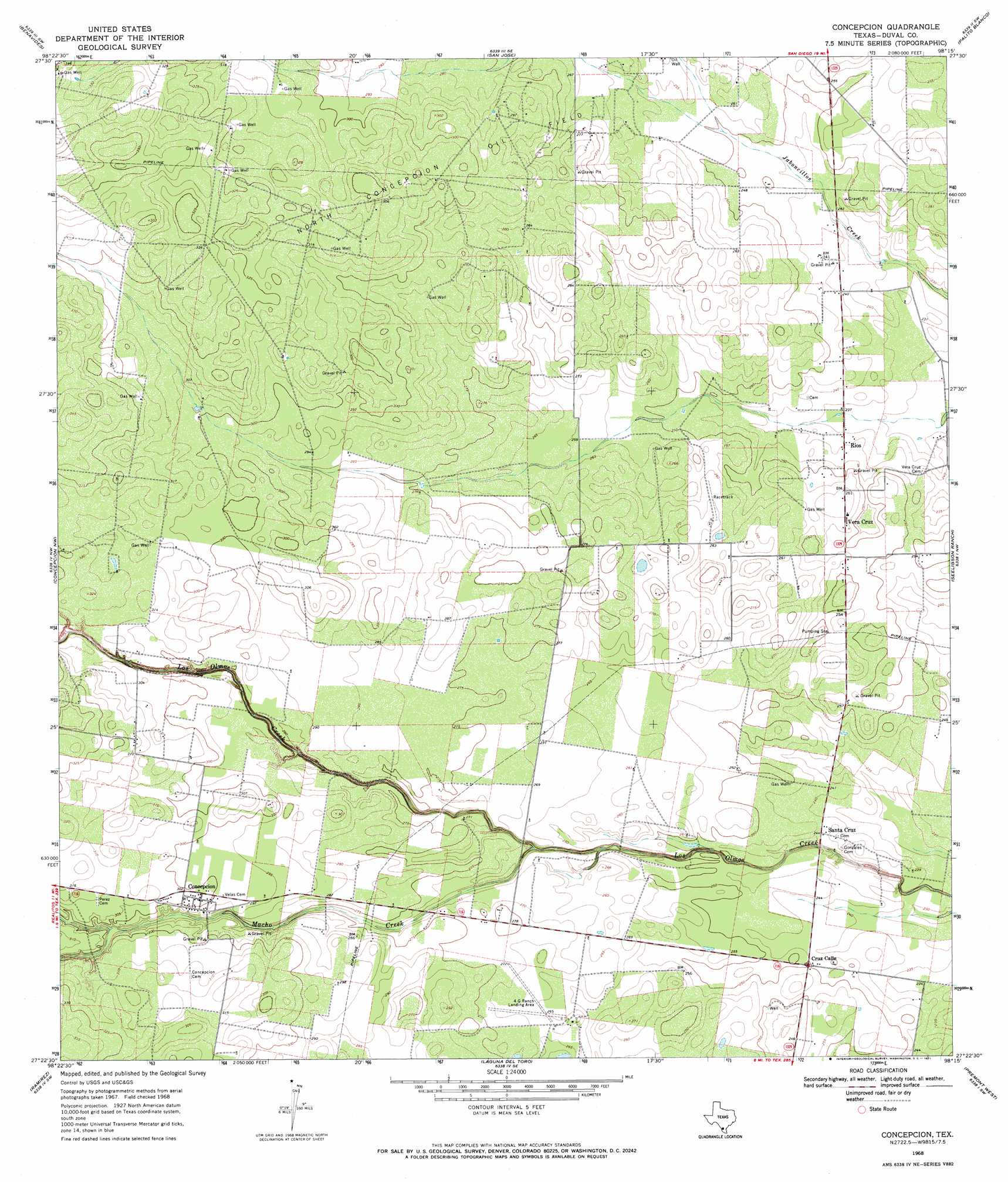
USGS Topo Quad 27098d3 - 1:24,000 scale
| Topo Map Name: | Concepcion |
| USGS Topo Quad ID: | 27098d3 |
| Print Size: | ca. 21 1/4" wide x 27" high |
| Southeast Coordinates: | 27.375° N latitude / 98.25° W longitude |
| Map Center Coordinates: | 27.4375° N latitude / 98.3125° W longitude |
| U.S. State: | TX |
| Filename: | o27098d3.jpg |
| Download Map JPG Image: | Concepcion topo map 1:24,000 scale |
| Map Type: | Topographic |
| Topo Series: | 7.5´ |
| Map Scale: | 1:24,000 |
| Source of Map Images: | United States Geological Survey (USGS) |
| Alternate Map Versions: |
Concepcion TX 1968, updated 1971 Download PDF Buy paper map Concepcion TX 2010 Download PDF Buy paper map Concepcion TX 2013 Download PDF Buy paper map Concepcion TX 2016 Download PDF Buy paper map |
1:24,000 Topo Quads surrounding Concepcion
Parrilla Creek Ne |
Benavides Nw |
Benavides Ne |
Ben Bolt Nw |
Alice South |
Parrilla Creek Se |
Benavides |
San Jose |
Palito Blanco |
Ben Bolt Se |
Realitos |
Concepcion Nw |
Concepcion |
Seeligson Ranch |
Ella |
Hebbronville Se |
Ramirez |
Laguna Del Toro |
Premont West |
Premont East |
Baluarte Ranch |
Palomas Ranch Nw |
Palomas Ranch |
Falfurrias |
Flowella |
> Back to 27098a1 at 1:100,000 scale
> Back to 27098a1 at 1:250,000 scale
> Back to U.S. Topo Maps home
Concepcion topo map: Gazetteer
Concepcion: Airports
4-G Ranch Airport elevation 82m 269′Concepcion: Oilfields
North Concepcion Oil Field elevation 89m 291′Concepcion: Populated Places
Concepcion elevation 89m 291′Conception elevation 91m 298′
Cruz Calle elevation 76m 249′
Rios elevation 73m 239′
Santa Cruz elevation 74m 242′
Vera Cruz elevation 78m 255′
Concepcion: Streams
Concepcion Creek elevation 76m 249′Concepcion digital topo map on disk
Buy this Concepcion topo map showing relief, roads, GPS coordinates and other geographical features, as a high-resolution digital map file on DVD: