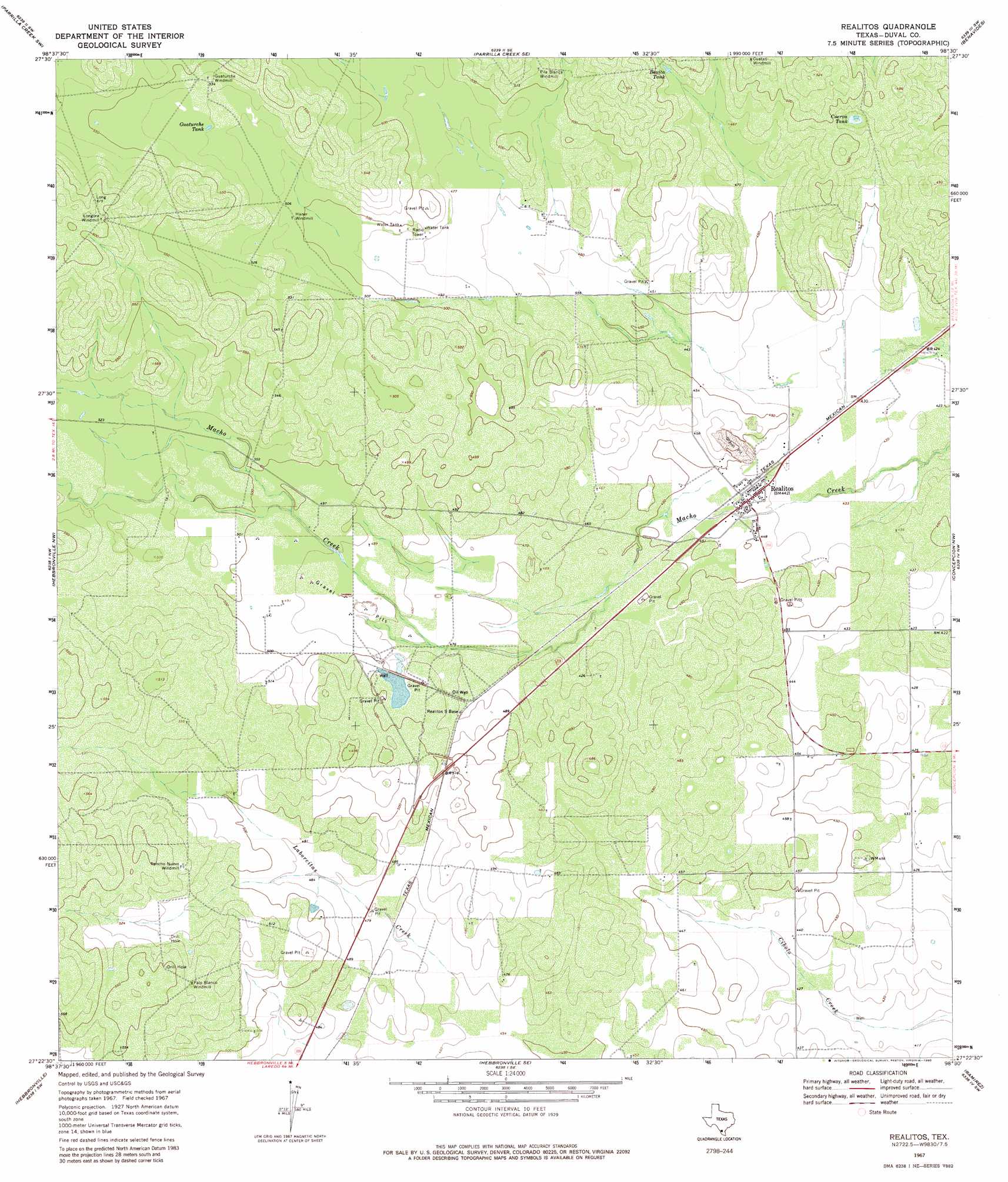
Realitos Topo Map Texas
To zoom in, hover over the map of Realitos
USGS Topo Quad 27098d5 - 1:24,000 scale
| Topo Map Name: | Realitos |
| USGS Topo Quad ID: | 27098d5 |
| Print Size: | ca. 21 1/4" wide x 27" high |
| Southeast Coordinates: | 27.375° N latitude / 98.5° W longitude |
| Map Center Coordinates: | 27.4375° N latitude / 98.5625° W longitude |
| U.S. State: | TX |
| Filename: | o27098d5.jpg |
| Download Map JPG Image: | Realitos topo map 1:24,000 scale |
| Map Type: | Topographic |
| Topo Series: | 7.5´ |
| Map Scale: | 1:24,000 |
| Source of Map Images: | United States Geological Survey (USGS) |
| Alternate Map Versions: |
Realitos TX 1967, updated 1971 Download PDF Buy paper map Realitos TX 1967, updated 1980 Download PDF Buy paper map Realitos TX 2010 Download PDF Buy paper map Realitos TX 2013 Download PDF Buy paper map Realitos TX 2016 Download PDF Buy paper map |
1:24,000 Topo Quads surrounding Realitos
Mills Bennett |
Parrilla Creek Nw |
Parrilla Creek Ne |
Benavides Nw |
Benavides Ne |
San Pablo |
Parrilla Creek Sw |
Parrilla Creek Se |
Benavides |
San Jose |
Bruni |
Hebbronville Nw |
Realitos |
Concepcion Nw |
Concepcion |
Bruni Se |
Hebbronville |
Hebbronville Se |
Ramirez |
Laguna Del Toro |
Armstrong Ranch |
Mccampbell Ranch |
Baluarte Ranch |
Palomas Ranch Nw |
Palomas Ranch |
> Back to 27098a1 at 1:100,000 scale
> Back to 27098a1 at 1:250,000 scale
> Back to U.S. Topo Maps home
Realitos topo map: Gazetteer
Realitos: Airports
O S Wyatt Airport elevation 162m 531′Realitos: Dams
Wright Brothers Materials Plant Dam elevation 147m 482′Realitos: Populated Places
Realitos elevation 135m 442′Realitos Colonia elevation 135m 442′
Realitos: Reservoirs
Bonita Tank elevation 151m 495′Cuerva Tank elevation 145m 475′
Guaturche Tank elevation 162m 531′
Wright Brothers Materials Plant Reservoir elevation 147m 482′
Realitos digital topo map on disk
Buy this Realitos topo map showing relief, roads, GPS coordinates and other geographical features, as a high-resolution digital map file on DVD: