Palito Blanco Topo Map Texas
To zoom in, hover over the map of Palito Blanco
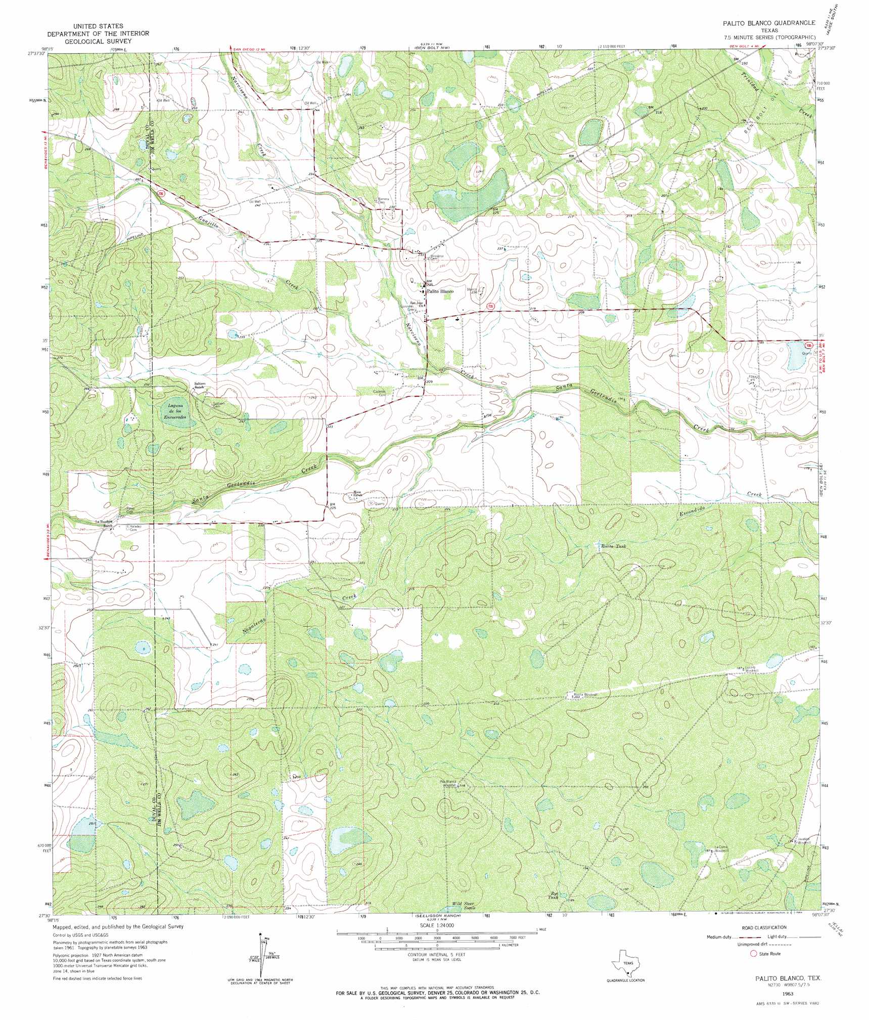
USGS Topo Quad 27098e2 - 1:24,000 scale
| Topo Map Name: | Palito Blanco |
| USGS Topo Quad ID: | 27098e2 |
| Print Size: | ca. 21 1/4" wide x 27" high |
| Southeast Coordinates: | 27.5° N latitude / 98.125° W longitude |
| Map Center Coordinates: | 27.5625° N latitude / 98.1875° W longitude |
| U.S. State: | TX |
| Filename: | o27098e2.jpg |
| Download Map JPG Image: | Palito Blanco topo map 1:24,000 scale |
| Map Type: | Topographic |
| Topo Series: | 7.5´ |
| Map Scale: | 1:24,000 |
| Source of Map Images: | United States Geological Survey (USGS) |
| Alternate Map Versions: |
Palito Blanco TX 1963, updated 1964 Download PDF Buy paper map Palito Blanco TX 2010 Download PDF Buy paper map Palito Blanco TX 2013 Download PDF Buy paper map Palito Blanco TX 2016 Download PDF Buy paper map |
1:24,000 Topo Quads surrounding Palito Blanco
Rosita |
Rosita Se |
San Diego |
Alice North |
Agua Dulce |
Benavides Nw |
Benavides Ne |
Ben Bolt Nw |
Alice South |
Kingsville Nw |
Benavides |
San Jose |
Palito Blanco |
Ben Bolt Se |
Kingsville West |
Concepcion Nw |
Concepcion |
Seeligson Ranch |
Ella |
Escondido Lake |
Ramirez |
Laguna Del Toro |
Premont West |
Premont East |
Paisano Lake |
> Back to 27098e1 at 1:100,000 scale
> Back to 27098a1 at 1:250,000 scale
> Back to U.S. Topo Maps home
Palito Blanco topo map: Gazetteer
Palito Blanco: Populated Places
Palito Blanco elevation 68m 223′Palito Blanco: Reservoirs
Rosita Tank elevation 60m 196′Rye Tank elevation 58m 190′
Palito Blanco: Streams
Guajillo Creek elevation 61m 200′Narciseno Creek elevation 58m 190′
Nopaleras Creek elevation 61m 200′
Palito Blanco: Swamps
Laguna de los Encuerados elevation 74m 242′Palito Blanco digital topo map on disk
Buy this Palito Blanco topo map showing relief, roads, GPS coordinates and other geographical features, as a high-resolution digital map file on DVD: