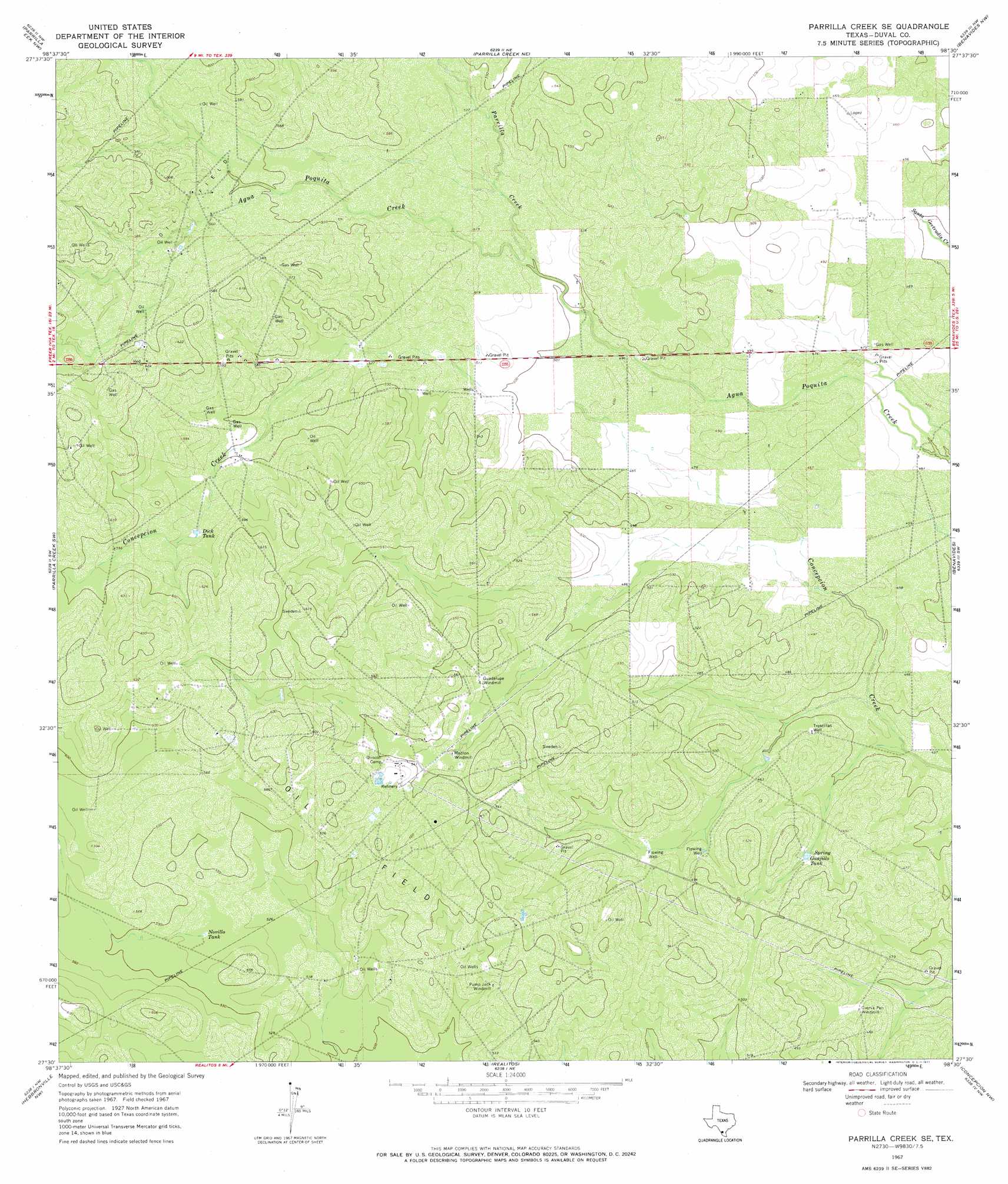
Parrilla Creek Se Topo Map Texas
To zoom in, hover over the map of Parrilla Creek Se
USGS Topo Quad 27098e5 - 1:24,000 scale
| Topo Map Name: | Parrilla Creek Se |
| USGS Topo Quad ID: | 27098e5 |
| Print Size: | ca. 21 1/4" wide x 27" high |
| Southeast Coordinates: | 27.5° N latitude / 98.5° W longitude |
| Map Center Coordinates: | 27.5625° N latitude / 98.5625° W longitude |
| U.S. State: | TX |
| Filename: | o27098e5.jpg |
| Download Map JPG Image: | Parrilla Creek Se topo map 1:24,000 scale |
| Map Type: | Topographic |
| Topo Series: | 7.5´ |
| Map Scale: | 1:24,000 |
| Source of Map Images: | United States Geological Survey (USGS) |
| Alternate Map Versions: |
Parrilla Creek SE TX 1967, updated 1971 Download PDF Buy paper map Parrilla Creek SE TX 2010 Download PDF Buy paper map Parrilla Creek SE TX 2013 Download PDF Buy paper map Parrilla Creek SE TX 2016 Download PDF Buy paper map |
1:24,000 Topo Quads surrounding Parrilla Creek Se
Biel Lake Se |
Sarnosa Hill |
Freer South |
Rosita |
Rosita Se |
Mills Bennett |
Parrilla Creek Nw |
Parrilla Creek Ne |
Benavides Nw |
Benavides Ne |
San Pablo |
Parrilla Creek Sw |
Parrilla Creek Se |
Benavides |
San Jose |
Bruni |
Hebbronville Nw |
Realitos |
Concepcion Nw |
Concepcion |
Bruni Se |
Hebbronville |
Hebbronville Se |
Ramirez |
Laguna Del Toro |
> Back to 27098e1 at 1:100,000 scale
> Back to 27098a1 at 1:250,000 scale
> Back to U.S. Topo Maps home
Parrilla Creek Se topo map: Gazetteer
Parrilla Creek Se: Reservoirs
Dick Tank elevation 174m 570′Guajillo Tank elevation 142m 465′
Novillo Tank elevation 163m 534′
Parrilla Creek Se: Streams
Parrilla Creek elevation 152m 498′Parrilla Creek Se: Wells
Trescillas Well elevation 140m 459′Parrilla Creek Se digital topo map on disk
Buy this Parrilla Creek Se topo map showing relief, roads, GPS coordinates and other geographical features, as a high-resolution digital map file on DVD: