Parrilla Creek Sw Topo Map Texas
To zoom in, hover over the map of Parrilla Creek Sw
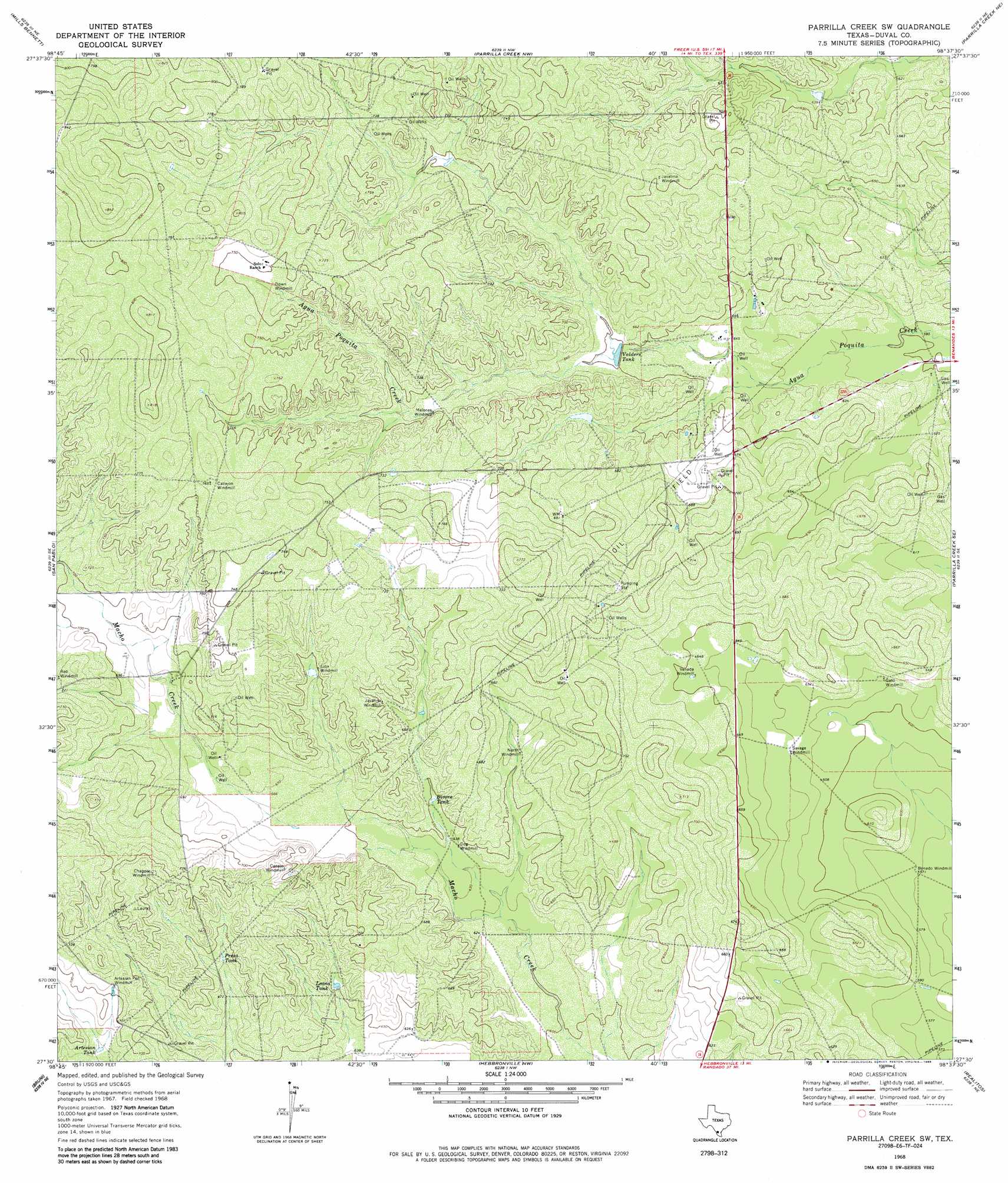
USGS Topo Quad 27098e6 - 1:24,000 scale
| Topo Map Name: | Parrilla Creek Sw |
| USGS Topo Quad ID: | 27098e6 |
| Print Size: | ca. 21 1/4" wide x 27" high |
| Southeast Coordinates: | 27.5° N latitude / 98.625° W longitude |
| Map Center Coordinates: | 27.5625° N latitude / 98.6875° W longitude |
| U.S. State: | TX |
| Filename: | o27098e6.jpg |
| Download Map JPG Image: | Parrilla Creek Sw topo map 1:24,000 scale |
| Map Type: | Topographic |
| Topo Series: | 7.5´ |
| Map Scale: | 1:24,000 |
| Source of Map Images: | United States Geological Survey (USGS) |
| Alternate Map Versions: |
Parrilla Creek SW TX 1968, updated 1971 Download PDF Buy paper map Parrilla Creek SW TX 1968, updated 1986 Download PDF Buy paper map Parrilla Creek SW TX 2010 Download PDF Buy paper map Parrilla Creek SW TX 2013 Download PDF Buy paper map Parrilla Creek SW TX 2016 Download PDF Buy paper map |
1:24,000 Topo Quads surrounding Parrilla Creek Sw
Biel Lake South |
Biel Lake Se |
Sarnosa Hill |
Freer South |
Rosita |
Mills Bennett Nw |
Mills Bennett |
Parrilla Creek Nw |
Parrilla Creek Ne |
Benavides Nw |
Mills Bennett Sw |
San Pablo |
Parrilla Creek Sw |
Parrilla Creek Se |
Benavides |
Oilton |
Bruni |
Hebbronville Nw |
Realitos |
Concepcion Nw |
Albercas Ranch |
Bruni Se |
Hebbronville |
Hebbronville Se |
Ramirez |
> Back to 27098e1 at 1:100,000 scale
> Back to 27098a1 at 1:250,000 scale
> Back to U.S. Topo Maps home
Parrilla Creek Sw topo map: Gazetteer
Parrilla Creek Sw: Airports
Hamilton Ranch Airport elevation 216m 708′Parrilla Creek Sw: Reservoirs
Artesian Tank elevation 203m 666′Bivora Tank elevation 197m 646′
Leona Tank elevation 199m 652′
Presa Tank elevation 208m 682′
Valders Tank elevation 198m 649′
Parrilla Creek Sw digital topo map on disk
Buy this Parrilla Creek Sw topo map showing relief, roads, GPS coordinates and other geographical features, as a high-resolution digital map file on DVD: