Escobas Topo Map Texas
To zoom in, hover over the map of Escobas
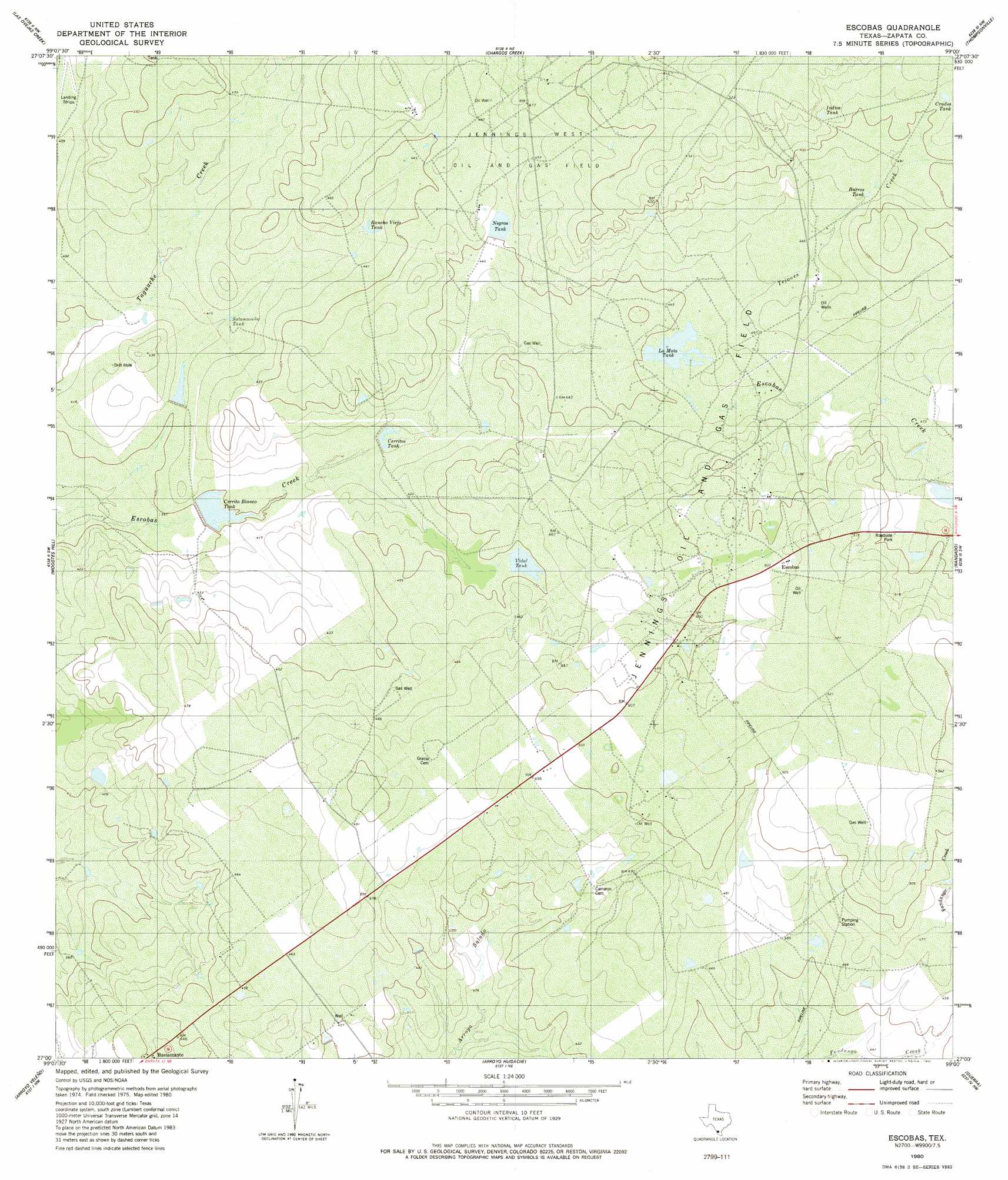
USGS Topo Quad 27099a1 - 1:24,000 scale
| Topo Map Name: | Escobas |
| USGS Topo Quad ID: | 27099a1 |
| Print Size: | ca. 21 1/4" wide x 27" high |
| Southeast Coordinates: | 27° N latitude / 99° W longitude |
| Map Center Coordinates: | 27.0625° N latitude / 99.0625° W longitude |
| U.S. State: | TX |
| Filename: | o27099a1.jpg |
| Download Map JPG Image: | Escobas topo map 1:24,000 scale |
| Map Type: | Topographic |
| Topo Series: | 7.5´ |
| Map Scale: | 1:24,000 |
| Source of Map Images: | United States Geological Survey (USGS) |
| Alternate Map Versions: |
Escobas TX 1980, updated 1980 Download PDF Buy paper map Escobas TX 2010 Download PDF Buy paper map Escobas TX 2013 Download PDF Buy paper map Escobas TX 2016 Download PDF Buy paper map |
1:24,000 Topo Quads surrounding Escobas
Blancas Creek South |
Agua Azul Creek West |
Agua Azul Creek East |
Albercas Ranch |
Bruni Se |
Arroyo Salado East |
Las Ovejas Creek |
Chargos Creek |
Thompsonville |
Armstrong Ranch |
Arroyo Burro |
Mogotes Hill |
Escobas |
Randado |
San Pablo Ranch |
Zapata |
Arroyo Veleno |
Arroyo Huisache |
Guerra |
San Antonio Viejo |
Zapata Se |
Arroyo Clareno |
Arroyo Miguel |
Cuevitas Sw |
Cuevitas |
> Back to 27099a1 at 1:100,000 scale
> Back to 27098a1 at 1:250,000 scale
> Back to U.S. Topo Maps home
Escobas topo map: Gazetteer
Escobas: Dams
Garza Lake Number 2 Dam elevation 122m 400′Lauro Garza Lake Number 1 Dam elevation 125m 410′
Tom East Lake Dam elevation 137m 449′
Escobas: Populated Places
Bustamante elevation 136m 446′Escobas elevation 155m 508′
Escobas: Reservoirs
Burros Tank elevation 147m 482′Cerrito Blanco Tank elevation 120m 393′
Cerritos Tank elevation 128m 419′
Crudos Tank elevation 154m 505′
Garza Lake Number 2 elevation 122m 400′
Indias Tank elevation 157m 515′
La Mota Tank elevation 137m 449′
Lauro Garza Lake Number 1 elevation 125m 410′
Negras Tank elevation 138m 452′
Rancho Viejo Tank elevation 133m 436′
Salómoneno Tank elevation 126m 413′
Tom East Lake elevation 137m 449′
Vidal Tank elevation 136m 446′
Escobas: Streams
Tejones Creek elevation 139m 456′Escobas digital topo map on disk
Buy this Escobas topo map showing relief, roads, GPS coordinates and other geographical features, as a high-resolution digital map file on DVD: