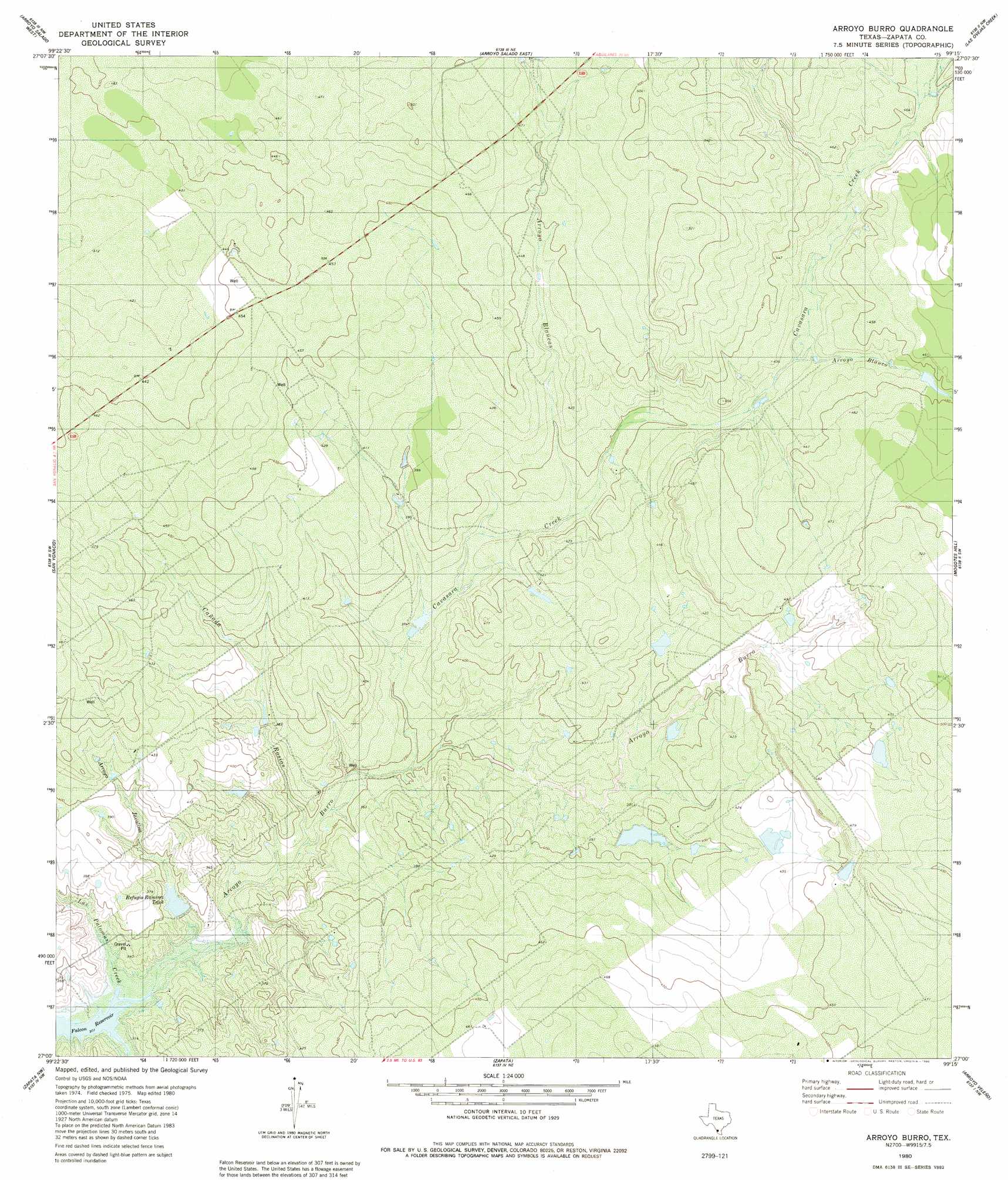
Arroyo Burro Topo Map Texas
To zoom in, hover over the map of Arroyo Burro
USGS Topo Quad 27099a3 - 1:24,000 scale
| Topo Map Name: | Arroyo Burro |
| USGS Topo Quad ID: | 27099a3 |
| Print Size: | ca. 21 1/4" wide x 27" high |
| Southeast Coordinates: | 27° N latitude / 99.25° W longitude |
| Map Center Coordinates: | 27.0625° N latitude / 99.3125° W longitude |
| U.S. State: | TX |
| Filename: | o27099a3.jpg |
| Download Map JPG Image: | Arroyo Burro topo map 1:24,000 scale |
| Map Type: | Topographic |
| Topo Series: | 7.5´ |
| Map Scale: | 1:24,000 |
| Source of Map Images: | United States Geological Survey (USGS) |
| Alternate Map Versions: |
Arroyo Burro TX 1980, updated 1980 Download PDF Buy paper map Arroyo Burro TX 2010 Download PDF Buy paper map Arroyo Burro TX 2013 Download PDF Buy paper map Arroyo Burro TX 2016 Download PDF Buy paper map |
1:24,000 Topo Quads surrounding Arroyo Burro
Isla Mesteno |
O'Keefe Lake |
Blancas Creek South |
Agua Azul Creek West |
Agua Azul Creek East |
Arroyo Salado West |
Arroyo Salado East |
Las Ovejas Creek |
Chargos Creek |
|
San Ygnacio |
Arroyo Burro |
Mogotes Hill |
Escobas |
|
Zapata Nw |
Zapata |
Arroyo Veleno |
Arroyo Huisache |
|
Zapata Se |
Arroyo Clareno |
Arroyo Miguel |
> Back to 27099a1 at 1:100,000 scale
> Back to 27098a1 at 1:250,000 scale
> Back to U.S. Topo Maps home
Arroyo Burro topo map: Gazetteer
Arroyo Burro: Dams
Paz Rameriz Lake Dam elevation 94m 308′Ramirez Lake Dam elevation 102m 334′
Arroyo Burro: Reservoirs
Paz Ramirez Lake elevation 94m 308′Ramirez Lake elevation 102m 334′
Refugio Ramirez Tank elevation 104m 341′
Arroyo Burro: Streams
Cavasara Creek elevation 104m 341′Las Palomas Creek elevation 92m 301′
Marcial Creek elevation 92m 301′
Arroyo Burro: Valleys
Arroyo Blancas elevation 116m 380′Arroyo Blanco elevation 125m 410′
Arroyo Bugies elevation 100m 328′
Arroyo Burro elevation 92m 301′
Arroyo Javalina elevation 94m 308′
Cañada Rosias elevation 100m 328′
Arroyo Burro digital topo map on disk
Buy this Arroyo Burro topo map showing relief, roads, GPS coordinates and other geographical features, as a high-resolution digital map file on DVD: